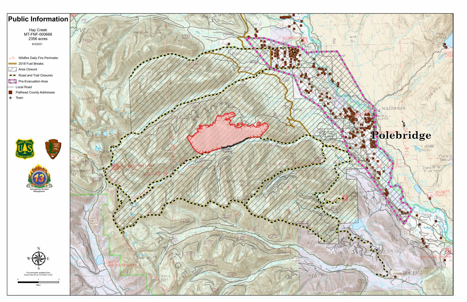
Here’s the latest Hay Creek Fire Public Information Map showing fire extent, closures and current evacuation zone boundaries.
Note the black “containment” line along part of the southern boundary of the fire. Looks like they are making some progress . . .

PDF version: https://nflandowners.org/nflawp/wp-content/uploads/2021/08/Hay-Creek-Fire-Public-Information-Map-Aug-3-2021.pdf