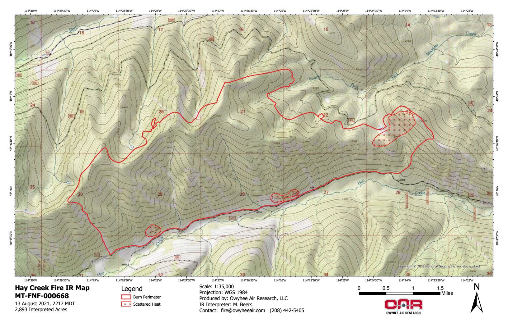
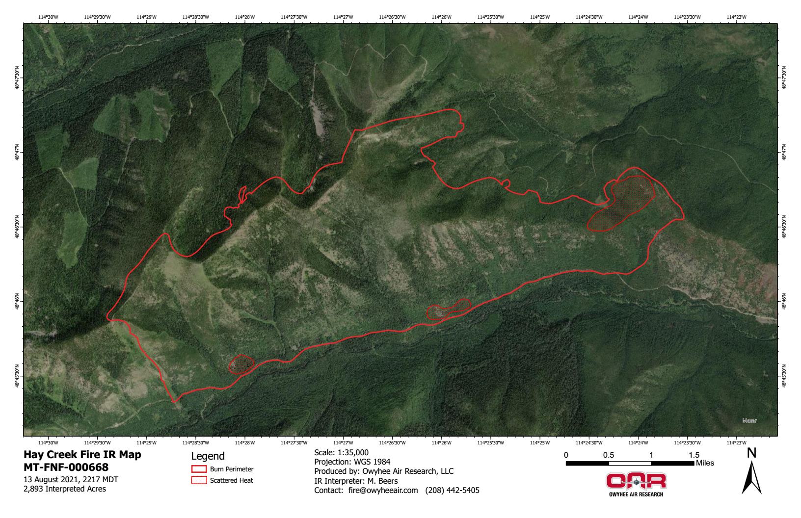
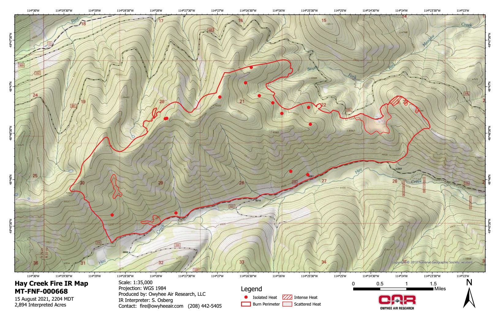
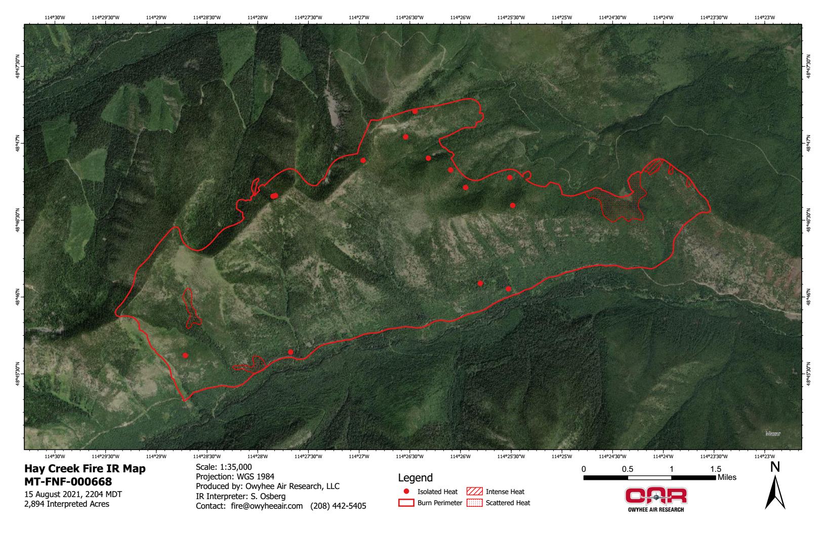
Here are the latest infrared heat maps of the Hay Creek Fire, based on data acquired on August 15, 2021 at 1104pm . . .
PDF versions:
https://nflandowners.org/nflawp/wp-content/uploads/2021/08/Hay-Creek-Fire-–-IR-Imagery-Topo-–-Aug-15-2021.pdf
https://nflandowners.org/nflawp/wp-content/uploads/2021/08/Hay-Creek-Fire-–-IR-Imagery-Topo-–-Aug-15-2021.pdf