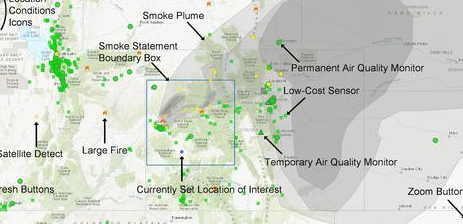
 With fire season fast approaching, this is a nice find. This very handy map showing fires, air quality and smoke plumes is part of the U.S. EPA’s “AirNow” air quality website. Use this link for a map centered on Columbia Falls, MT: https://fire.airnow.gov/?lat=48.3637&lng=-114.1893&zoom=7#. Or you can find it on the NFPA’s “Wildfire Information” page.