Skip to content

NFLA

North Fork Landowners Association

  • >>Pay Dues/Donate<<
  • NFLA Calendar
  • About the NFLA
  • Join the NFLA
  • Documents/Meeting Minutes
  • Welcome and Sunshine Committees
  • Fire Mitigation Committee
  • North Fork History Project
    • Oral History Interviews
  • Social Committee
  • Weeds Committee
  • Sondreson Community Hall
  • North Fork Patrol
  • Newsletters
  • North Fork Zoning Regulations

Search

Join the NFLA

If you want to join the NFLA, see our contact page. Everyone is welcome.

LINKS TO OTHER INFO

NF Preservation Assoc.
NF Trails Assoc.
North Fork Weather
Flathead National Forest
Glacier National Park
Montana FW&P
Montana DNRC
State of Montana
Flathead County
Planning & Zoning Office
County Commissioners
Sheriff’s Office
Flathead Basin Commission
Hungry Horse News
Daily Inter Lake
Flathead Beacon
Missoulian
Gov. Greg Gianforte
Sen. Steve Daines
Sen. Tim Sheehy
Rep. Ryan K. Zinke

IN CASE OF EMERGENCY

Emergency Services
Alert Landing Zones

North Fork Fire History Map as of August 5, 2021

Jay Nichols, the Public Information Officer with the Type 2 fire team passed along an updated version of their fire history map showing the current Hay Creek Fire boundaries…

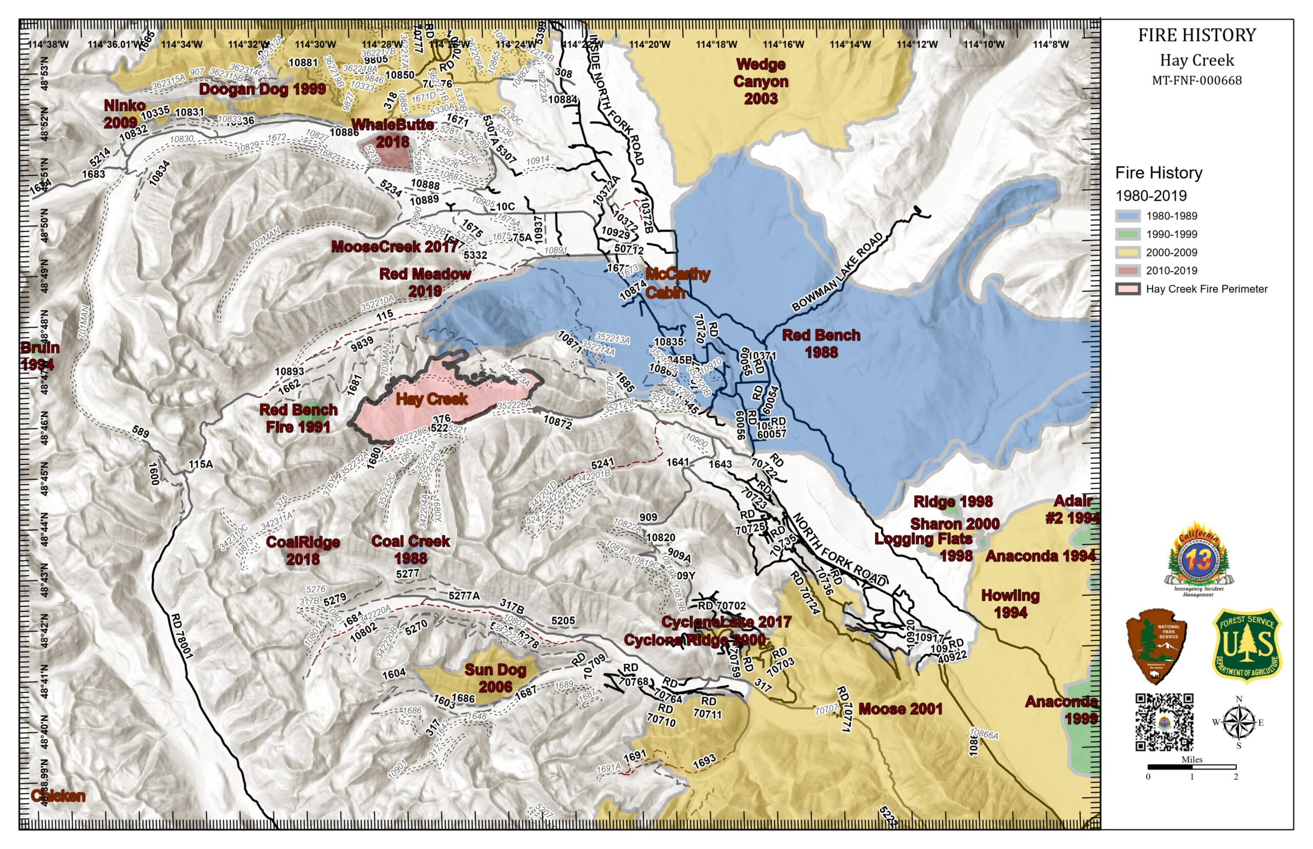
PDF Version: https://nflandowners.org/nflawp/wp-content/uploads/2021/08/North-Fork-Fire-History-Map-August-5-2021.pdf

Posted on August 5, 2021Author Bill WalkerCategories Fire Mitigation, NewsTags Hay Creek Fire, North Fork fire history

Post navigation

Previous Previous post: Hay Creek Fire still at about 2677 acres
Next Next post: Hay Creek Fire – updated Public Information Map for August 5
Proudly powered by WordPress