Weasel Fire pushes into North Fork; no risk to private property at this point

From Rob Davies, Hungry Horse/Glacier View District Ranger . . .

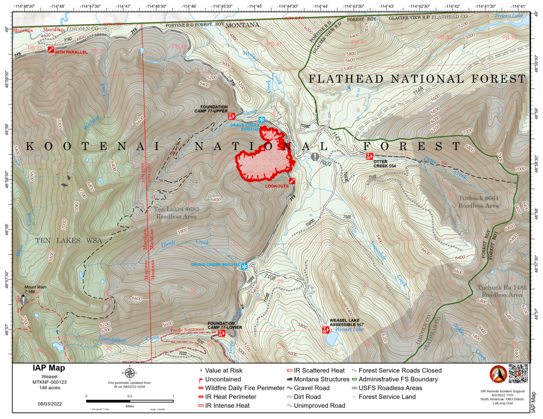
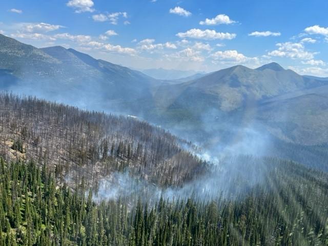
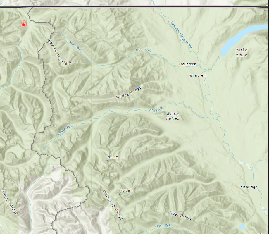
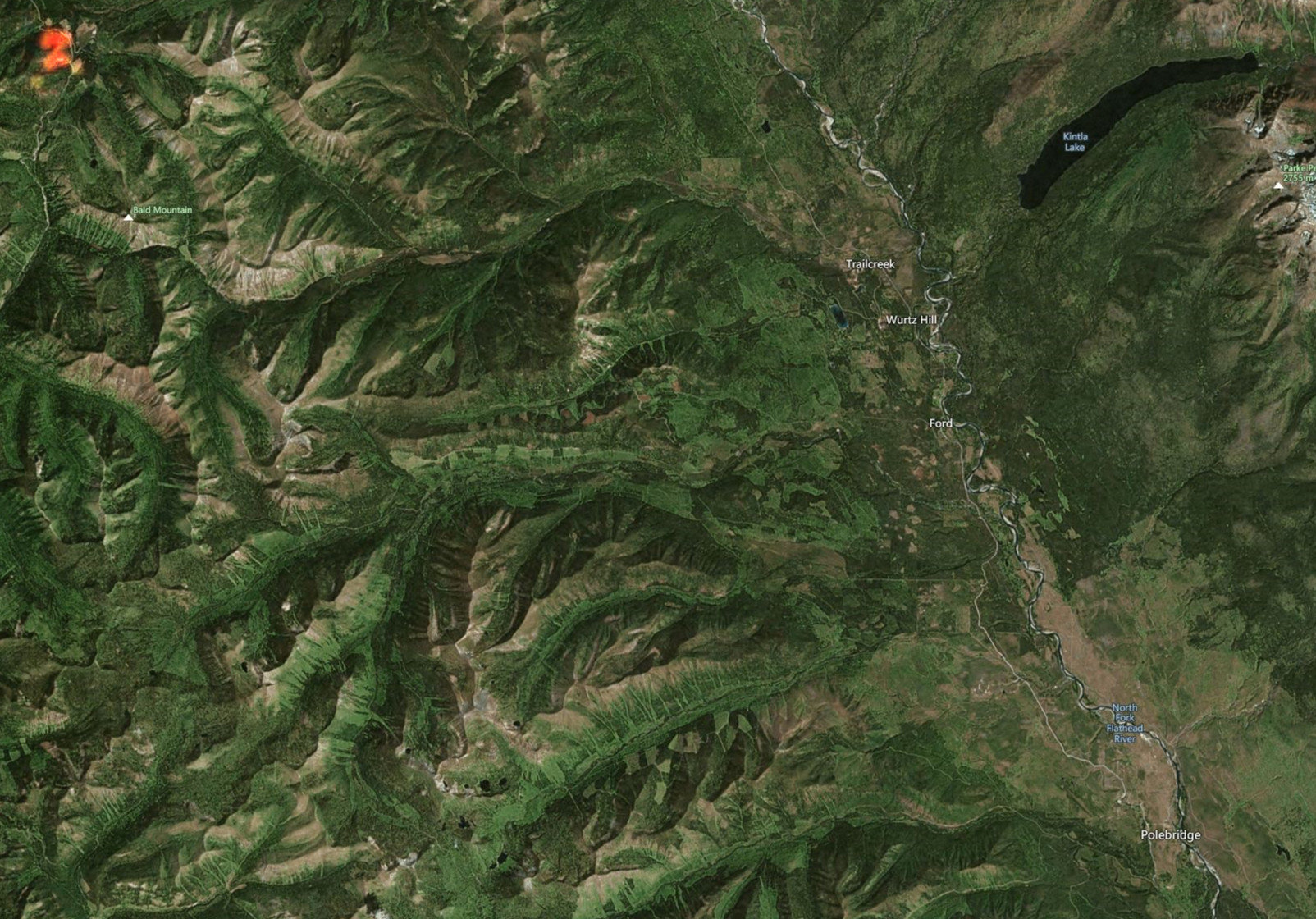
As of about 1200 today the Weasel Fire on the Kootenai NF has jumped FS Road 319 and is headed northeast towards the Frozen Lake area.  It is estimated that about 50 acres of the fire are now on the Flathead National Forest and the overall size is now over 200 acres.  We are in touch with the Kootenai NF and the Canadians are in the communication loop as well. This is on Glacier View Ranger District and the lands consist of 5a Backcountry Non-Motorized Year-Round and 1b Recommended Wilderness Area and Tuchuck – Whale Recommended Wilderness.  There are no suppression actions planned at this time on the Flathead side of the fire.  We will be implementing/evaluating closures, updating signage and assessing any potential values at risk in the area.  I have attached a map of the fire from this AM.  This does not include the fire growth from today but it will give you an idea of where the fire is located.  It should also be noted that there was a Weasel Fire from 2017 (3800 acres) on the Kootenai and Flathead and is directly east of the current Weasel Fire.

I recommend steering folks to InciWeb to find the latest-greatest info about the Weasel Fire: https://inciweb.nwcg.gov/incident/8290/.

Thanks,
Rob

Weasel Fire Map, August 3, 2022

Area wildfire status, morning of August 4th

Using information from various online resources…

The Weasel Fire in the Kootenai National Forest continues to grow slowly, reaching 162.38 acres according to the IR estimate posted this morning. It still poses no threat to the North Fork.

The Flattop Mountain Fire in Glacier NP continues to skunk around at 0.1 acres.

Weasel Fire Aerial Recon, August 2, 2022 - USFS
Weasel Fire Aerial Recon, August 2, 2022 – USFS

Area wildfire status, morning of August 2nd

Using information from Lynn Ogle, Debo Powers (currently at Cyclone LO) and online resources…

The Weasel Fire in the Kootenai National Forest grew quite a bit yesterday, reaching 150 acres (see attached image). There was some spotting across Road 319 to the east, but it rained for 30 minutes and a helicopter made water dumps, too. It continues to be no threat to the North Fork.

The Flattop Mountain Fire in Glacier NP continues to hold at around at 0.1 acres.

Weasel Fire Location, 2 Aug 22

Area wildfire status, morning of August 1st

Using information from Lynn Ogle, Debo Powers (currently at Cyclone LO) and some digging through online resources…

The Weasel Fire is at 30 acres, up from it’s initial 10, and moving towards the northeast. It generated a lot of visible smoke yesterday, but is currently no threat to the North Fork. Location is in the Kootenai National Forest, 26 miles northwest of Polebridge (see image; fire location is in upper left corner).

The hot spots in last year’s Hay Creek burn disappeared from the satellite imagery overnight and there is no smoke from that location.

The Flattop Mountain Fire in Glacier NP continues to skunk around at 0.1 acres.

There were no other verifiable local smoke reports yesterday.

Bill

Weasel Fire Location, 1 Aug 22