Using information from various online resources…
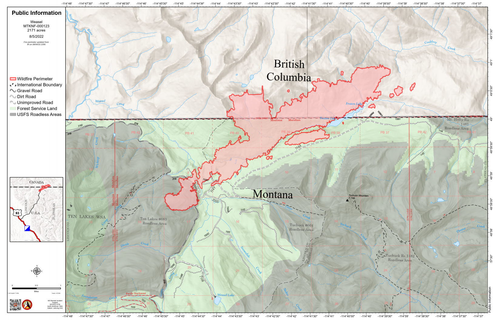
The Weasel Fire, which began in the Kootenai National Forest, made a substantial run yesterday, jumping FS Road 319 and pushing northeast towards the Frozen Lake area and on into Canada north of Tuchuck Mountain.. It is now estimated at 2174 acres. The blaze is currently burning in the Kootenai National Forest, the far northwest corner of the North Fork in the Flathead Forest’s Glacier View district, and a substantial portion is in Canada. See the accompanying map for more information.
According to a note sent yesterday afternoon from Rob Davies, Hungry Horse/Glacier View District Ranger: “We are in touch with the Kootenai NF and the Canadians are in the communication loop as well. This is on Glacier View Ranger District and the lands consist of 5a Backcountry Non-Motorized Year-Round and 1b Recommended Wilderness Area and Tuchuck – Whale Recommended Wilderness. There are no suppression actions planned at this time on the Flathead side of the fire. We will be implementing/evaluating closures, updating signage and assessing any potential values at risk in the area.”
Monitor the Weasel Fire InciWeb site for additional information: https://inciweb.nwcg.gov/incident/8290/. Also keep an eye on the NFLA website for fire-related postings.
0930: Update from Andy Huntsberger, District Fire Management Officer: “We are… currently working on area/trail closures for this area. We aren’t planning to close Trail Creek Road at this time but areas to the north of Trail Creek Road will be closed and some trails in the area will be affected.”
Bill