Using information from various online resources…
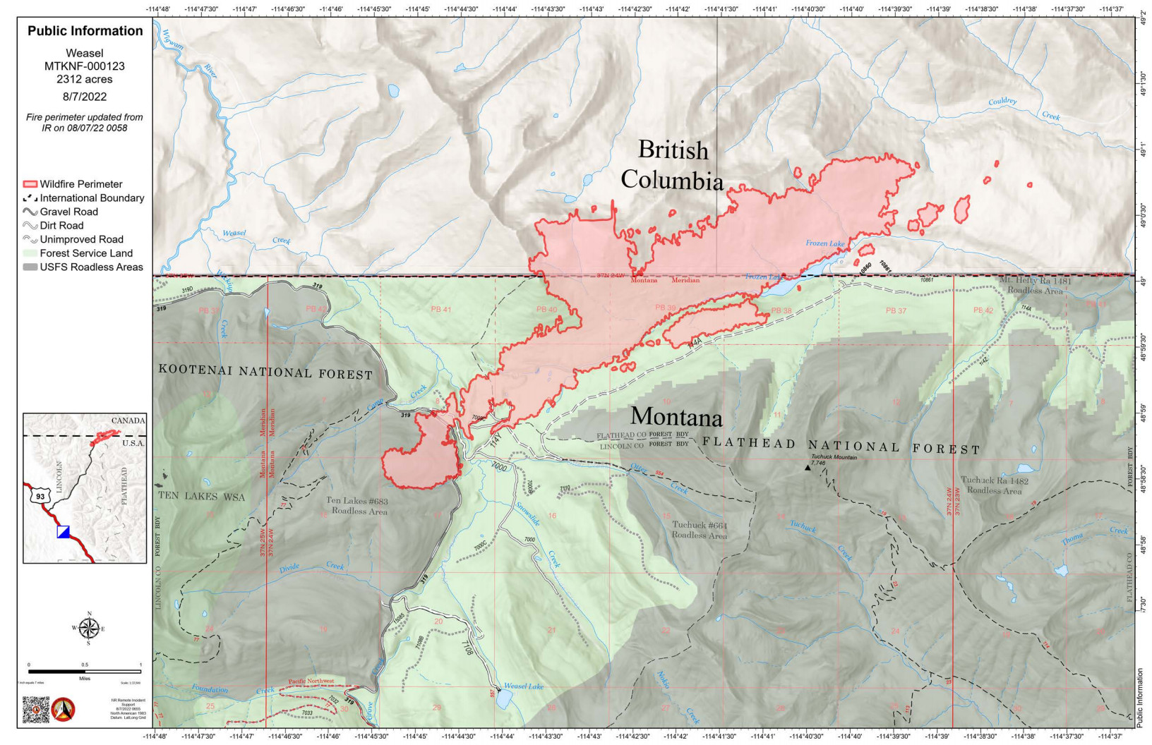
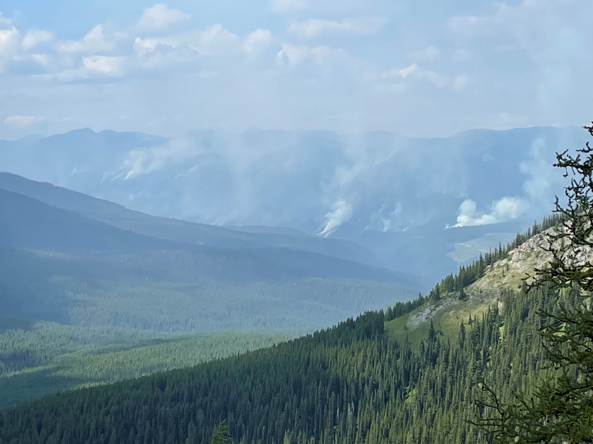
According to this morning’s IR (heat mapping) pass, the Weasel Fire gained another 38 acres yesterday and is now estimated at 2312 acres (the estimate posted last night was 2384 acres). The blaze is currently burning in the Kootenai National Forest, the far northwest corner of the North Fork in the Flathead Forest’s Glacier View district, and in Canada. See the attached map for fire location and extent.
The US and Canada are working together to control the Weasel Fire. From the InciWeb site: Jurisdictional collaboration is occurring between the Incident Management Team (IMT) in the United States located in Eureka, Montana and the BC Wildfire Service Incident Management Team in Canada, located in Cranbrook. The two IMT’s are closely coordinating on wildfire management and are sharing resources as required.
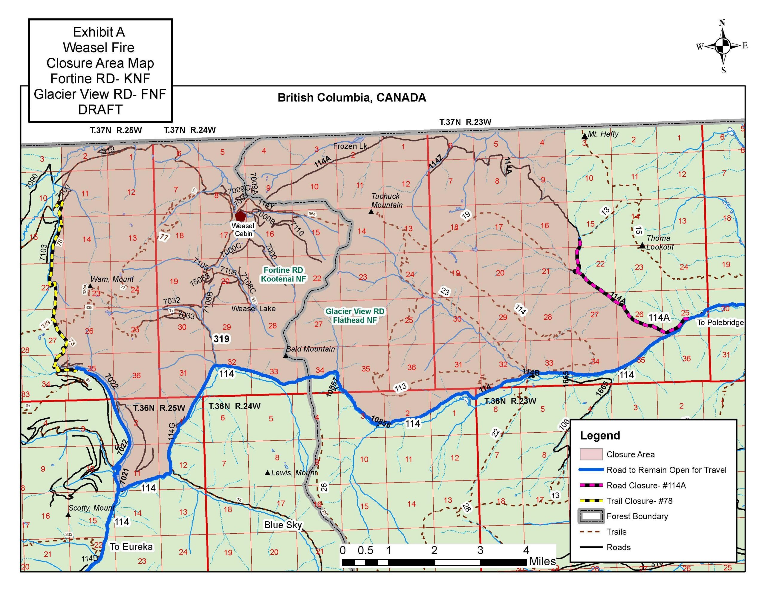
The area closure associated with the fire was increased to include segments of both the Kootenai and Flathead Forests yesterday. For the North Fork, this affects an area above Trail Creek Road north to the border and from the Whitefish Divide east to the Frozen Lake Road vicinity. Trail Creek Road remains open. See the attached map for details.
Monitor the Weasel Fire InciWeb site for additional information: https://inciweb.nwcg.gov/incident/8290/. Also keep an eye on the NFLA website for fire-related postings.