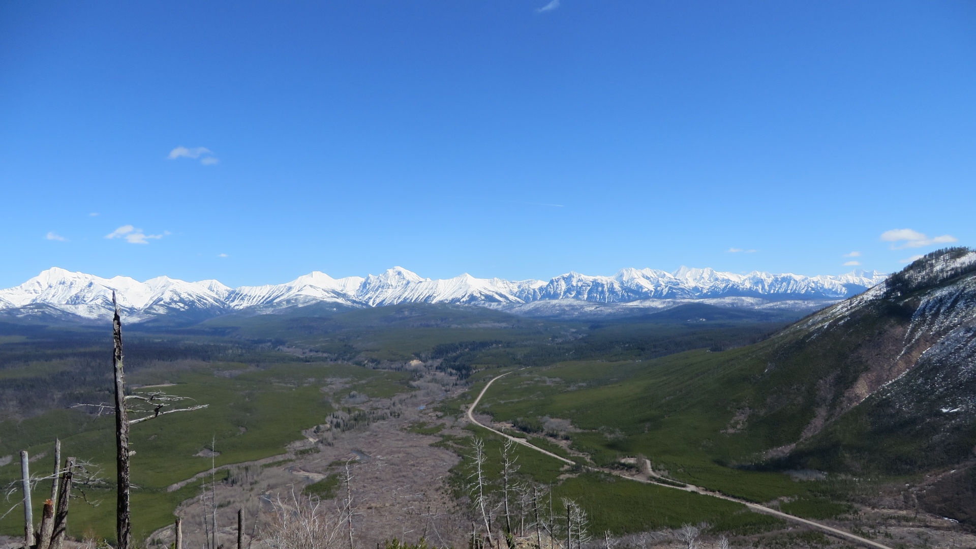
Camas Road in Glacier NP as seen from Glacier View Mtn, April 16, 2017 – W. K. Walker
Looks like reservations will be needed for all Glacier Park entrances next year…
As Glacier National Park finalizes the details of an evolving vehicle-reservation system slated to go online for a third summer in 2023, the most urgent refrain from gateway business leaders is: When?
When will they know next year’s plan to manage vehicle access at entrances girding the million-acre park’s sprawling footprint, around which the economic picture is as diverse as ecologic? When can they begin sharing specifics of the adaptive system so that guests won’t be “blindsided” by changes to its configuration next summer? And when will they know whether two popular entrances that so far have remained unencumbered by the reservation requirement will be added to the list?…
It’s time for another round of Forest Service Special Use Permits. The official “scoping letter” is linked below. See the project web site for additional documentation, including maps.
None of the proposed Special Use Permits affect the North Fork directly, with the exception of a guided snowmobile tour that comes up from the west side of the Whitefish Divide and terminates at Red Meadow Campground.
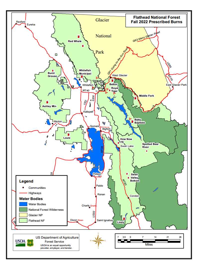
The Flathead National Forest just published information on this fall’s prescribed burns. The only entry of local interest is this one (listed under “Hungry Horse District” for some reason)…
Red Whale Fuels Reduction— Approximately 750 acres will be targeted for prescribed burning this fall in Moose creek and Moran creek. This project location is in the North Fork of the Flathead about 4 miles northwest of Polebridge. Depending on weather this burn is planned for mid to late September to early October. The purpose of this project is to help restore a more historical fire regime to the ecosystem, improve wildlife habitat and reduce hazardous fuels to reduce wildfire risk and aid in potential future fire suppression efforts and improve wildlife habitat.
Of course, any prescribed burn is contingent on weather, fuel conditions, and air quality lining up just right.
To the Flathead Valley friends and pupils of Karen Chesna (formerly Karen C. McNeil):
You may not have heard that Karen suffered a fatal heart attack on August 6, at her home in Missoula.
She is survived by her sister Barbara and her two children: Henry and Fiona McNeil.
If you wish to join her family, friends, and pupils in memory of Karen, please contact the Arbor Day foundation at the following address: https://shop.arborday.org/trees-in-memory. There you may order a tree to be planted in a U.S. national forest as a living memorial for Karen.
National Park Service Glacier National Park
Incident Commander: M. Lewelling
Fire Information Email: glac_fire_line@nps.gov
Fire Information Recording: 406-206-6099
Fire Information Office: 406-206-5272 (8 am to 6 pm)
Quartz Fire grows two acres; crews patrolling after Thursday’s lightning
Current Situation: The Quartz Fire was mapped at 1698 acres last night, resulting in a two acre increase over the infrared mapping done Tuesday night. Consistent rains over the past few days have significantly reduced fire activity. Scattered heat remains within the fire’s perimeter.
Wet weather over the Quartz Fire resulted in additional lightning to the area. Glacier fire personnel observed many lightning strikes resulting in two fires in the northwest region of the park. The Numa Lookout observed one lightning strike in the late afternoon resulting in a tree torching. A crew accessed the area via helicopter but did not find any active fire yesterday. Firefighters will hike in from Bowman Lake today to patrol the area and will be prepared to respond if any new fires are discovered. Firefighters located at Quartz Lake observed a second lightning strike in the Quartz drainage near the Quartz Fire, but there was no smoke observed after the afternoon rain. Crews will continue to patrol and scout the Quartz area today.
Weather: Winds are expected to increase on Friday ahead of a cold front that will pass over Glacier on Saturday. Winds will be 10-20 mph from the west through the day and 5-15 mph overnight, which may slightly increase fire activity during the warmest part of the day. Smoke may be visible if fire activity increases.
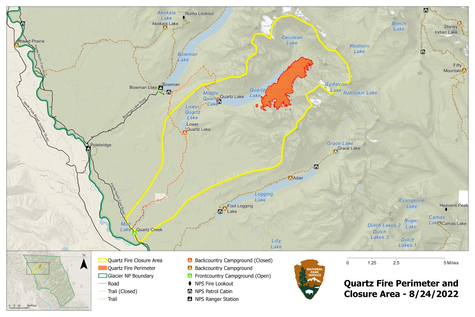
Closures: Glacier National Park has enacted a Closure Order for the areas, campgrounds, and trails within the Quartz Lake drainage from the Continental Divide to the Inside North Fork Road for the protection of park visitors, employees, and natural resources. This includes the Quartz Lake Loop trails starting from just south of Bowman Lake toward Quartz Lake, as well as the Quartz Lake and Lower Quartz Lake Wilderness Campgrounds. A map of the closure is available on InciWeb.
Fire Restrictions: The fire danger rating in Glacier National Park is currently Very High. All park visitors are reminded that campfires are allowed only in designated fire rings or grates and should be kept small. Never leave a fire unattended and drown any campfire with water until cold to the touch before leaving it.
Air Quality: National air quality and smoke conditions can be monitored at https://fire.airnow.gov/. Visibility in different parts of Glacier National Park can vary from hour to hour, depending on fire and wind conditions both locally and throughout the west. Check the park’s webcams at https://www.nps.gov/glac/learn/photosmultimedia/webcams.htm for current views.
Quartz Fire Statistics: Size: Approximately 1698 acres Total Personnel: 35 Start Date: Sunday, August 14, 2022 Containment: 0% Cause: Lightning Location: 25 miles north of West Glacier
This information was received from Ryan Butler, Assistant Fire Management Officer-Operations for the Hungry Horse-Glacier View Ranger District. Note that the Coal Ridge Fire is still about 10 acres . . .
[ Update! All trails in the Coal Ridge Fire vicinity (trails 2, 239 & 4) have reopened. ]
Not much to report on Coal Ridge fire. Yesterday was quiet with no growth and only smoldering was observed. Two cells did go over the fire yesterday and district personnel are hiking up to the fire today to confirm how much rain was received on the fire. As always, please feel free to reach out to me if you have question. Thank You
Coal Ridge Fire (2), August 25, 2022 – USFSCoal Ridge Fire (1), August 25, 2022 – USFS
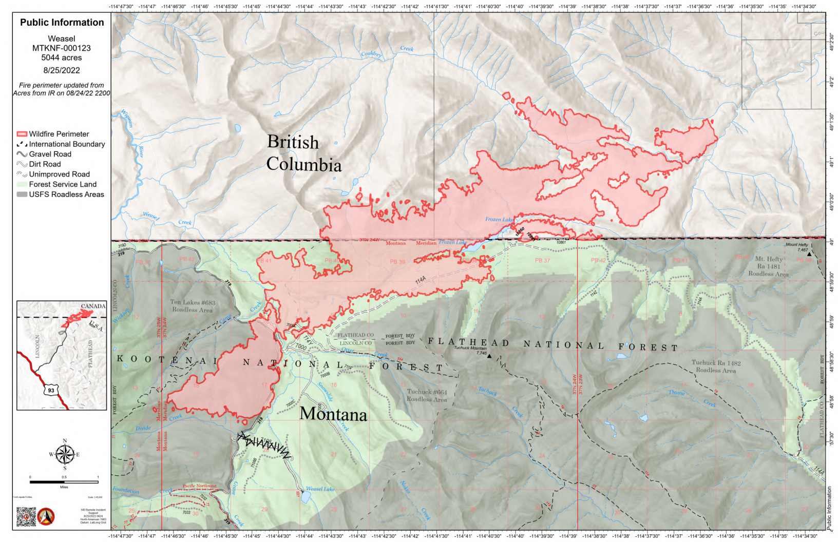
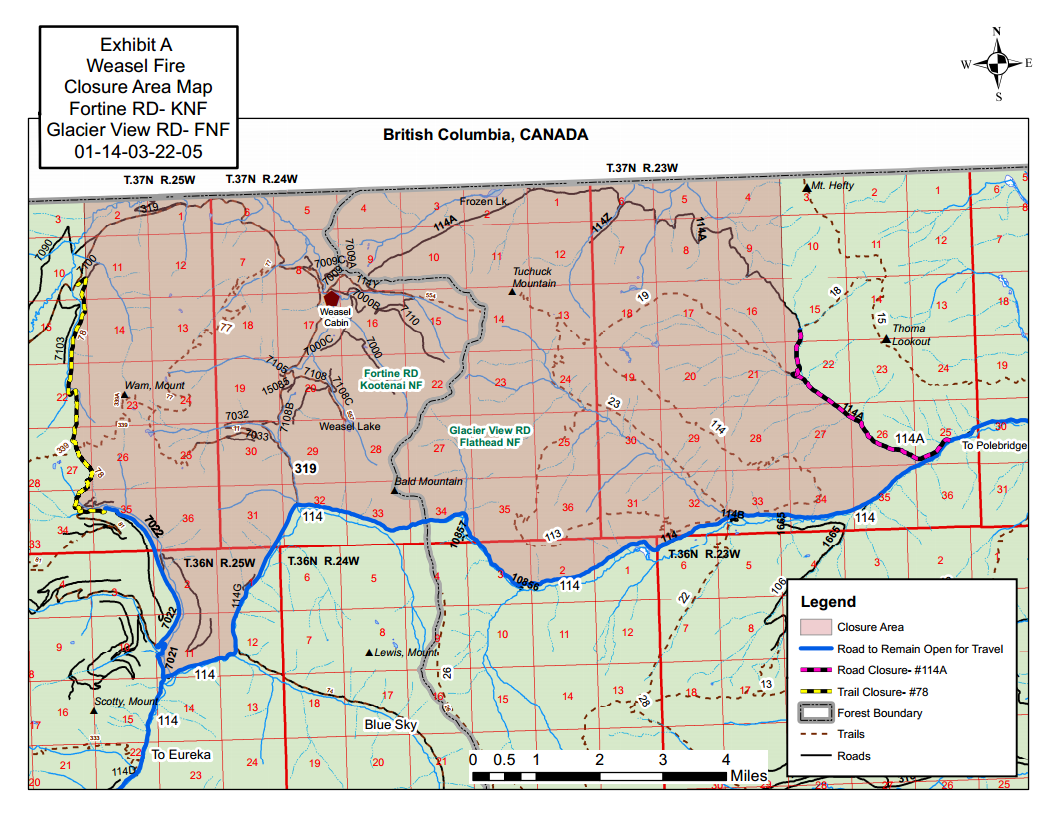
The Weasel Fire has grown very little over the past couple of days, gaining only 43 acres overall for a total of 5044, most of it in Canada. Today, August 25, Firefighters continue to improve areas along roads, clear debris from the roadway and are providing point protection of resources in the area. Lower temperatures and an increased chance of rain showers is predicted with thunderstorms this today. Fire managers continue to monitor, assess, and coordinate with Canadian efforts.
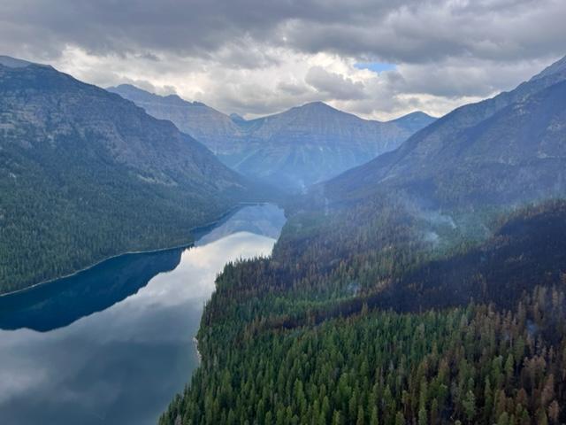
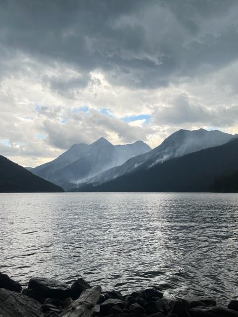
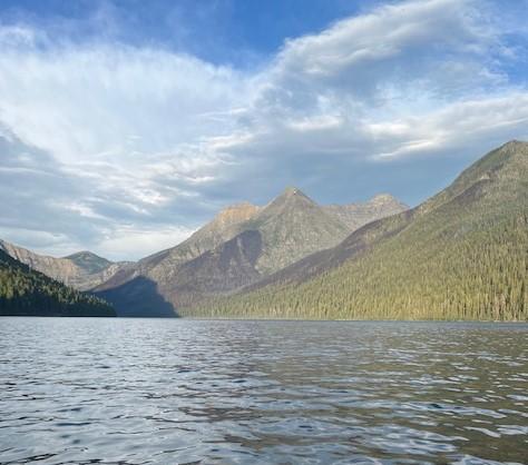
Quartz Fire before a rainstorm on August 23, 2022 – NPS
From the press release . . .
National Park Service Glacier National Park Incident Commander: M. Lewelling
Fire Information Email: glac_fire_line@nps.gov Fire Information Recording: 406-206-6099 Fire Information Office: 406-206-5272 (8 am to 6 pm)
Weather tempers fire activity on Quartz Fire
Current Situation: Weather has limited fire activity on the Quartz Fire over the past two days, and no measurable growth has been recorded. Additional rain is expected over the fire area today with a chance of lightning in the general area this afternoon.
Fire personnel continue scouting areas near the fire and assessing structures and other park facilities in anticipation of drier weather moving into the fire area and potential increased fire activity in the coming days. Crews continue to be available to respond to any new fire starts that may result from recent lightning.
Quartz Fire after rain showers on August 23, 2022 – NPS
Weather: Showers and thunderstorms are predicted to continue today. On Friday, showers and thunderstorm activity are forecast to become less widespread. A dry cold front is expected to pass over the fire area starting Saturday. The frontal passage is expected to bring lower relative humidity and gusty winds over the weekend and into early next week. These conditions may lead to increased fire activity through the weekend.
Closures: Glacier National Park has enacted a Closure Order for the areas, campgrounds, and trails within the Quartz Lake drainage from the Continental Divide to the Inside North Fork Road for the protection of park visitors, employees, and natural resources. This includes the Quartz Lake Loop trails starting from just south of Bowman Lake toward Quartz Lake, as well as the Quartz Lake and Lower Quartz Lake Wilderness Campgrounds. A map of the closure is available on InciWeb.
Fire Restrictions: The fire danger rating in Glacier National Park is currently Very High. All park visitors are reminded that campfires are allowed only in designated fire rings or grates and should be kept small. Never leave a fire unattended and drown any campfire with water until cold to the touch before leaving it.
Air Quality: National air quality and smoke conditions can be monitored at https://fire.airnow.gov/. Visibility in different parts of Glacier National Park can vary from hour to hour, depending on fire and wind conditions both locally and throughout the west. Check the park’s webcams at https://www.nps.gov/glac/learn/photosmultimedia/webcams.htm for current views.
Quartz Fire Statistics: Size: Approximately 1696 acres Total Personnel: 35 Start Date: Sunday, August 14, 2022 Containment: 0% Cause: Lightning Location: 25 miles north of West Glacier
Quartz Fire Perimeter and Closure Area, August 24, 2022
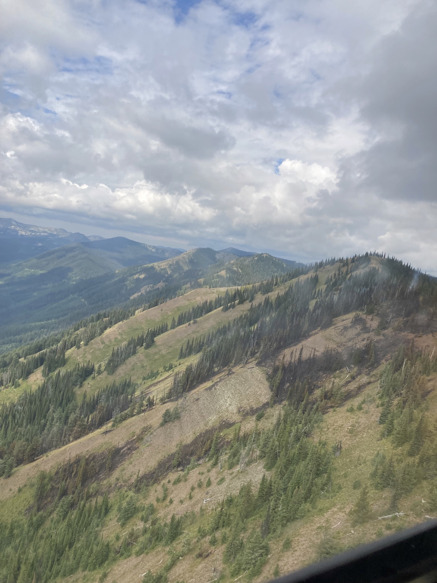
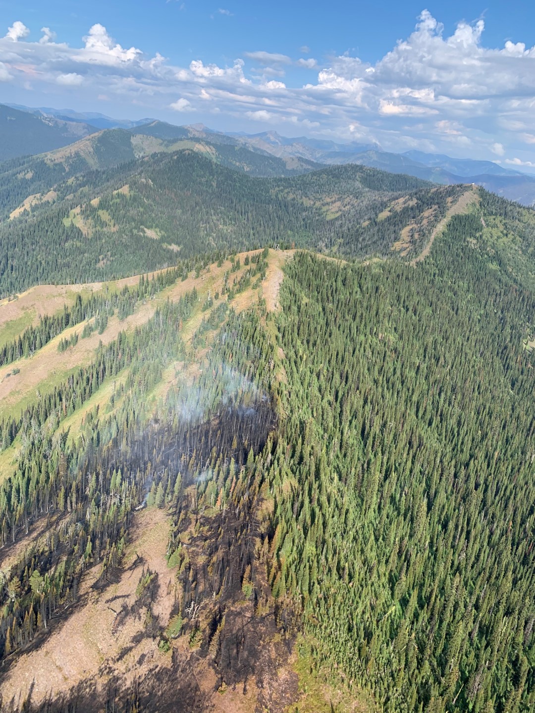
Coal Ridge Fire burn scar below old Coal Ridge Lookout site, August 24, 2022 – USFS
This information was received from Ryan Butler, Assistant Fire Management Officer-Operations for the Hungry Horse-Glacier View Ranger District. Note that the Coal Ridge Fire is still about 10 acres . . .
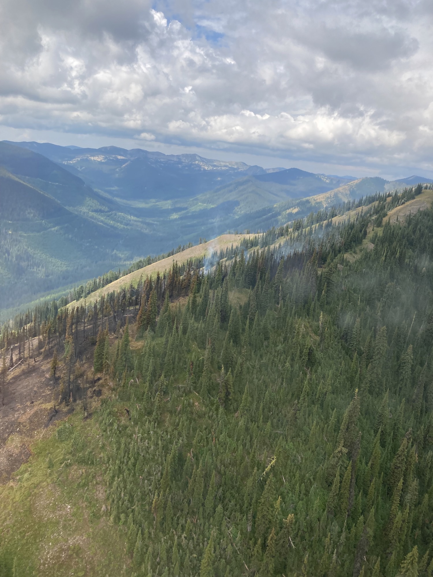
Yesterday was pretty uneventful on the Coal Ridge Fire. Cloud cover and high humidity kept fire behavior to smoldering of heavy fuels. Attached are some photos of our recon flight. As you can see in some of the photos north aspects are too wet to support fire. Ground crews will be out on the 317B rd again today and I will report back to you all if there is rain in the rain gauge. Once the T-storms and rain move out of the area, looks like Saturday, we will have a contingent back up on Coal ridge. As always, please feel free to reach out to me if you have question. Thank You.
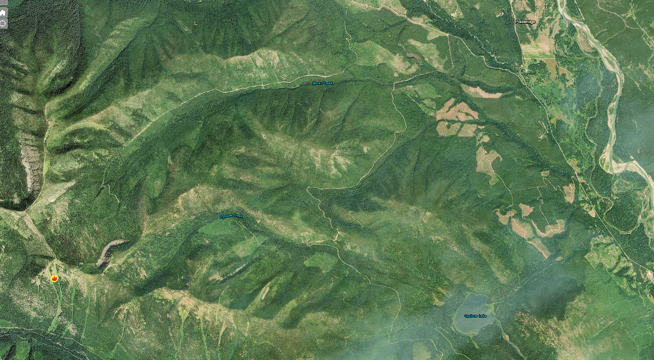
Coal Ridge Fire – view from south along ridgetop, August 24, 2022 – USFSCoal Ridge Fire Location