The Weasel Fire has grown very little over the past couple of days, gaining only 43 acres overall for a total of 5044, most of it in Canada. Today, August 25, Firefighters continue to improve areas along roads, clear debris from the roadway and are providing point protection of resources in the area. Lower temperatures and an increased chance of rain showers is predicted with thunderstorms this today. Fire managers continue to monitor, assess, and coordinate with Canadian efforts.
On Saturday, July 30, 2022, the lightning caused Weasel fire originated on the Kootenai National Forest and advanced across the Flathead National Forest into Canada. The National Forests are closely coordinating with the BC Wildfire Service Incident Management Team in Canada, located in Cranbrook. Reporting on the Canadian portion of the fire can be found at the BC Wildfire Service website.
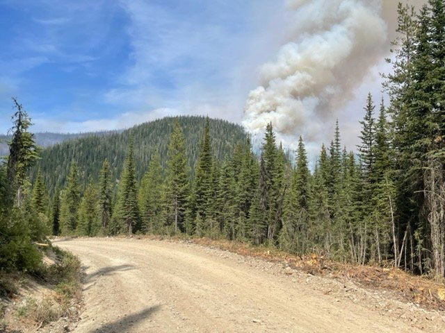
The fire on the U.S. side is currently estimated at 2,310 acres. Yesterday fire activity continued to be slightly active with creeping, backing and individual tree torching due to winds and terrain. The fire continues to burn in heavy dense fuels in steep, rugged and unpopulated terrain.
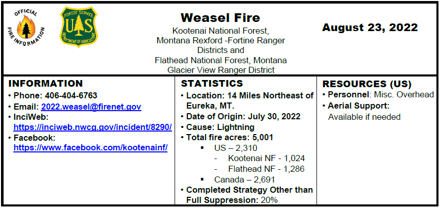
Today, August 23, Firefighters continue to improve areas along roads, clear debris from the roadway and are providing point protection of resources in the area. Lower temperatures and an increased chance of rain showers is predicted with thunderstorms this evening. Fire managers continue to monitor, assess, and coordinate with Canadian efforts.
Fire information will be providing updates every other day unless significant changes occur.
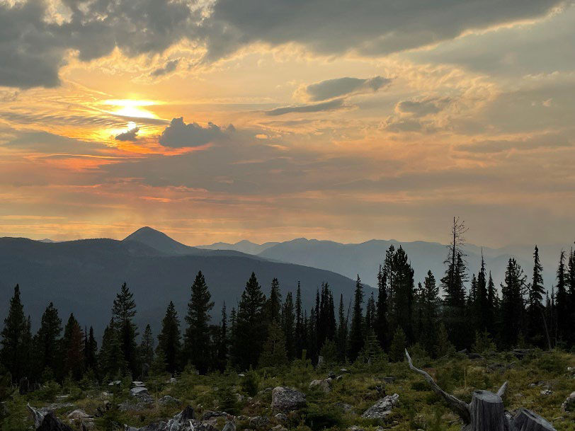
Weasel Fire from Thoma Lookout, August 22, 2022 at 1945 – Leif Haugen, USFS
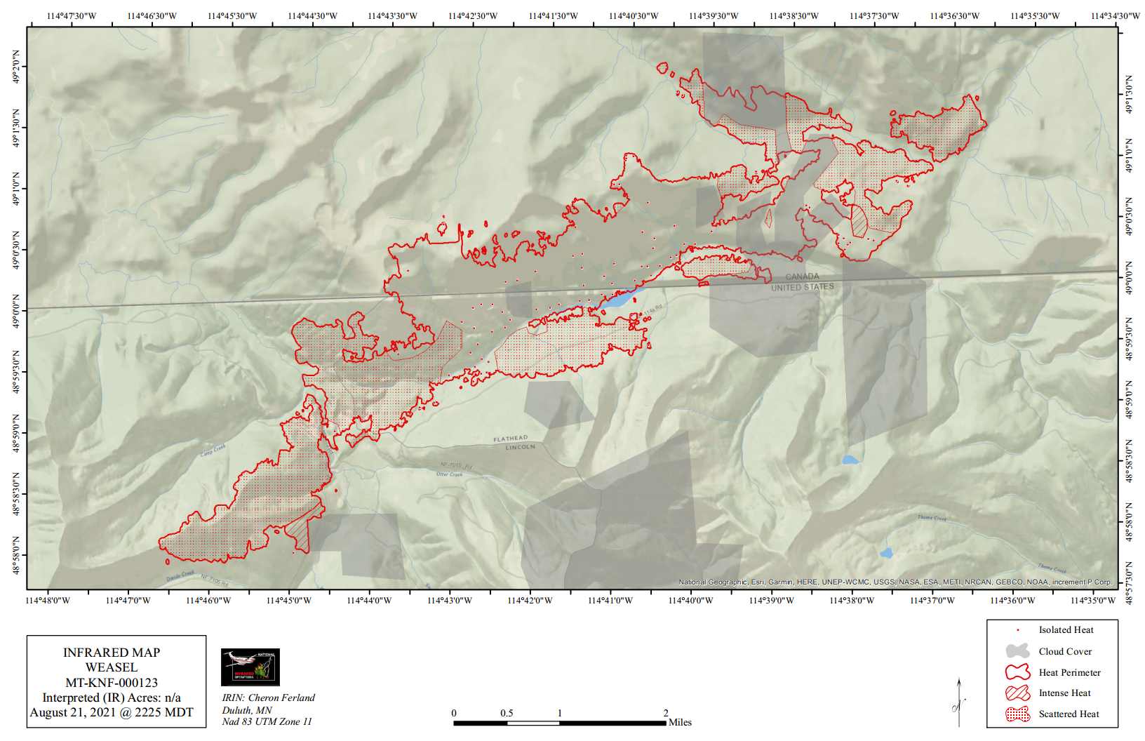
Map:
Weasel Fire Map, August 23, 2022
Current Closures:
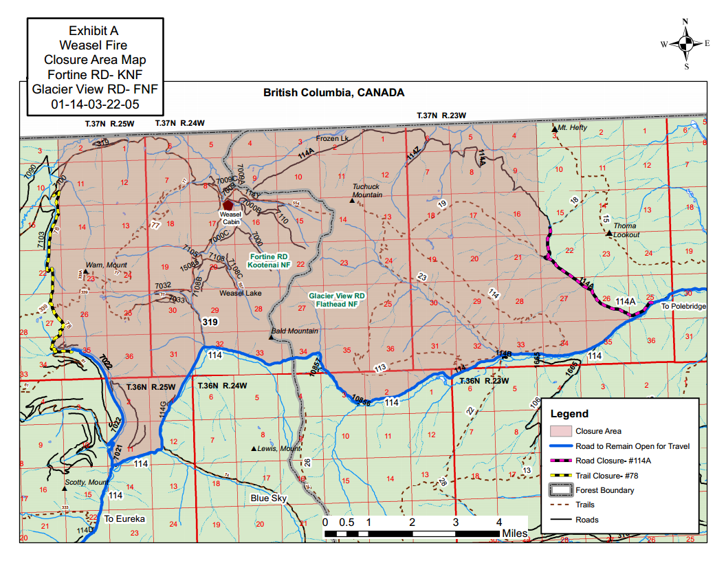
An area closure order is in place and posted that restricts access to the burned fire area. The purpose of the closure is for public safety. The FS #319 road to the Weasel Cabin is closed, and FS #114 road to Polebridge is closed due to road construction unrelated to the fire. The fire closure and road construction closure maps are also posted on InciWeb.
Weasel Fire Area Closure Map
PREVENTION MESSAGE
Know Before You Go – Visit www.mtfireinfo.org for current Montana fire restrictions. Currently the Kootenai and Flathead National Forests are not in restrictions.
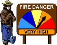
Fire Danger: Very High
When the fire danger is “very high”, fires will start easily from most causes. The fires will spread rapidly and have a quick increase in intensity, right after ignition. Small fires can quickly become large fires and exhibit extreme fire intensity, such as long-distance spotting and fire whirls. These fires can be difficult to control and will often become much larger and longer-lasting fires
Weasel Fire from Weasel Lake Road, August 22, 2022 – RJ McDole, USFS
(NOTE: Unless something exciting happens with the Weasel Fire, this will be the last morning update for this blaze. Instead, I’ll be passing along the official “Fact Sheet” which is usually released in the afternoon. – ww)
Summary: The Weasel fire remains active, gaining 408 acres since the last reliable estimate about three days ago. In the U.S., the fire is 20% contained; Canada is also establishing containment lines to the east.
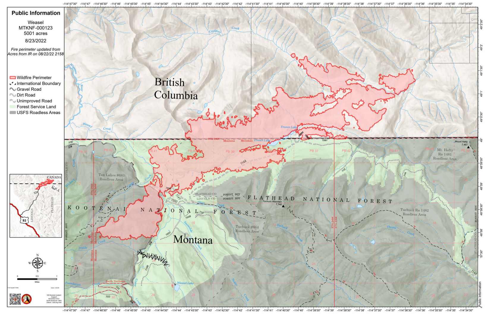
According to this morning’s IR (heat mapping) pass, the Weasel Fire gained 408 acres since the last accurate estimate about three days ago and was estimated at 5001 acres. The fire is still active and expansion was broadly distributed. Better than half (55%) of the fire is in Canada. The fire is now 20% contained within the U.S. section; Canadian personnel have been establishing containment lines along the fire’s northeastern/eastern flank to block spread into the Flathead Valley. The blaze is currently burning in the Kootenai National Forest (19%), the far northwest corner of the North Fork in the Flathead Forest’s Glacier View district (26%), and in Canada (55%). See the attached map for fire location and extent.
The US and Canada are working together to control the Weasel Fire. From the InciWeb site: Jurisdictional collaboration is occurring between the Incident Management Team (IMT) in the United States located in Eureka, Montana and the BC Wildfire Service Incident Management Team in Canada, located in Cranbrook. The two IMT’s are closely coordinating on wildfire management and are sharing resources as required.
The area closure associated with the fire was finalized August 9 and includes segments of both the Kootenai and Flathead Forests. For the North Fork, this affects an area above Trail Creek Road north to the border and from the Whitefish Divide east to the Frozen Lake Road vicinity. Trail Creek Road remains open. See the attached map and closure order document. Also note that, beginning August 22, major work will be in progress in the Glacier View Ranger District on Trail Creek Road (NFS 114) that will restrict travel for about a month.
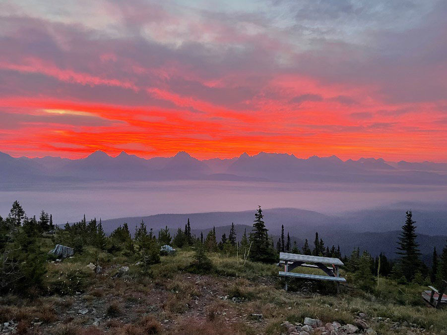
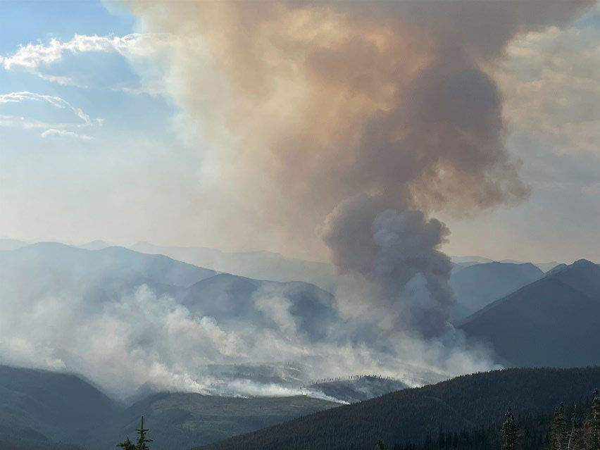
Weasel Fire from Thoma Lookout, August 20, 2022 at sunrise – Leif Haugen, USFS
Summary: Clouds again hampered an accurate estimate of the Weasel Fire’s extent but the fire did not appear to have made significant gains. In the U.S., the fire is 20% contained; Canada is also establishing containment lines to the east.
Reminder: Heavy road work begins on NFS Road 114 (Trail Creek/Grave Creek Road) today. It may take up to four weeks for completion, during which time the road will be closed to through traffic. See this post for details.
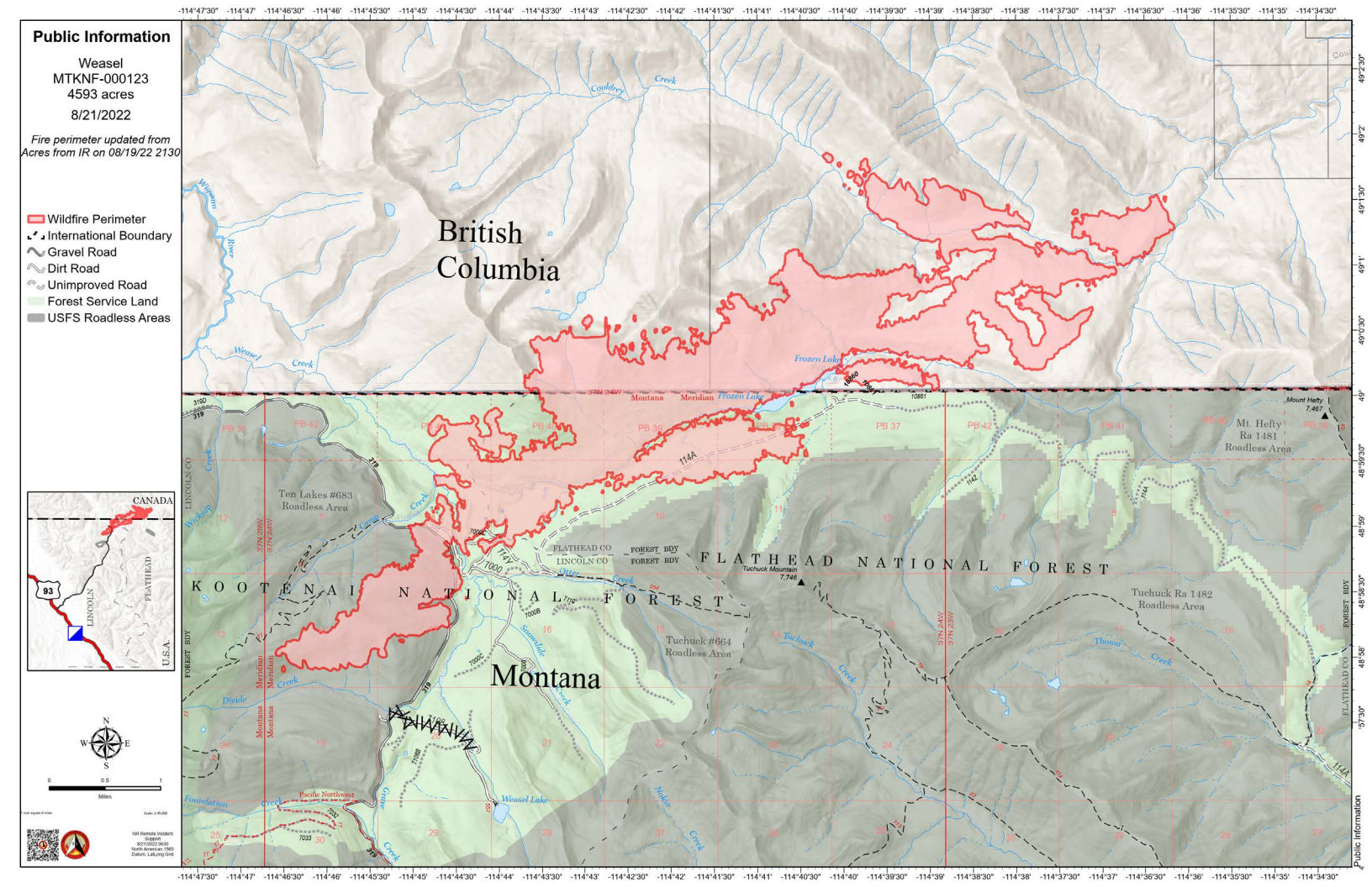
According to Saturday morning’s IR (heat mapping) pass, the Weasel Fire gained 390 acres and was estimated at 4593 acres. (Cloudiness has prevented estimates for the last couple of days, so the current fire extent is likely a bit larger.) Better than half of this area — and most of the fire growth — is in Canada. Expansions were along Couldrey Creek on the northern flank and in Lincoln County along the southwest perimeter. The fire is now 20% contained within the U.S. section; Canadian personnel have been establishing containment lines along the fire’s northeastern/eastern flank to block spread into the Flathead Valley. The blaze is currently burning in the Kootenai National Forest, the far northwest corner of the North Fork in the Flathead Forest’s Glacier View district, and in Canada. See the attached map for fire location and extent.
The US and Canada are working together to control the Weasel Fire. From the InciWeb site: Jurisdictional collaboration is occurring between the Incident Management Team (IMT) in the United States located in Eureka, Montana and the BC Wildfire Service Incident Management Team in Canada, located in Cranbrook. The two IMT’s are closely coordinating on wildfire management and are sharing resources as required.
The area closure associated with the fire was finalized August 9 and includes segments of both the Kootenai and Flathead Forests. For the North Fork, this affects an area above Trail Creek Road north to the border and from the Whitefish Divide east to the Frozen Lake Road vicinity. Trail Creek Road remains open. See the attached map and closure order document. Also note that, beginning August 22, major work will be in progress in the Glacier View Ranger District on Trail Creek Road (NFS 114) that will restrict travel for about a month.
Weasel Fire from Thoma Lookout, August 19, 2022,1530 – Leif Haugen, USFS
Summary: The weasel Fire added 390 acres on Friday, August 19, adding acreage at its southwest corner in Lincoln County and broadly along the northern perimeter in Canada. (There was no heat mapping pass this morning due to weather, so yesterday’s gains are unavailable.) In the U.S., the fire is 20% contained; Canada is also establishing containment lines to the east.
According to Saturday morning’s IR (heat mapping) pass, the Weasel Fire gained 390 acres and was estimated at 4593 acres. (There was no heat mapping pass this morning due to weather, so the current fire extent is likely a bit larger.) Better than half of this area — and most of the fire growth — is in Canada. Expansions were along Couldrey Creek on the northern flank and in Lincoln County along the southwest perimeter. The fire is now 20% contained within the U.S. section; Canadian personnel have been establishing containment lines along the fire’s northeastern/eastern flank to block spread into the Flathead Valley. The blaze is currently burning in the Kootenai National Forest, the far northwest corner of the North Fork in the Flathead Forest’s Glacier View district, and in Canada. See the attached map for fire location and extent.
The US and Canada are working together to control the Weasel Fire. From the InciWeb site: Jurisdictional collaboration is occurring between the Incident Management Team (IMT) in the United States located in Eureka, Montana and the BC Wildfire Service Incident Management Team in Canada, located in Cranbrook. The two IMT’s are closely coordinating on wildfire management and are sharing resources as required.
The area closure associated with the fire was finalized August 9 and includes segments of both the Kootenai and Flathead Forests. For the North Fork, this affects an area above Trail Creek Road north to the border and from the Whitefish Divide east to the Frozen Lake Road vicinity. Trail Creek Road remains open. See the attached map and closure order document. Also note that, beginning August 22, major work will be in progress in the Glacier View Ranger District on Trail Creek Road (NFS 114) that will restrict travel for about a month.
Weasel Fire – Photo from Thoma Lookout August 17, 2022, 1830 – Leif Haugen
Summary: The weasel Fire added 251 acres yesterday, adding acreage at its southwest corner in Lincoln County and along the northern perimeter in Canada. In the U.S., it is 20% contained; Canada is also establishing containment lines to the east.
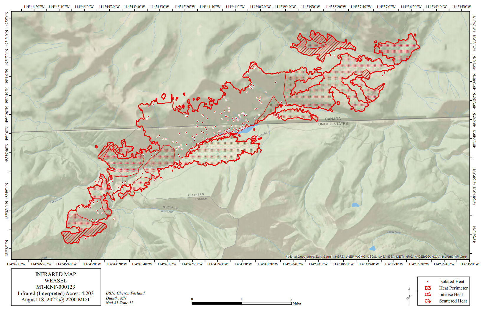
According to this morning’s IR (heat mapping) pass, the Weasel Fire gained 251 acres yesterday and is now estimated at 4203 acres. Better than half of this area — and most of the fire growth — is in Canada. Expansions yesterday were along Couldrey Creek on the northern flank and in Lincoln County along the southwest perimeter. The fire is now 20% contained within the U.S. section; Canadian personnel have been establishing containment lines along the fire’s northeastern/eastern flank to block spread into the Flathead Valley. The blaze is currently burning in the Kootenai National Forest, the far northwest corner of the North Fork in the Flathead Forest’s Glacier View district, and in Canada. See the attached map for fire location and extent.
The US and Canada are working together to control the Weasel Fire. From the InciWeb site: Jurisdictional collaboration is occurring between the Incident Management Team (IMT) in the United States located in Eureka, Montana and the BC Wildfire Service Incident Management Team in Canada, located in Cranbrook. The two IMT’s are closely coordinating on wildfire management and are sharing resources as required.
The area closure associated with the fire was finalized August 9 and includes segments of both the Kootenai and Flathead Forests. For the North Fork, this affects an area above Trail Creek Road north to the border and from the Whitefish Divide east to the Frozen Lake Road vicinity. Trail Creek Road remains open. See the attached map and closure order document. Also note that, beginning August 22, major work will be in progress in the Glacier View Ranger District on Trail Creek Road (NFS 114) that will restrict travel for about a month.
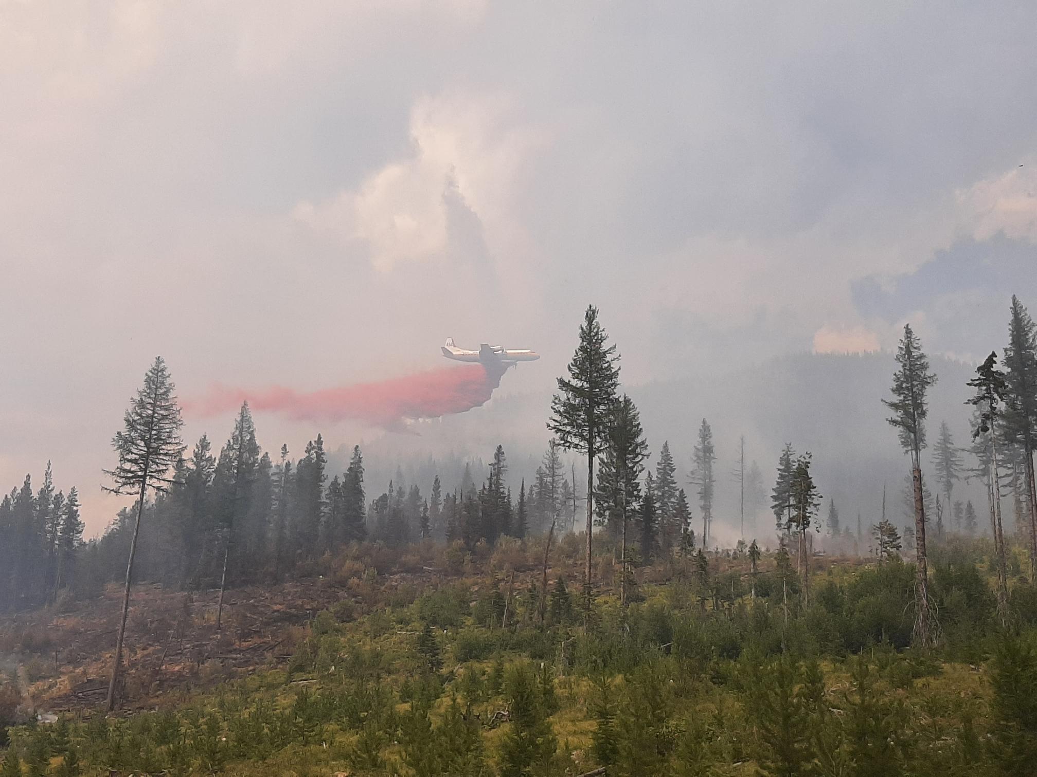
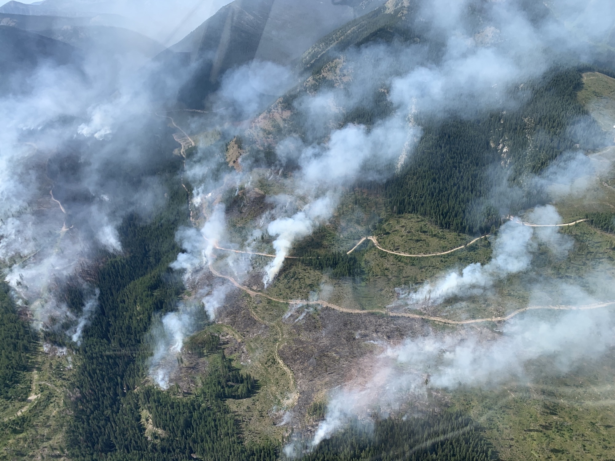
An airtanker making a run on the Weasel Creek wildfire, August 12, 2022 – BC Wildlife Service (Canada)
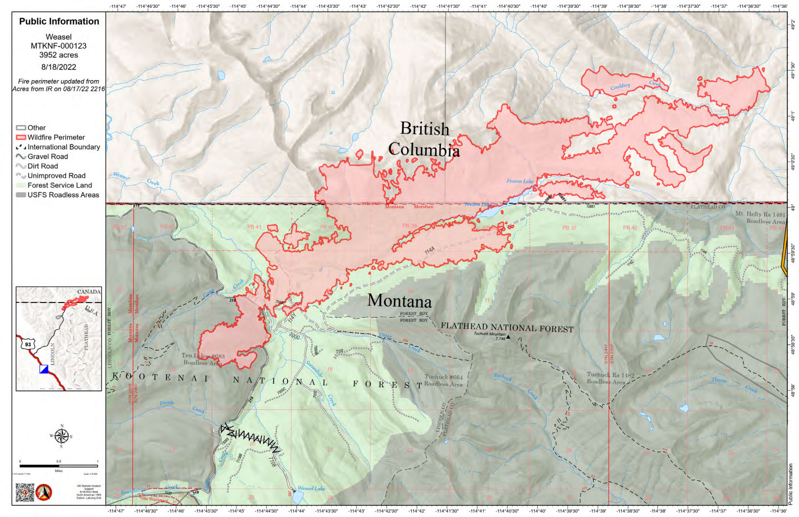
Summary: The weasel Fire added 215 acres yesterday. All the action was within Canada. In the U.S., it is 20% contained…
According to this morning’s IR (heat mapping) pass, the Weasel Fire gained 215 acres yesterday and is now estimated at 3952 acres. Better than half of this area — and essentially all of the fire growth — is in Canada. The largest expansion was along Couldrey Creek on the northern flank where a hotspot grew of about 125 acres. The fire is now 20% contained within the U.S. section; Canadian personnel have been establishing containment lines along the fire’s northeastern/eastern flank to block spread into the Flathead Valley. The blaze is currently burning in the Kootenai National Forest, the far northwest corner of the North Fork in the Flathead Forest’s Glacier View district, and in Canada. See the attached map for fire location and extent.
The US and Canada are working together to control the Weasel Fire. From the InciWeb site: Jurisdictional collaboration is occurring between the Incident Management Team (IMT) in the United States located in Eureka, Montana and the BC Wildfire Service Incident Management Team in Canada, located in Cranbrook. The two IMT’s are closely coordinating on wildfire management and are sharing resources as required.
The area closure associated with the fire was finalized August 9 and includes segments of both the Kootenai and Flathead Forests. For the North Fork, this affects an area above Trail Creek Road north to the border and from the Whitefish Divide east to the Frozen Lake Road vicinity. Trail Creek Road remains open. See the attached map and closure order document. Also note that, beginning August 22, major work will be in progress in the Glacier View Ranger District on Trail Creek Road (NFS 114) that will restrict travel for about a month.
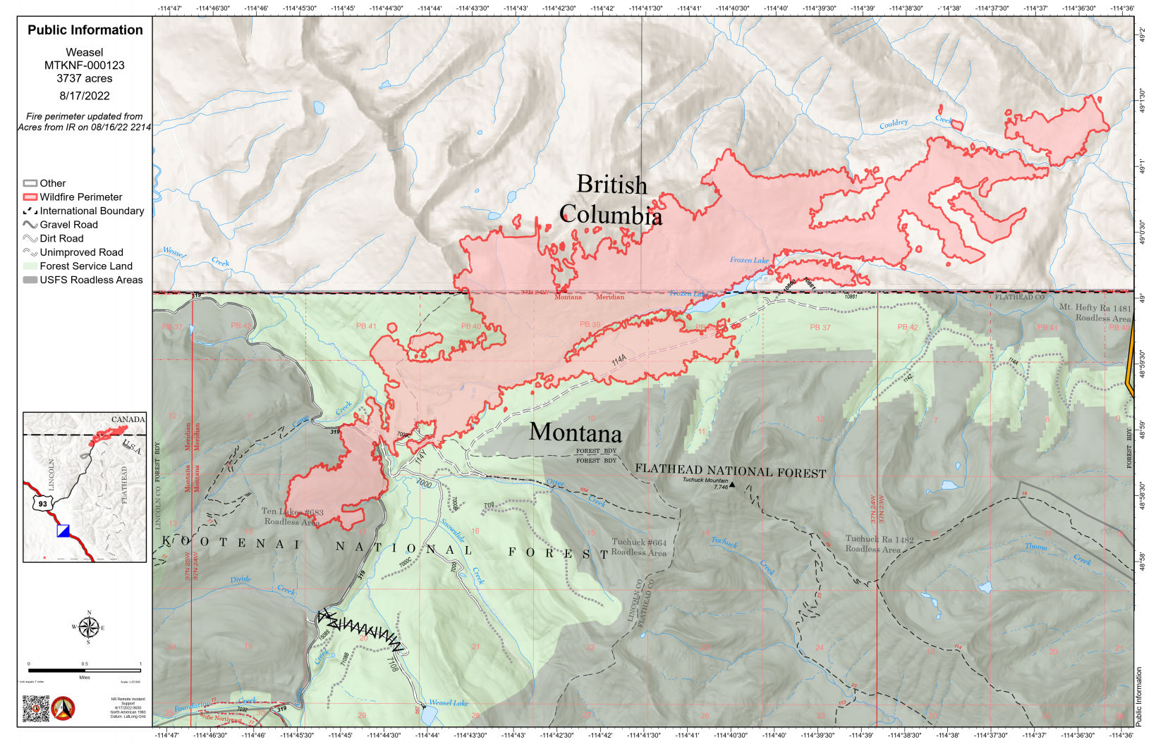
Summary: The weasel Fire added 78 acres yesterday, almost entirely within Canada. It is 20% contained…
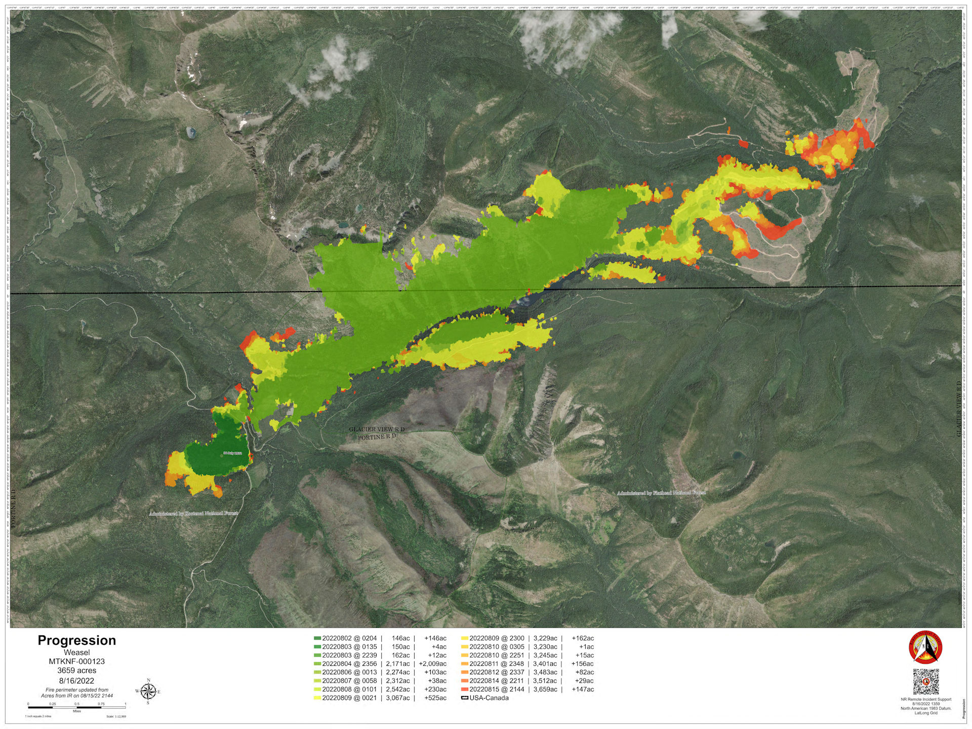
(Bonus! We have a fire progression map today, showing the fire’s daily spread up through yesterday. See below.)
According to this morning’s IR (heat mapping) pass, the Weasel Fire gained 78 acres yesterday and is now estimated at 3737 acres. Better than half of this area (about 55%) is in Canada. The fire is now 20% contained. There’s still lots of heat within the fire’s boundaries, but most of its expansion was in Canada, along the northeastern and eastern flanks. The blaze is currently burning in the Kootenai National Forest, the far northwest corner of the North Fork in the Flathead Forest’s Glacier View district, and in Canada. See the attached map for fire location and extent.
The US and Canada are working together to control the Weasel Fire. From the InciWeb site: Jurisdictional collaboration is occurring between the Incident Management Team (IMT) in the United States located in Eureka, Montana and the BC Wildfire Service Incident Management Team in Canada, located in Cranbrook. The two IMT’s are closely coordinating on wildfire management and are sharing resources as required.
The area closure associated with the fire was finalized August 9 and includes segments of both the Kootenai and Flathead Forests. For the North Fork, this affects an area above Trail Creek Road north to the border and from the Whitefish Divide east to the Frozen Lake Road vicinity. Trail Creek Road remains open. See the attached map and closure order document. Also note that, beginning August 22, major work will be in progress in the Glacier View Ranger District on Trail Creek Road (NFS 114) that will restrict travel for about a month.
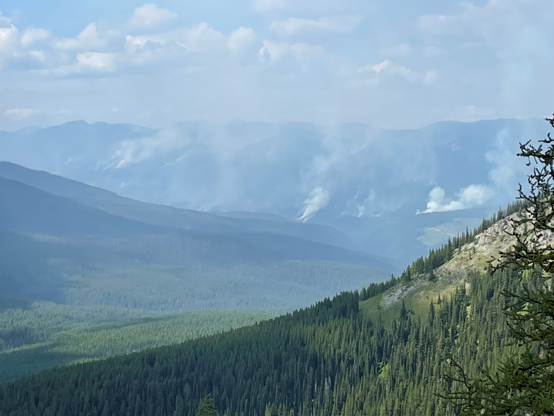
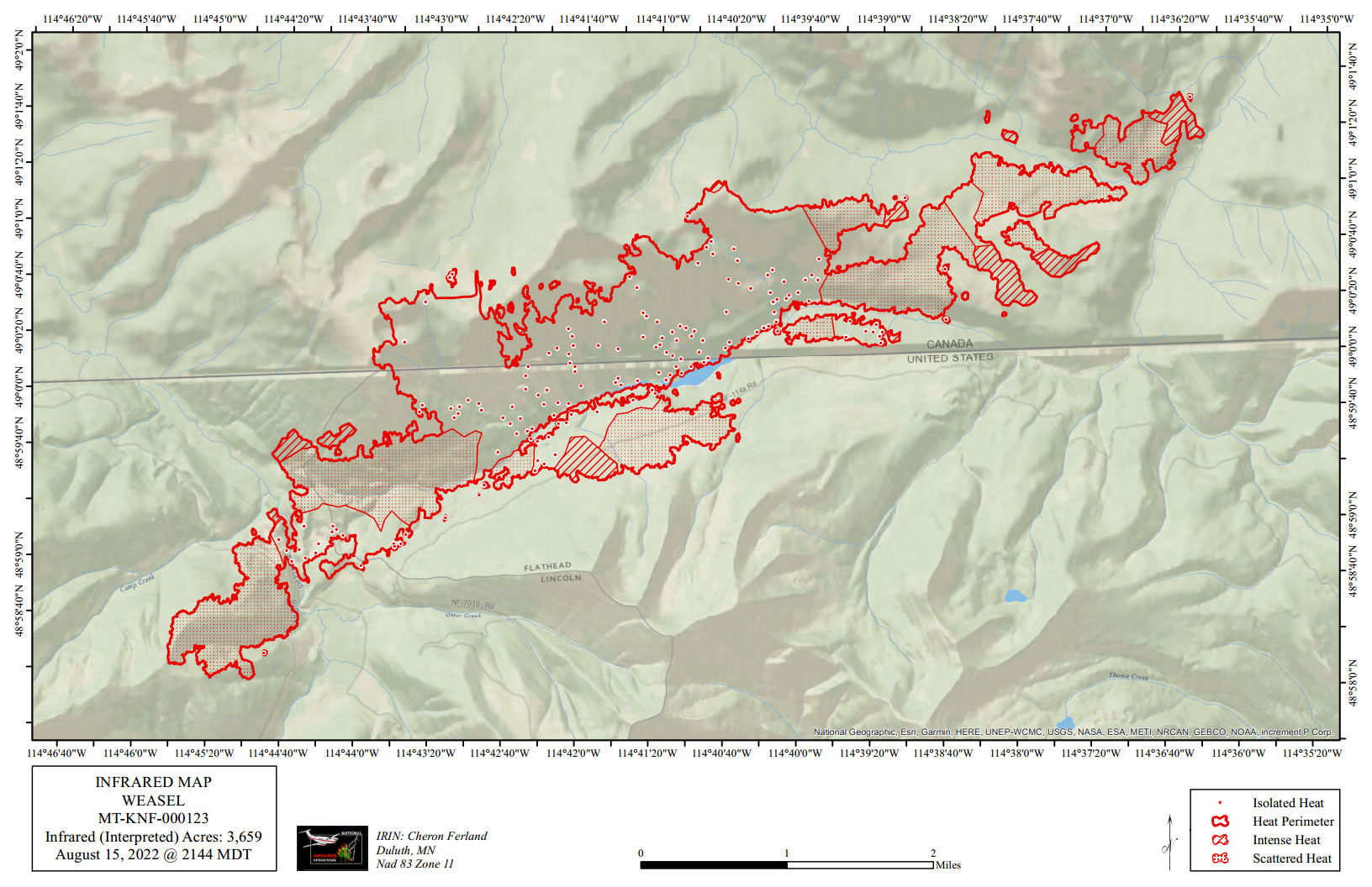
Weasel Fire on August 5, 2022, by Leif Haugen, Thoma Lookout
Summary: The weasel Fire continues to be active, adding 92 acres yesterday distributed along the western, southern and eastern flanks in the U.S. and Canada…
According to this morning’s IR (heat mapping) pass, the Weasel Fire gained 92 acres yesterday and is now estimated at 3659 acres. Better than half of this area (about 54%) is in Canada. The fire continues to be very active, with intense heat in the expansion zones as well as in several portions of the northeastern, southern, and southwestern flanks of the fire. There are also several hot spots scattered throughout the interior. The blaze is currently burning in the Kootenai National Forest, the far northwest corner of the North Fork in the Flathead Forest’s Glacier View district, and in Canada. See the attached map for fire location and extent.
The US and Canada are working together to control the Weasel Fire. From the InciWeb site: Jurisdictional collaboration is occurring between the Incident Management Team (IMT) in the United States located in Eureka, Montana and the BC Wildfire Service Incident Management Team in Canada, located in Cranbrook. The two IMT’s are closely coordinating on wildfire management and are sharing resources as required.
The area closure associated with the fire was finalized August 9 and includes segments of both the Kootenai and Flathead Forests. For the North Fork, this affects an area above Trail Creek Road north to the border and from the Whitefish Divide east to the Frozen Lake Road vicinity. Trail Creek Road remains open. See the attached map and closure order document. Also note that, beginning August 22, major work will be in progress in the Glacier View Ranger District on Trail Creek Road (NFS 114) that will restrict travel for about a month.
East flank of Weasel Creek fire, August 13, 2022 – BC Wildlife Service (Canada)
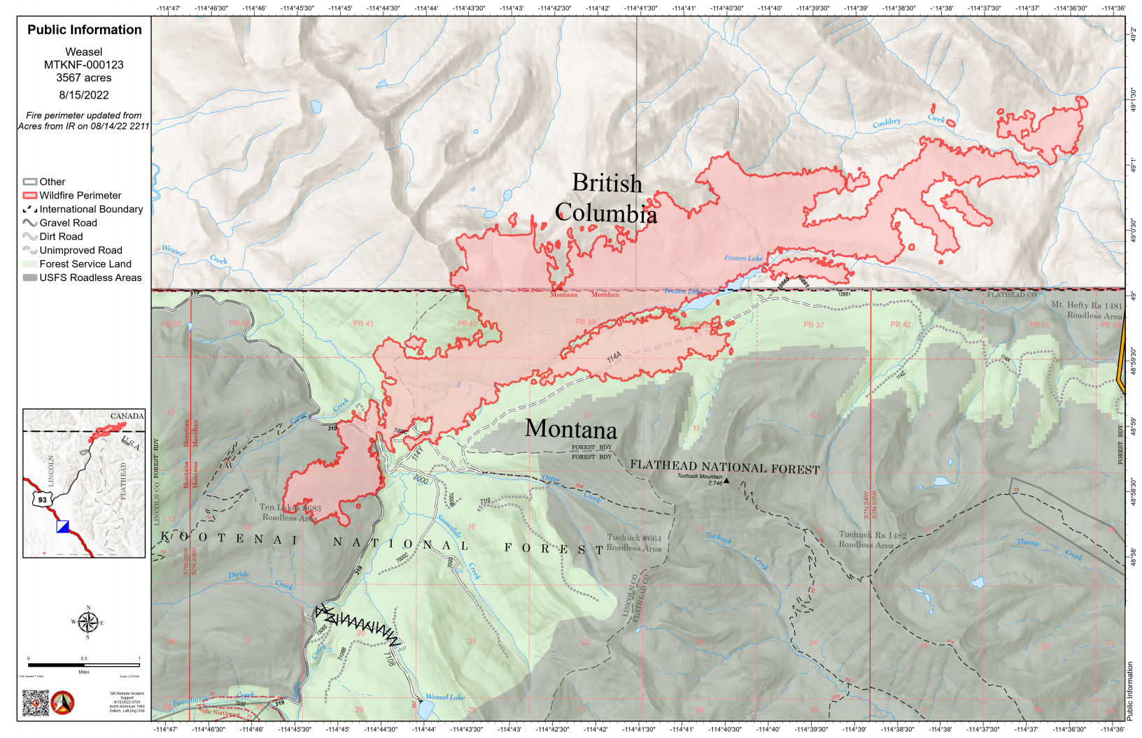
Summary: The weasel Fire added 55 acres yesterday, primarily along the western section in the U.S. and the eastern areas within Canada…
According to this morning’s IR (heat mapping) pass, the Weasel Fire gained 55 acres yesterday and is now estimated at 3567 acres. Better than half of this area (about 54%) is in Canada. Expansion was along the the west and northwest perimeters in the U.S. and to the northeast and east in Canada. The blaze is currently burning in the Kootenai National Forest, the far northwest corner of the North Fork in the Flathead Forest’s Glacier View district, and in Canada. See the attached map for fire location and extent.
The US and Canada are working together to control the Weasel Fire. From the InciWeb site: Jurisdictional collaboration is occurring between the Incident Management Team (IMT) in the United States located in Eureka, Montana and the BC Wildfire Service Incident Management Team in Canada, located in Cranbrook. The two IMT’s are closely coordinating on wildfire management and are sharing resources as required.
The area closure associated with the fire was finalized August 9 and includes segments of both the Kootenai and Flathead Forests. For the North Fork, this affects an area above Trail Creek Road north to the border and from the Whitefish Divide east to the Frozen Lake Road vicinity. Trail Creek Road remains open. See the attached map and closure order document. Also note that, beginning August 22, major work will be in progress in the Glacier View Ranger District on Trail Creek Road (NFS 114) that will restrict travel for about a month.