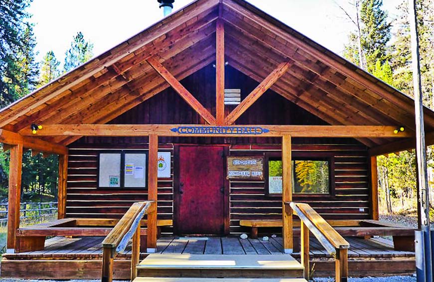
For those of you who missed it in May, Bob Lee will be giving his well-regarded First Aid/CPR/AED class in the North Fork again this summer. It is an all-day course, starting at 9:00am. The date is Tuesday, July 12. The course will be held at Sondreson Hall. Cost will be $45/person. (Make checks out to Red Tail Education and Research.)
If it has been two years or more since you took this course, you need to take it again in order to maintain your certification.
Course size limit is 10 people! Contact Bill Walker (wkwalker@nvdi.com or 406-407-2764) if you wish to attend.
Note! Like last time, the certification cards will be distributed electronically. The emails sometimes get misdirected to spam, so it is important to keep an eye out for that.
The Summer 2022 Interlocal Agreement Meeting is at 1:00pm, on Wednesday, July 13 at Sondreson Community Hall. This summer’s Interlocal is hosted by the North Fork Landowners’ Association (NFLA). It follows the annual Firewise meeting at 9:30am. Lunch is at noon, with the NFLA providing the main course. If you wish, bring a side dish or desert to share.
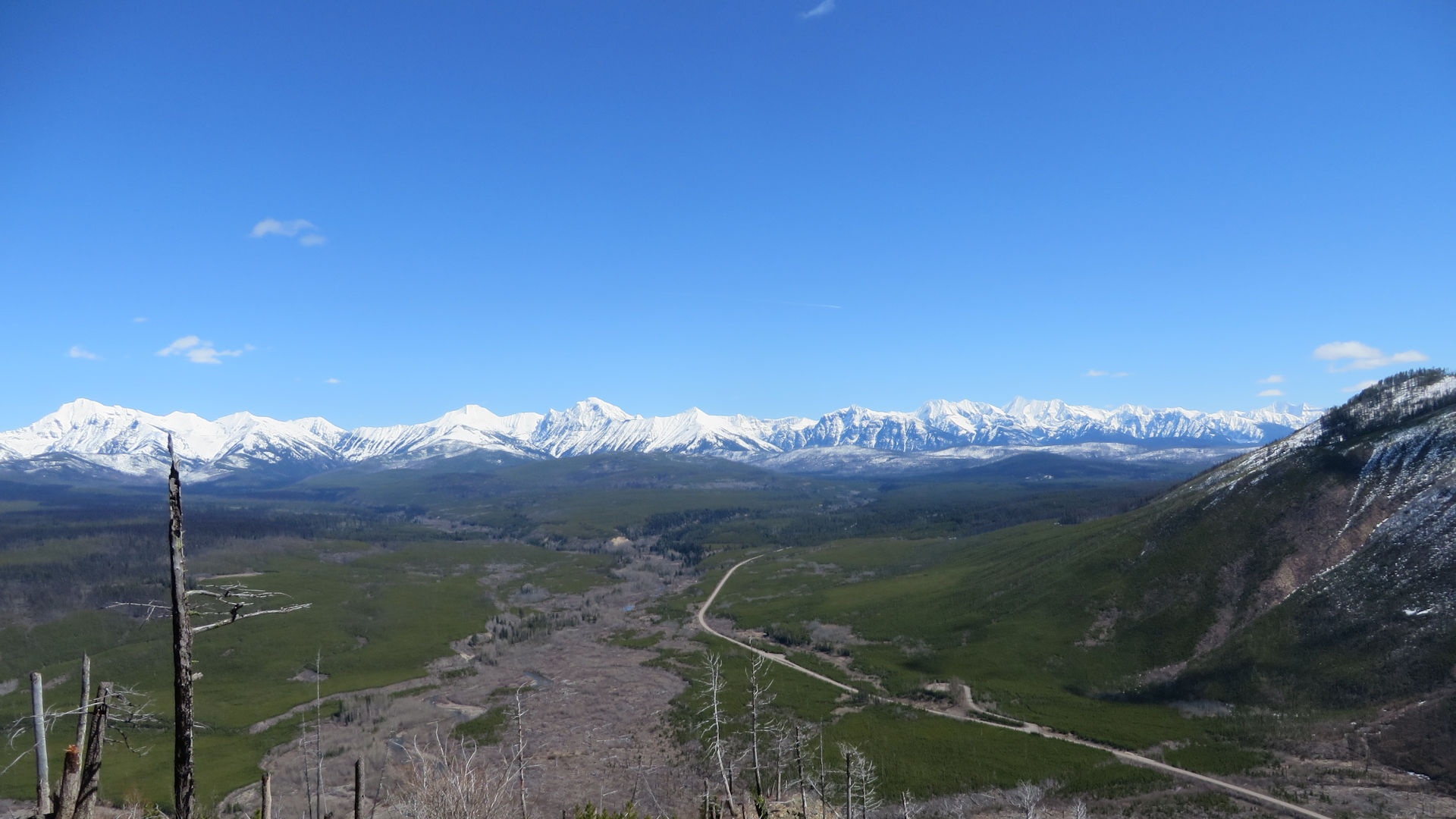
Camas Road in Glacier NP as seen from Glacier View Mtn, April 16, 2017 – W. K. Walker
Here’s some information a lot of folks have been waiting for, received late in the afternoon on May 27 from Pete Webster, Deputy Superintendent of Glacier Park . . .
An update from Jim Dahlstrom, North Fork District Ranger concerning Camas Road Bypass permits (continue the reading the main article for more details): “The passes will be here at the station by the end of the day [Saturday, May 28]… Ideally, [North Forkers] …would present themselves in person during business hours where we record their vehicle information, etc. and then get them their pass. Since I don’t have the packet in front of me right now, I don’t have many more details on the program logistics. But it shouldn’t be too onerous.”
Welcome to Summer!
Now that we have begun the vehicle reservation system, I want to share with you what we are calling the Camas Road Bypass permit. This is the access we committed to for this season to allow immediate park neighbors, with justifiable needs, a chance to use the Camas Road for thru traffic without a vehicle reservation.
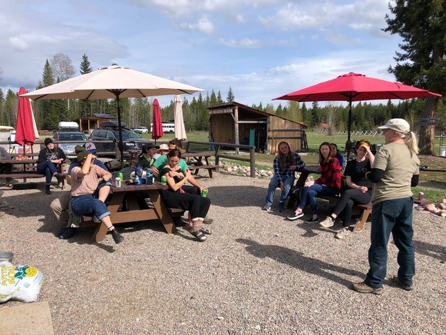
Polebridge Bear Smart training session, Home Ranch Bottoms, May 26, 2022
PBBS Program Coordinator Suzanne Hildner reports . . .
The Polebridge Bear Smart (PBBS) Committee would like to announce a very successful first Polebridge Employee Training session at Home Ranch Bottoms this afternoon. We had 12 participants who were from all across the country and with a couple of exceptions all new to living and recreating in bear country. Many had already seen a bear. They were a really fantastic audience, polite, engaged and asked excellent questions. Most were already in possession of bear spray.The entire event lasted a little over an hour. Thanks to all who helped make this happen. Next training is June 4th.
Bob Lee will be giving his well-regarded First Aid/CPR/AED class in the North Fork again this spring. It is an all-day course, starting at 9:00am. The date is Tuesday, May 24. The course will be held at Sondreson Hall. Cost will be $45/person.
If it has been two years or more since you took this course, you need to take it again in order to maintain your certification.
Course size limit is 10 people! Contact Bill Walker (wkwalker@nvdi.com or 406-407-2764) if you wish to attend.
Note! Like last time, the certification cards will be distributed electronically. The folks sending the cards insist that every recipient have a unique email address. I.e., if you share an email address with someone else and you are both attending the course, one of you would need to pick up a second address. I can hand out temporary course email addresses if needed, just let me know. Also note that the emails sometimes get misdirected to spam, so it is important to keep an eye out for that.
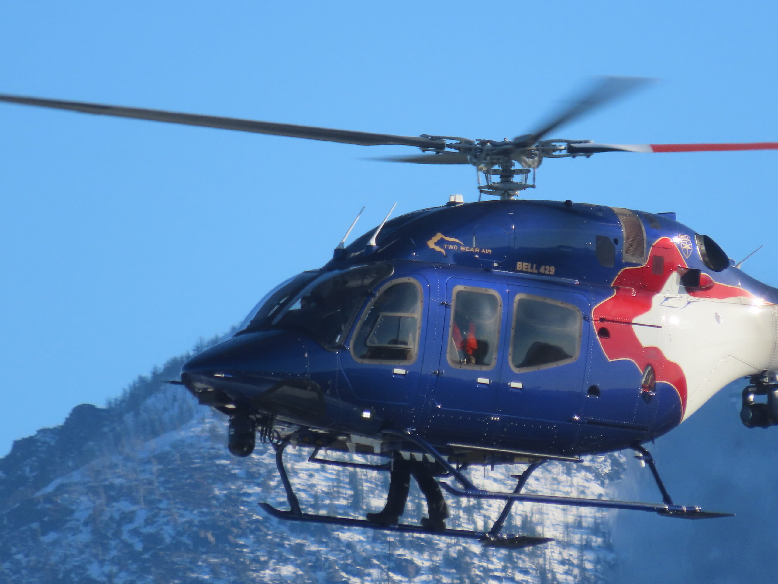
Two Bear Air will be conducting training at the Demers Ridge gravel pit from this Friday (May 13) through Thursday (May 19). Signs will be posted and helo operations will occur both day and night.
They’re just doing their own training, running scenarios in the gravel pit such as rolled vehicles and medical response.
[ The entrance to the Demers gravel pit was already blocked off this afternoon. ]
The Sondreson Hall spring cleanup is fast approaching. This year, there will be two events: Cleaning out the loft over the kitchen area on Saturday, May 7, and the usual general cleanup in and around the building on Saturday, May 14. Start time for both events will probably be 10:00am.
We need to ensure we have volunteers on both days for some specific tasks, listed below. Contact Irv Heitz (47irvh@gmail.com or 406-261-2690) if you can help out.
Sat., May 7, 10:00am – Loft Cleanup
Clean up. Haul unneeded junk from loft above kitchen.
Some of this material should probably be kept (Christmas decorations, for example); some may be useful to other folks in the community; some may just be trash.
We need folks to haul down and help sort all this out.
We will also need a trailer for disposal of material that doesn’t make the cut.
Sat. May 14, 10:00am – General Hall Cleanup
Outside tasks include, but are not limited to…
Place cinder blocks under wood-fired cook stove in kitchen.
Search for and repair roof leak over counter window. Look on roof for loose screws/nails.
Clean up brush with weed-whacker.
Cut and remove to burn pile those trees/brush per Deb Starling Hazardous fuels reduction inventory. (Irv will have marked them)
Fix inside roof by new chimney; seal and insulate. (Call Irv for instructions.)
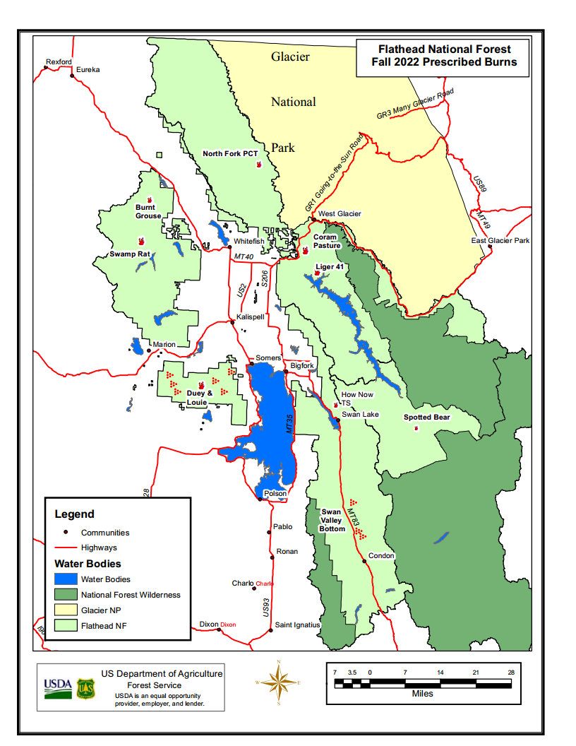
Flathead National Forest Prescribed Fire, Spring 2022
Here’s the Flathead Forest press release announcing this spring’s prescribed burns. Short version: There’s only one on the North Fork, the “North Fork Road PCT,” where “5 acres of hand piles will be ignited along the North Fork Road north of the Demers Ridge trailhead.”
The full text of the release . . .
Kalispell, MT, March 21, 2022 — The Flathead National Forest is planning to conduct spring prescribed fire projects when weather, fuel conditions, and air quality become favorable. Smoke will be visible from various places in the Flathead Valley depending on the location of the burn units and weather conditions.
Each project follows a Prescribed Fire Burn Plan. The prescribed fire projects are located and designed to be controlled to reduce the potential for adverse effects, or to escape as a wildland fire. These projects will follow Montana air quality standards and coordinated with Montana State Department of Environmental Quality to reduce the impacts of smoke to our neighbors, cooperators, and surrounding communities. The project areas include:
Pile burning: On the attached map major locations of concentrated piles are identified. These may include both landing and hand piles. There are also scattered piles not identified on the map which may also be burned.
Swan Lake Ranger District:
Dewey and Louie Timber Sales – This project includes broadcast burning in timber harvest units located within the Blacktail Mountain area west of Lakeside, MT and South of Kila, MT. These treatments will use prescribed fire for fuels reduction, vegetation regeneration, and wildlife habitat improvement.
How Now Timber Sale – This project includes broadcast burning in timber harvest units located on Sixmile Mountain, North of Swan Lake, MT. These treatments will use prescribed fire for fuels reduction and vegetation regeneration.
Swan Valley Bottom Maintenance Burning – This project includes maintenance broadcast burning in previously treated timber harvest units located within the Swan Valley. These treatments will use prescribed fire for fuels reduction, large ungulate winter range improvement, and improvement of forest health.
Swan Lake Ranger Station – This project includes under burning the administrative site at the Swan Lake Ranger District office located in Bigfork, MT. These treatments will used to rejuvenate the grass and reduce fuels.
Pile Burning – Hand or machine piles are located in locations within the Blacktail Mountain area, Swan Valley, Bigfork community, and miscellaneous piles around the district as a result of but not limited to: logging, hazardous fuels reduction in the wildland urban interface, hazard tree removal, recreation site management and trail or road construction. These piles are burned to reduce fuel loads in these areas. These piles are strategically burned based on their location, access, and weather conditions.
Tally Lake Ranger District:
Burnt Grouse 2.0 – This ecosystem burn will use prescribed fire for fuels reduction, vegetation regeneration, and wildlife habitat improvement. The burn would involve up to 150 acres of planned ignition.
Swamp Rat 5/5A/6 – Treatment will include approximately 57 acres of a hand ignited understory burn just south of Star Meadows.
Hungry Horse/Glacier View Districts:
Coram Pasture RX – Forest Service Administrative Site near Martin City, used for pasturing agency livestock. Up to 15 acres of livestock pasture will be burned to rejuvenate the grass and remove encroaching conifers. Five acres of hand piles from blowdown cleanup will also be treated.
Liger 41 Rx—20 acres of understory burning will occur adjacent to FS road 38 near Emery Bay campground. The purpose of this burn will be to reduce fire hazard and to prepare the site for regeneration planting.
North Fork Road PCT—5 acres of hand piles will be ignited along the North Fork Road north of the Demers Ridge trailhead.
Spotted Bear Ranger District:
Spotted Bear Ranger District is monitoring the weather and fuels conditions this spring in anticipation of conducting a few prescribed burns to meet a variety of objectives including slash reduction and site preparation in harvest units as well as reducing natural fuels in the surrounding areas. All of the burn units under consideration for this spring are near the Spotted Bear Ranger Station on south and west aspects.
For more information about these projects, contact the appropriate Ranger Station:
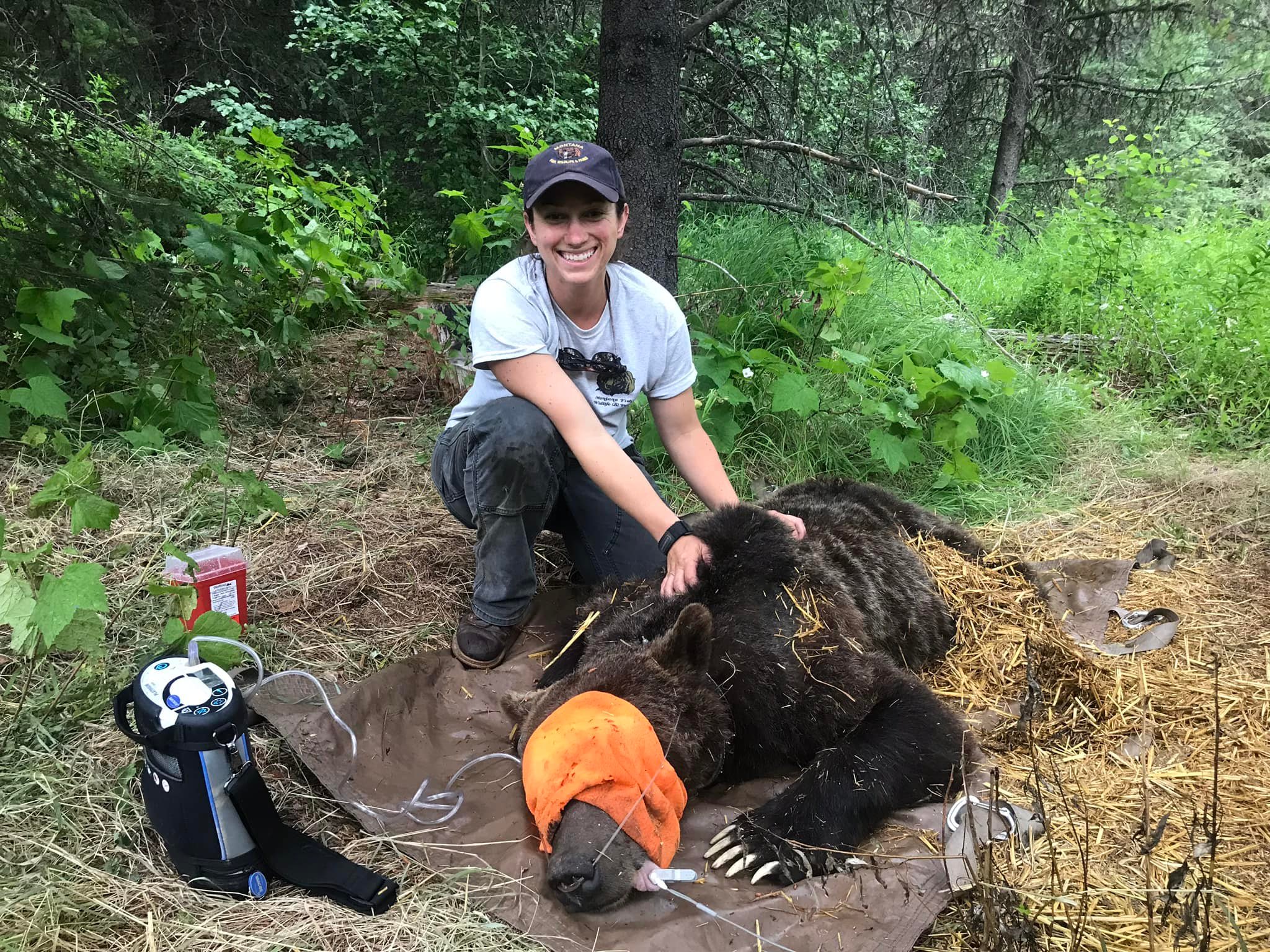
Justine Valieres, Wildlife Conflict Specialist for Montana Fish, Wildlife & Parks (Region 1)
Recently announced on Facebook by Tim Manley . . .
Congratulations to Justine Vallieres! She is the new Wildlife Conflict Specialist for Montana Fish, Wildlife & Parks (Region 1) based out of Kalispell.
I retired at the end of 2021. Justine was one of several qualified individuals that applied for the job and was selected by the interview committee. I know Justine will do a great job!
View East into Glacier NP from Glacier View Mtn, April 16, 2017 – W. K. Walker
Here’s the latest on this year’s “vehicle reservation” (they are not called “tickets” anymore) system for gaining entrance to Glacier National Park.
Highlights:
Tickets …er, uh… vehicle reservations will be required to enter the park’s Going-to-the-Sun (GTSR) corridor and at Polebridge.
A separate reservation is required for the GTSR and for Polebridge. GTSR reservations are good for 3 days, between 6:00am and 4:00pm; Polebridge reservations are good for only 1 day, between 6:00am and 6:00pm.
Vehicle reservations will be required from May 27 to September 11. They will be available 120 days in advance on a rolling window starting March 2 at 8:00am. Like last year, reservations cost $2.00.
Vehicle reservations can be purchased from recreation.gov, either online or through their call center.
North Fork specific details not mentioned in the press release (Camas Road transit, local boating access, etc.) will be discussed at the Interlocal on February 9.
 For those of you who missed it in May, Bob Lee will be giving his well-regarded First Aid/CPR/AED class in the North Fork again this summer. It is an all-day course, starting at 9:00am. The date is Tuesday, July 12. The course will be held at Sondreson Hall. Cost will be $45/person. (Make checks out to Red Tail Education and Research.)
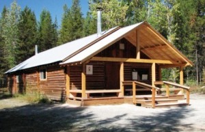 The Summer 2022 Interlocal Agreement Meeting is at 1:00pm, on Wednesday, July 13 at Sondreson Community Hall. This summer’s Interlocal is hosted by the North Fork Landowners’ Association (NFLA). It follows the annual Firewise meeting at 9:30am. Lunch is at noon, with the NFLA providing the main course. If you wish, bring a side dish or desert to share.