INCIDENT UPDATE
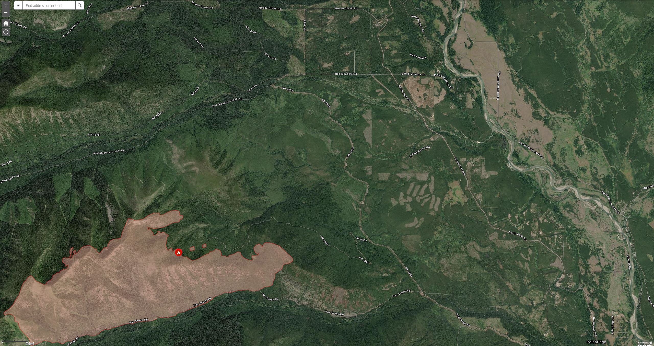
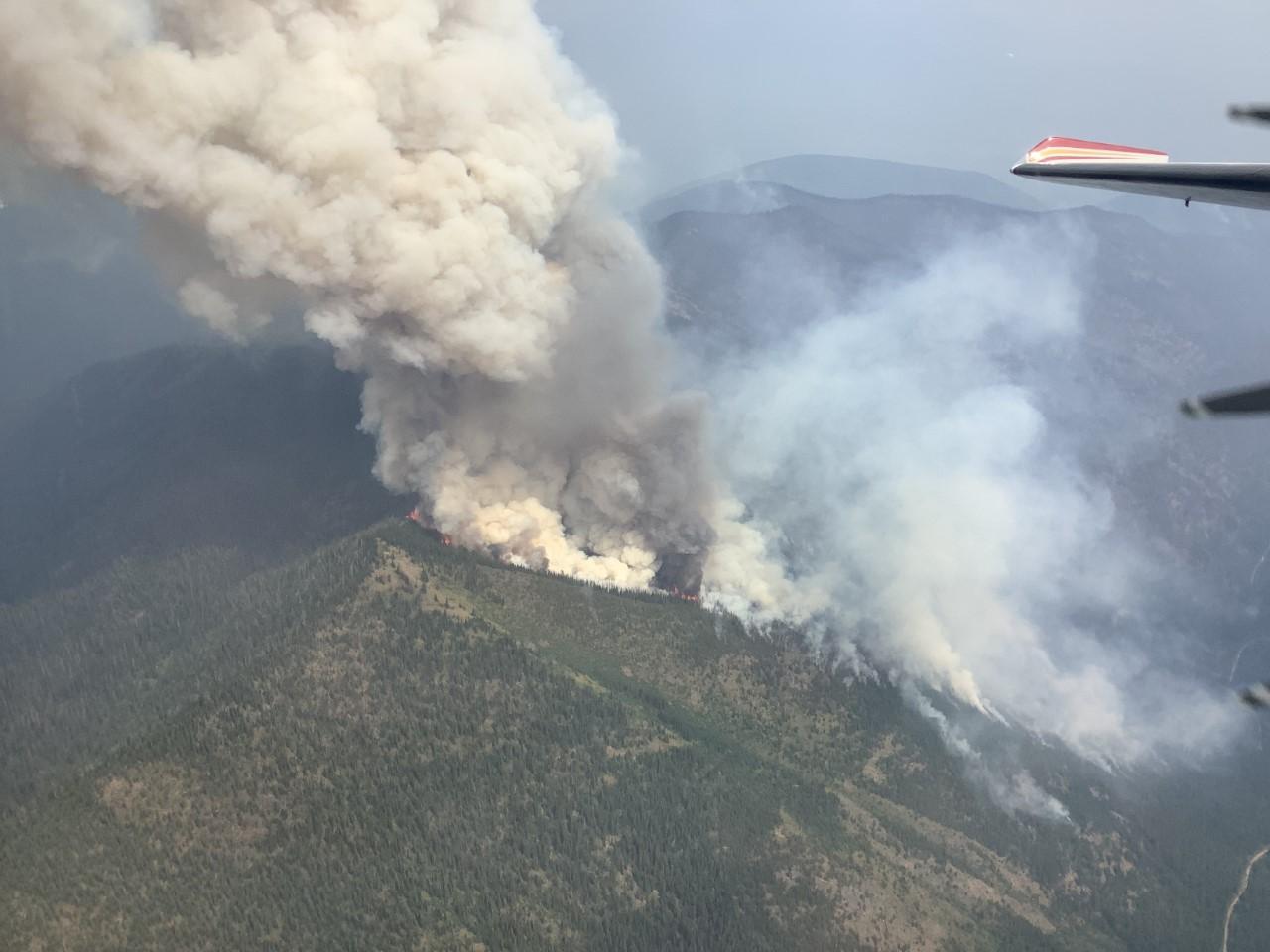
Due to the recent precipitation, cloud cover, and cooler temperatures, growth on the Hay Creek Fire has been minimal. The last mapping flight took place on July 31, 2021, updated acreage is posted when available. A return to warmer and dryer conditions today and tomorrow will bring increased fire potential.
Firefighters continue to prep Hay Creek Road #376 and evaluate conditions for future tactical firing operations. Heavy equipment task forces continue their work widening and establishing roads and fuels breaks along primary and contingency lines west of the North Fork Road. Crews are strengthening contingency lines between private properties and the Flathead National Forest along Red Meadow Road. The structure protection group continues to finalize their structure protection plan; the group is assessing private properties and historic cabins in addition to preparing for various evacuation scenarios.
Exercise caution when driving in the area due to recent rainfall and the potential for downed trees due to wind. Most of Montana is experiencing EXTREME fire danger; Stage 2 Fire Restrictions are in effect. Know Before You Go- Visit www.mtfireinfo.org for Montana fire restrictions.
EVACUATIONS
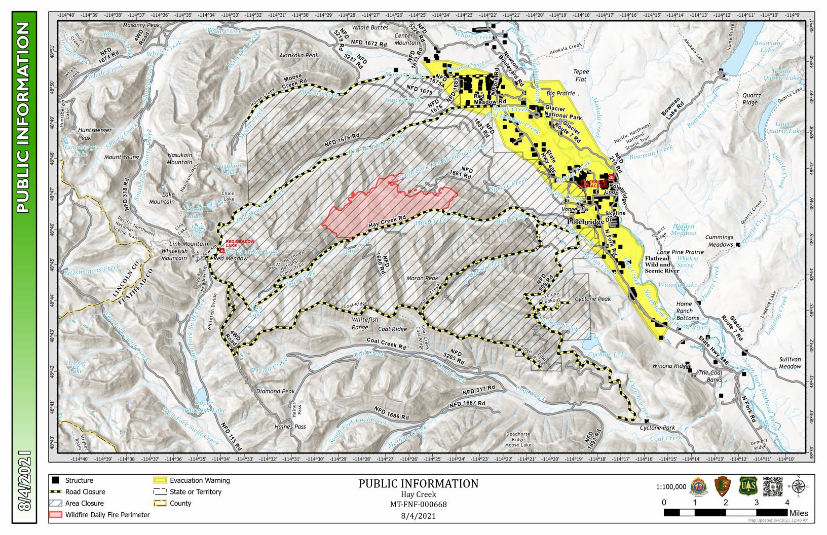
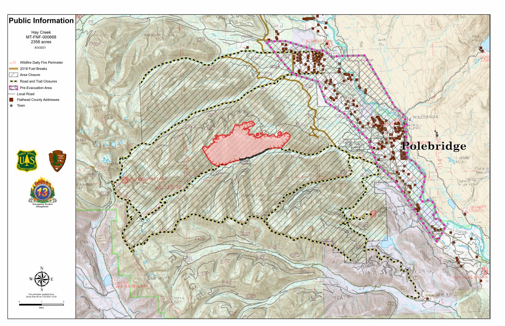
Evacuation Warnings include all residences east and west of the North Fork Road from Home Ranch Bottoms north to and including Moose Creek Road and the community of Polebridge. Glacier National Park has issued an Evacuation Warning for the North Fork area of Glacier National Park north of Logging Creek. See details at https://go.usa.gov/xFjcA and Current Fire Information – Glacier National Park.
CLOSURES
Road and trail closures are in place. See details at Inciweb: https://inciweb.nwcg.gov/incident/article/7712/62192/.
WEATHER AND AIR QUALITY
Hot and dry conditions return today. The chance for precipitation returns Thursday. For the most current fire weather forecast go to https://www.weather.gov/wrh/fire?wfo=mso. For smoke and air quality go to http://svc.mt.gov/deq/todaysair/. For current visibility in Glacier NP see https://www.nps.gov/glac/learn/photosmultimedia/webcams.htm.
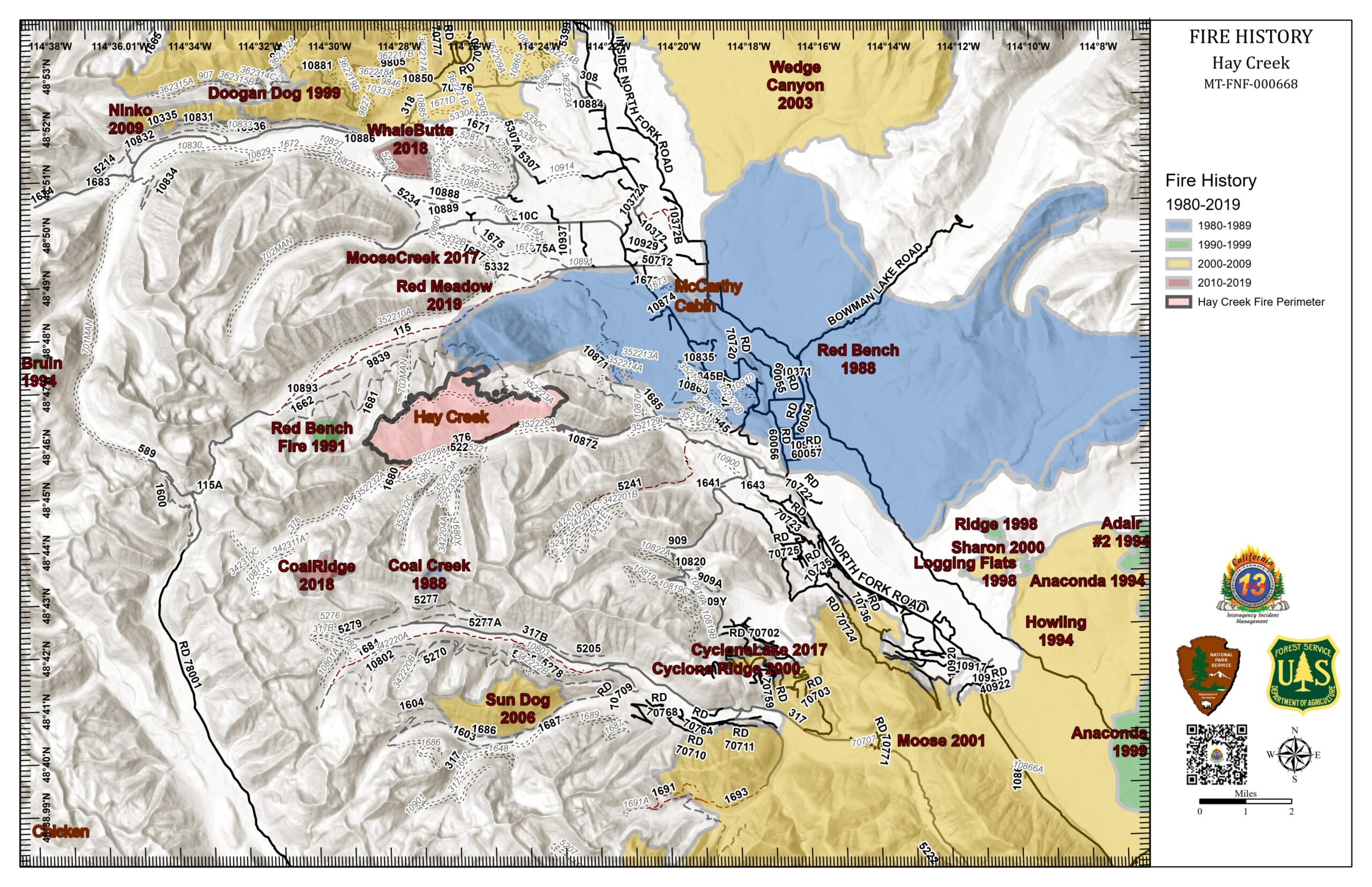
INCIDENT BACKGROUND
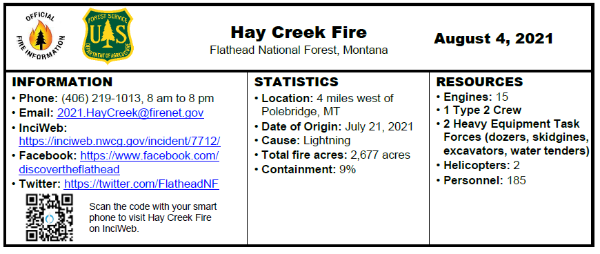
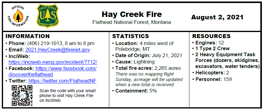
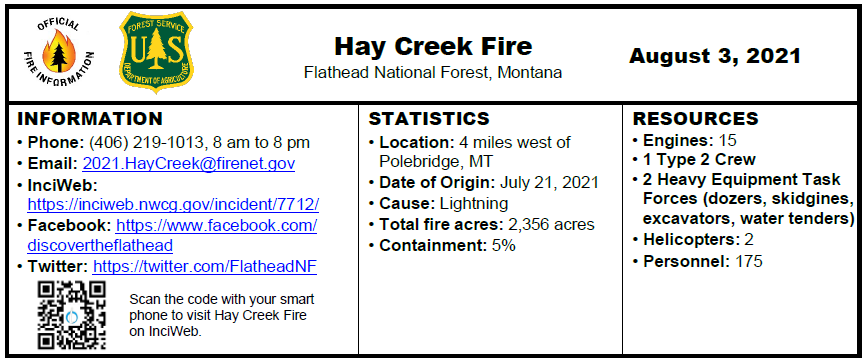
The Hay Creek Fire was reported on the evening of July 21, 2021. It is burning in the North Fork area of the Flathead National Forest and is being managed under a full suppression strategy.
Public and firefighter safety is the number one priority. Additional priorities include minimizing impacts to private property, structures and critical infrastructure, and road corridors and natural resources. Due to high fire activity in our region and across the country, resources are limited and prioritized.