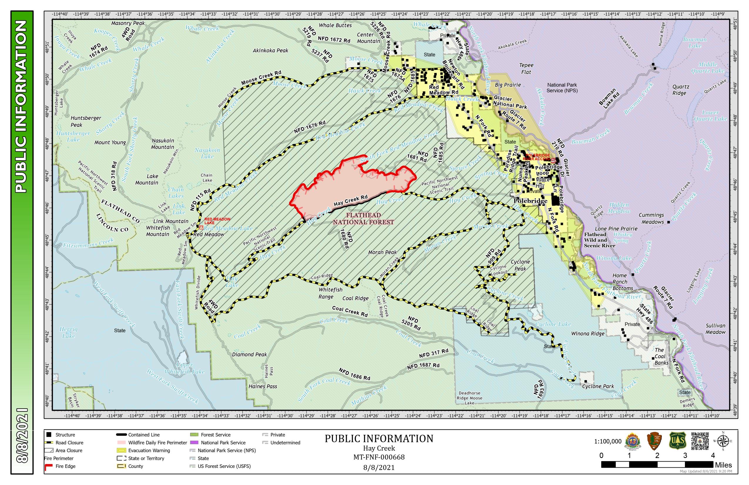
Here’s the latest Hay Creek Fire Public Information Map showing fire extent, closures and current evacuation zone boundaries. Note that containment is up slightly at 23%. The fire grew a bit yesterday and is now 2894 acres (1171ha), 191 acres larger than the previous official estimate . . .