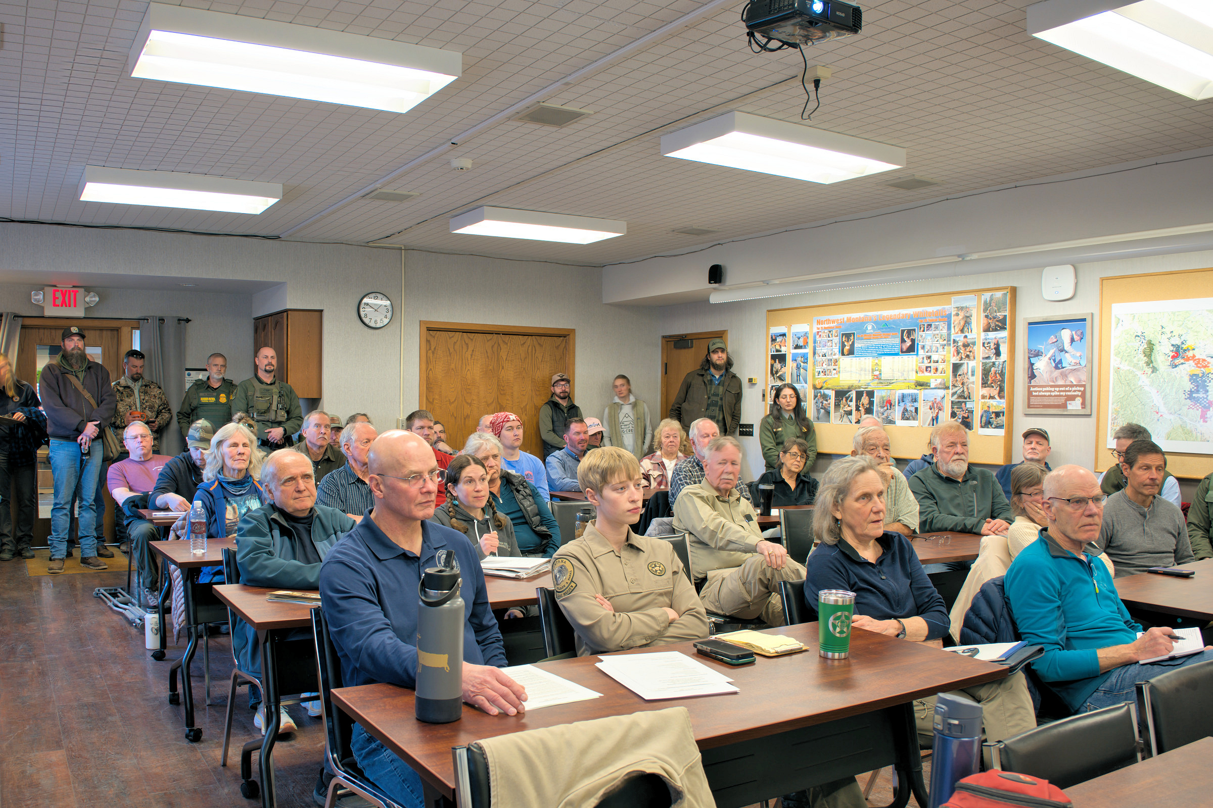
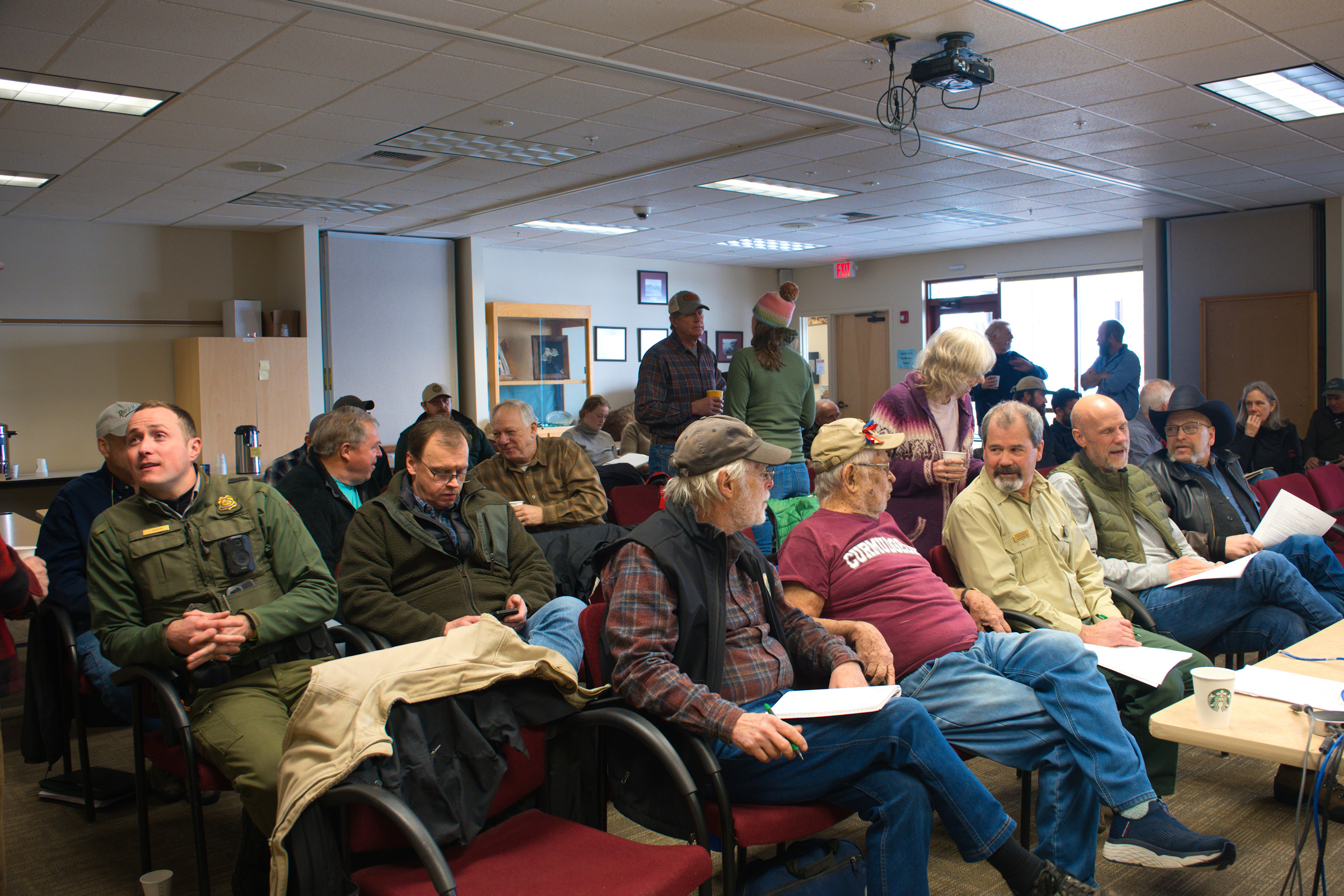
Winter North Fork Interlocal Agreement Meeting, Feb 11, 2026 – W. K. Walker
Here is the slide deck used for the presentation by Montana Fish, Wildlife and Parks (FWP) at the Winter 2026 North Fork Interlocal Agreement Meeting. It was held on February 11, 2026 at FWP headquarters in Kalispell. This material is available courtesy of Region 1 Wildlife Biologist Ethan Lula. Thanks, Ethan!
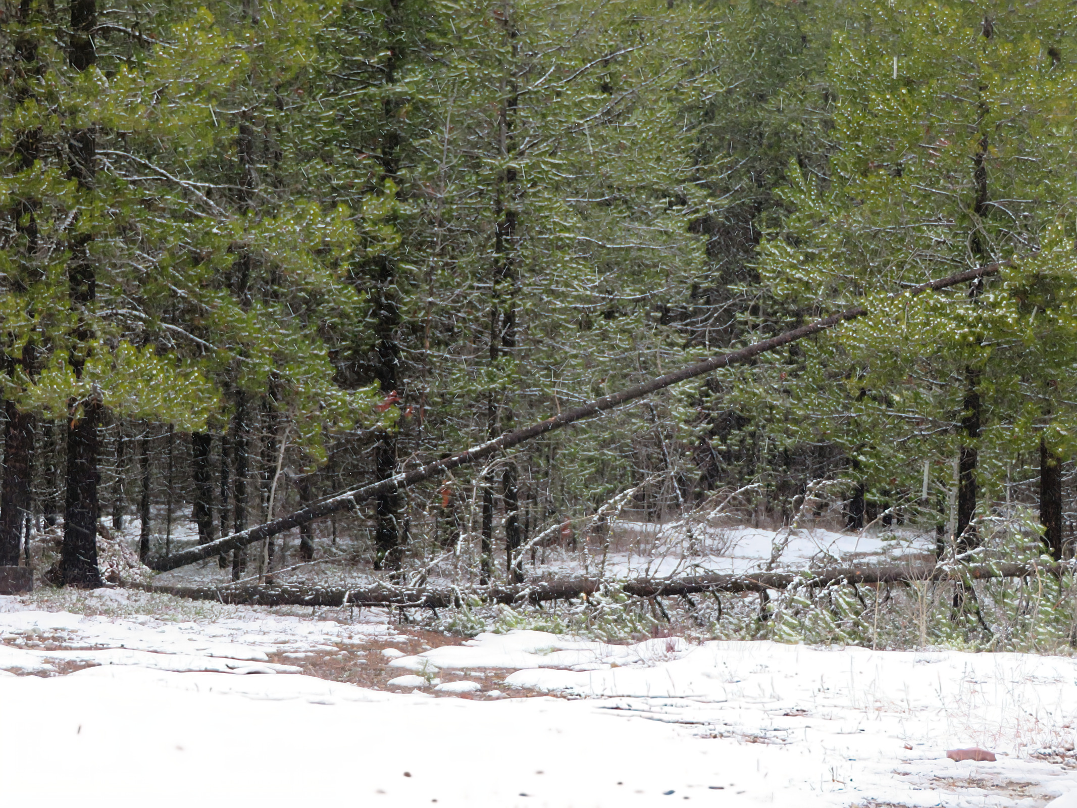
The area’s December 2025 windstorm caused a lot of damage. All that downed wood will attract beetle activity as soon as things warm up a bit. Although she wasn’t able to attend the meeting, Holly McKenzie, the local Service Forester for the Montana Department of Resources and Conservation (DNRC), put together a set of cleanup recommendations, along with supporting materials, which were made available at the Interlocal meeting on February 11.
NOTE! We hope to get Holly to make a presentation to the community at Sondreson Hall in late spring.
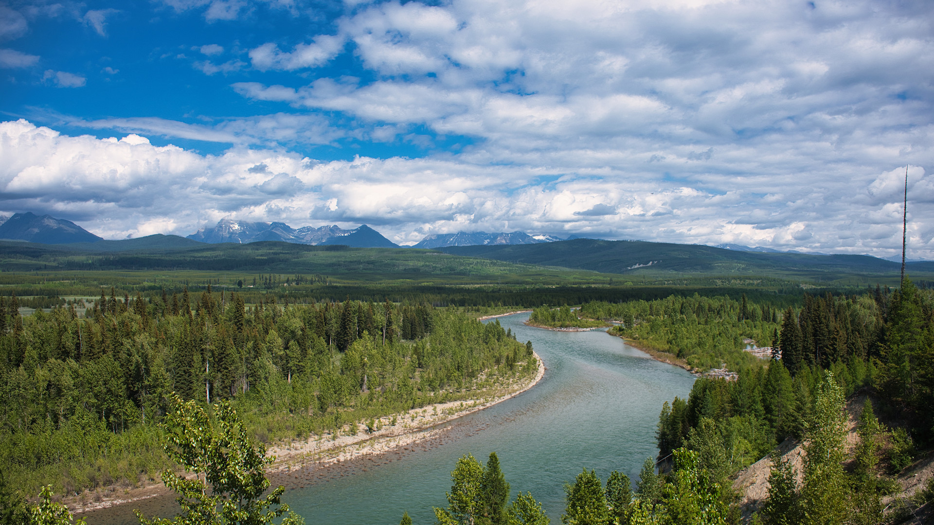
North Fork of the Flathead River, May 28, 2023 – W. K. Walker
After years of efforts and false starts, the Flathead National Forest has released a draft Comprehensive River Management Plan (CRMP). Here are the high points of immediate concern . . .
Two public information sessions will be held at Flathead Valley Community College on February 17 and 18, from 6 to 8pm at the Arts and Technology building, room 139 (AT-139). Both sessions will be open-house format, with information stations staffed by members of the project team.
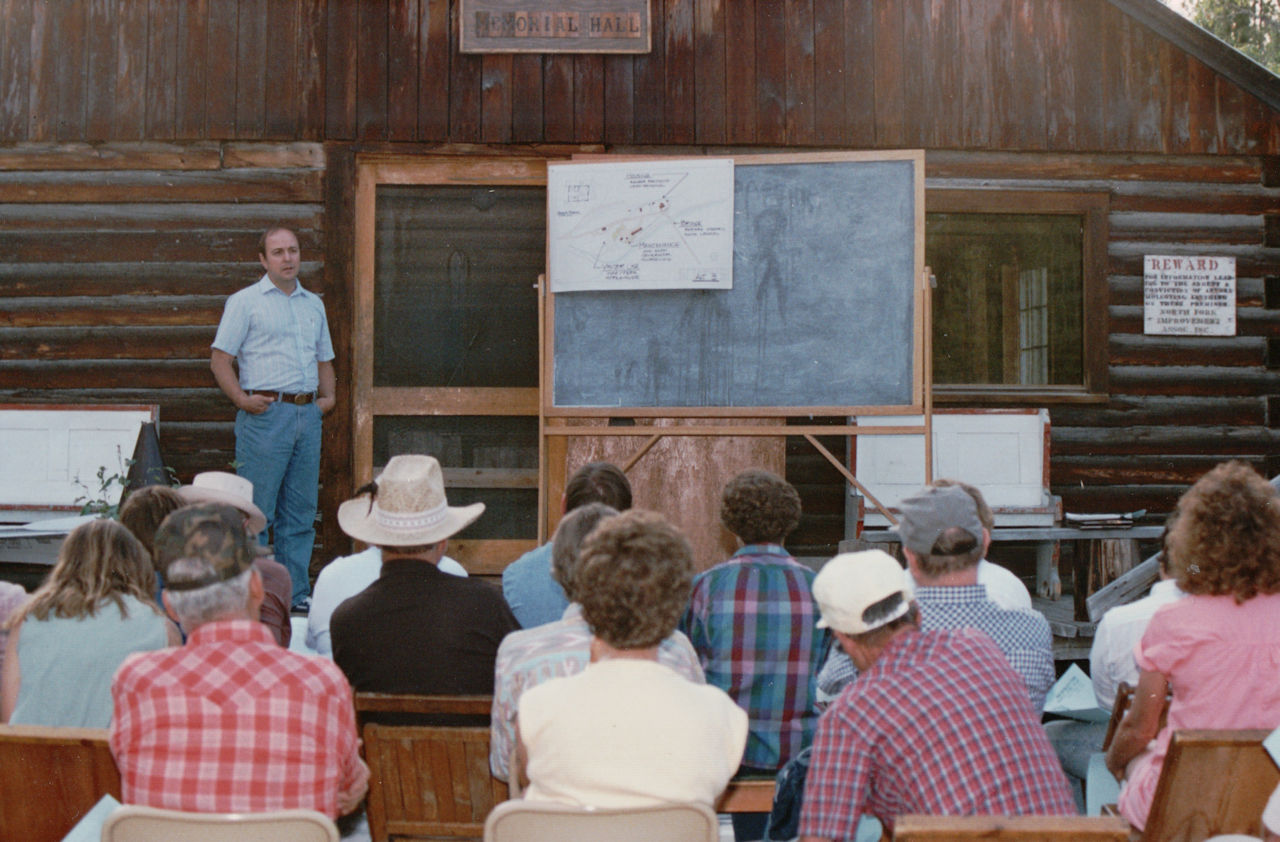
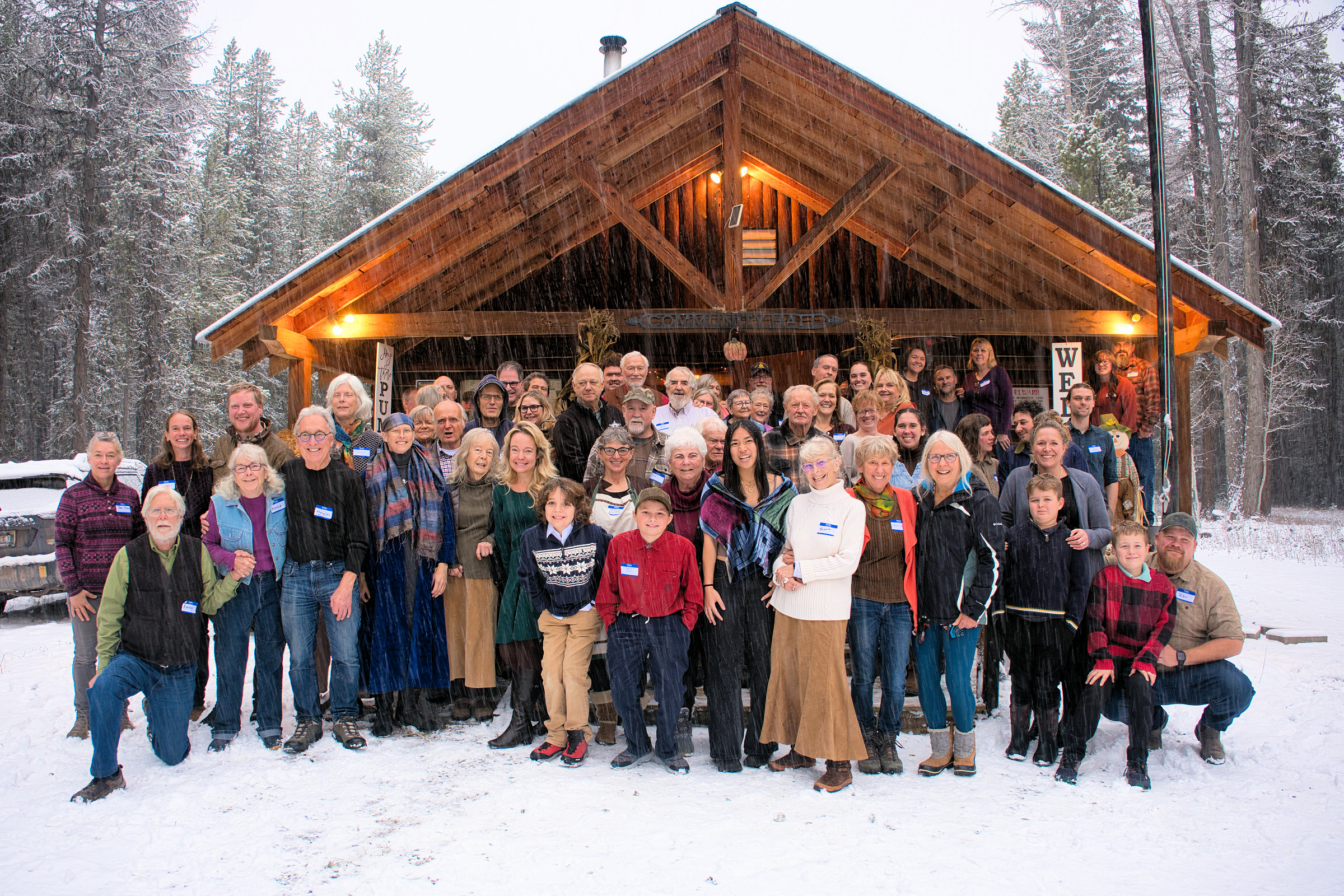
Bob Dunkley explains Park plans for the Polebridge Ranger Station, post Red Bench Fire, at the 1989 Interlocal at Sondreson Hall.
A quick reminder . .
This year’s Winter 2026 Interlocal Agreement Meeting is on Wednesday, February 11, from 10:00am to 1:00pm, hosted by Montana Fish, Wildlife and Parks (FWP).
It will be held at the Kalispell FWP Headquarters Public Meeting Room, 490 North Meridian Road. There is also a virtual attendance option — click here for information.
2025 Winter North Fork Interlocal Agreement Meeting – W. K Walker
In case some of you are North Fork residents/landowners, but are not on the Interlocal mailing list, Here’s a copy of a recent email about submitting local issues and concerns for discussion at the meeting…
Hi, folks.
This year’s Winter 2026 Interlocal Agreement Meeting is hosted by Montana Fish, Wildlife and Parks on February 11, at 10:00am. It will be held at the Kalispell FWP Headquarters Public Meeting Room, 490 North Meridian Road. (Click here for information on virtual attendance.)
For those of you new to this, Interlocal meetings are held twice each year, winter and summer. These semi-annual get-togethers are intended to encourage open discussion between North Fork landowners and neighbors, and local, state and federal agencies. In other words, it’s a big deal if you have an interest in the North Fork.
As a convenience (it’s not required), I’m serving as a central point of contact for issues that North Fork organizations and individuals would like to see addressed by the various government agencies represented at the meeting. If you’ll send me your issues via email to wkwalker@nvdi.com by the afternoon of Tuesday, January 27, I’ll see to it that they get passed on to the various organizations in enough time for them to prepare their presentations.
Please feel free to get in touch if you have any questions.
Mark Heaphy has pointed out that property owners should be keeping track of hours spent sawing, stacking, burning and removing downed trees that resulted from the recent windstorm. A big THANK YOU to all who are also helping neighbors in this regard. Happy Sawing ….
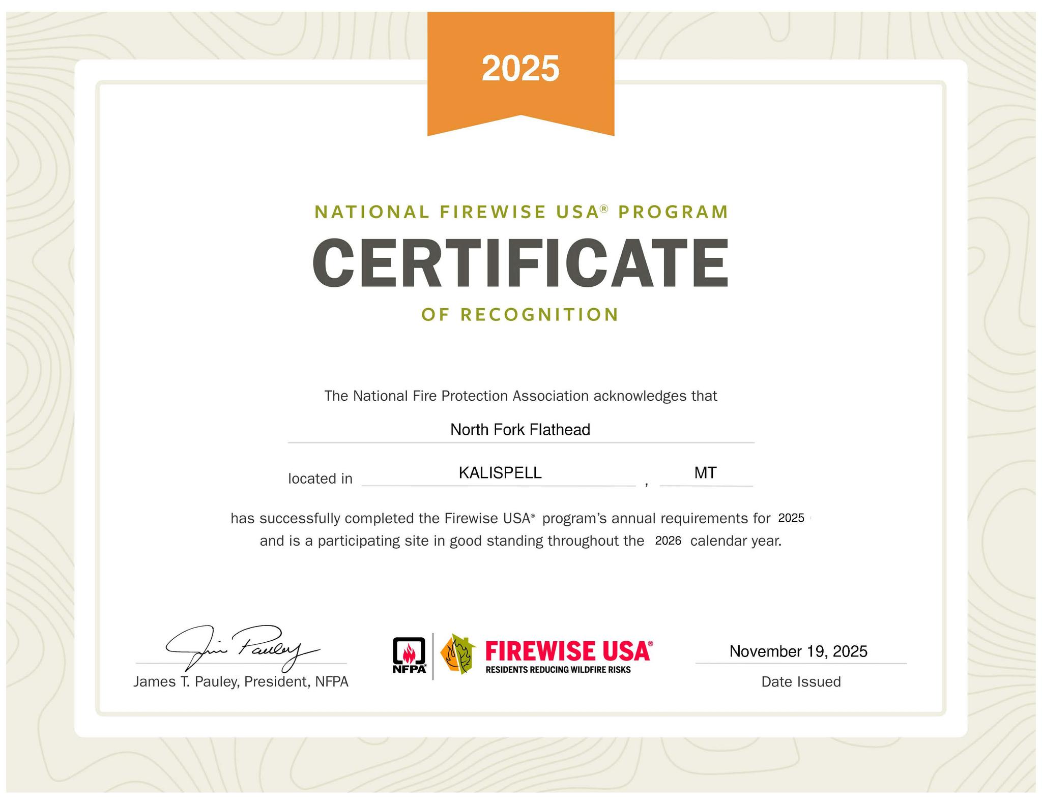
Our Firewise Certification has been Renewed for 2026, and our Firewise Community is in Good Standing!!
We recorded $120,000 in qualifying work, and greatly exceeded the required $16,000 investment.
This translates to about $255 per dwelling, compared to the requirement of $34 per dwelling.
That is simply an indication of the work so many North Forkers are doing to make their structures and surrounding forest more fire resistant.
We appreciate everyone who reported their hours and expenditures last year. Thanks to Suzanne Hildner for gathering all that information! She has big shoes to fill after taking over the data collection from Molly Shepherd, who has done it religiously since our beginning.
If you missed reporting last year, please keep track of the work you do from November 1, 2025 to October 31, 2026 and submit it by November 1, 2026. We will make sure to get it counted! [Suzanne Hildner’s email: sdhildner@icloud.com.]
The North Fork Flathead has been recognized as a Firewise Community since 2006. We look forward to celebrating 20 years of Firewise next year!!
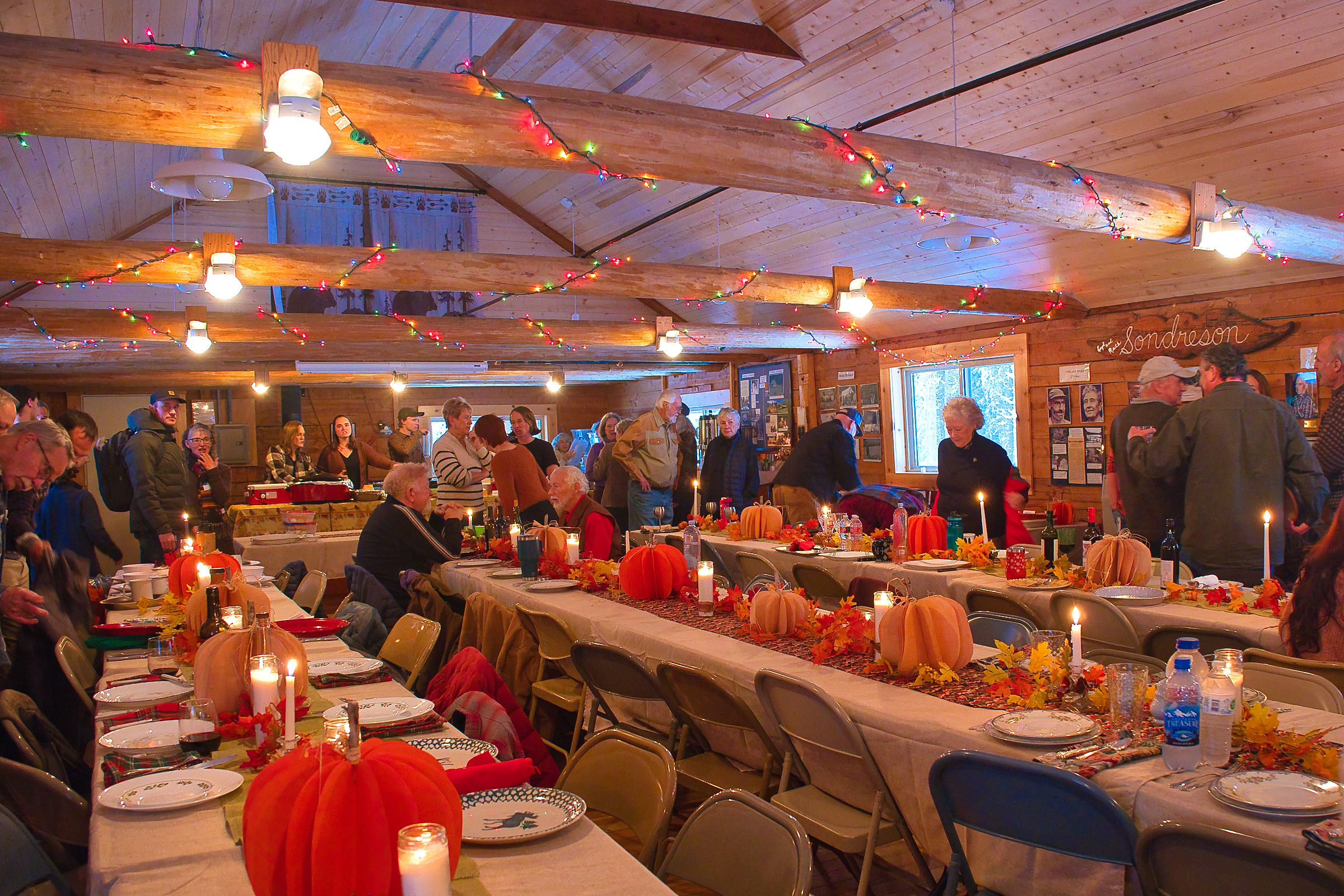
Folks get in line for the Thanksgiving feast at Sondreson Hall, November 28, 2024. – W. K. Walker
It’s that time again! Don’t miss the Thanksgiving 2025 celebration and potluck at Sondreson Hall, November 27, starting at 3:00pm.
NFLA provides ham, turkey and mashed potatoes, hall doors open at 3:00pm with food served starting at 4:00pm. Bring your own place setting, silverware, drink ware and beverage. Please bring a dish to share and, if it is a specialty dish (vegan, vegetarian, contains nuts, gluten free, etc.), please note this on a card to be placed in front of the dish.
If anyone wants to help or has any questions, text or call Zoe at (406) 955 1017 (phone number is wrong on official calendar).
The Montana Department of Natural Resources and Conservation (DNRC) is asking for public moment on the proposed Cyclomoose Forest Management Project. Most of the work would be located in the Coal Creek State Forest near Polebridge. (See the map.)
Comments should be sent to:
Department of Natural Resources and Conservation
Attn: Cullen O’Brien
Stillwater Unit
P.O. BOX 164, Olney, MT 59927 Cullen.O’Brien@mt.gov
The comment deadline is October 16, 2025 so, realistically, comments should be sent via email.