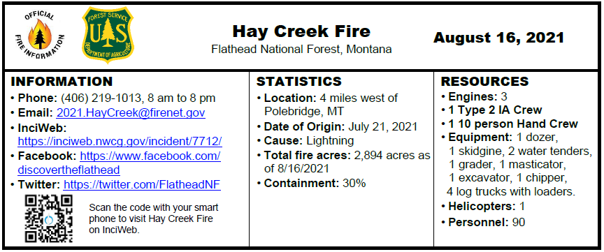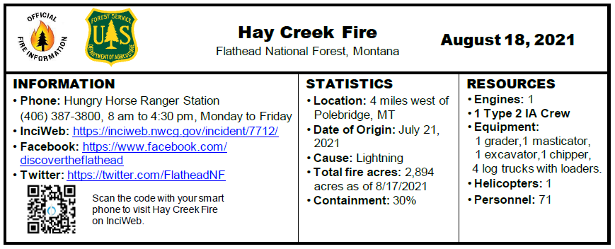
INCIDENT UPDATE
On Saturday, August 21, management of the Hay Creek Fire will be transferred to a Type 4 organization from the Flathead National Forest. A community meeting will be held at the Sondreson Hall on Thursday, August 19th, at 6:00 pm.
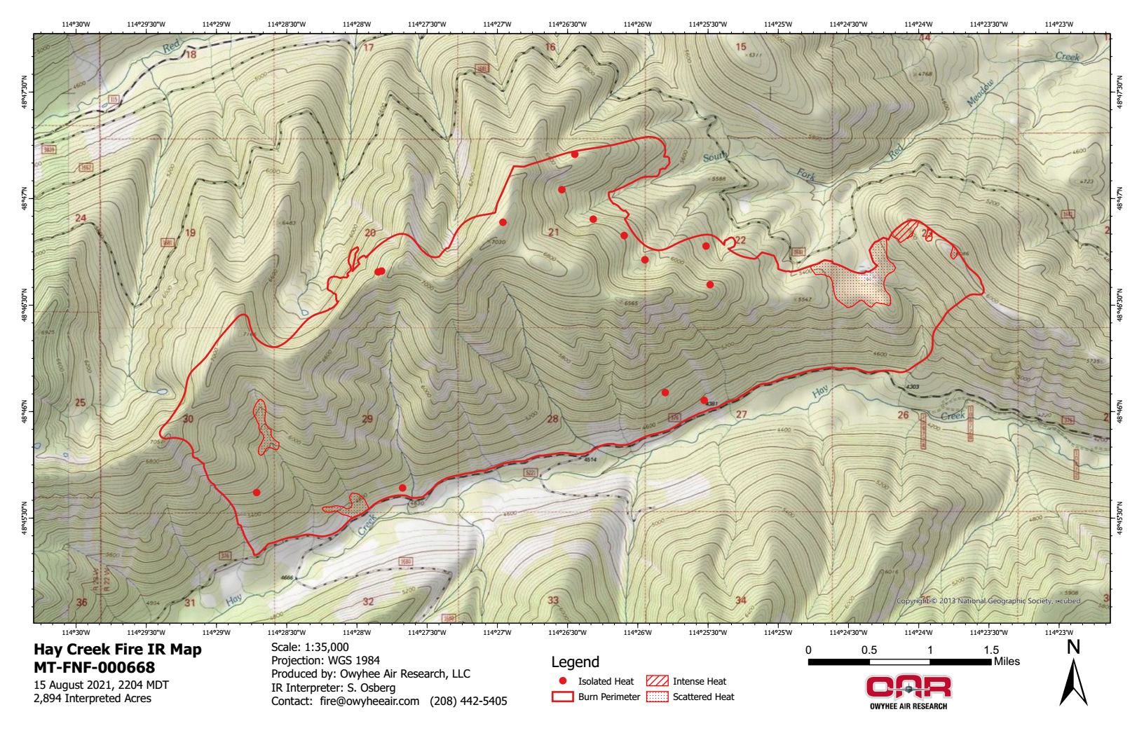
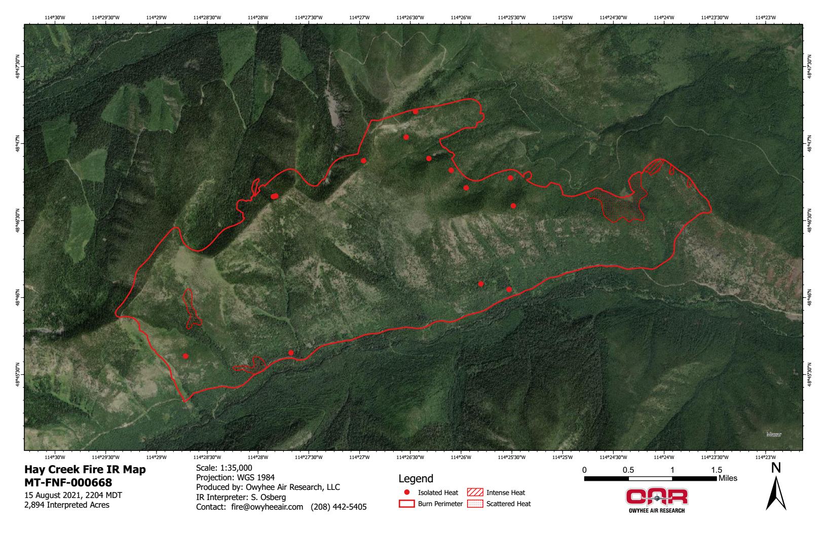
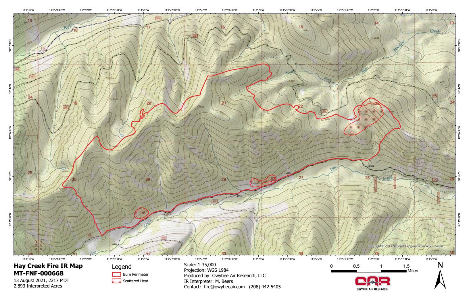
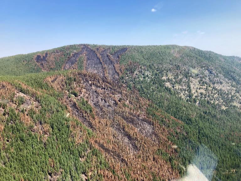
Crews will continue to wrap up operations involved with fuel reduction along roads and contingency lines, and patrol and mop up hot spots as needed. The helibase has been moved from the Hay Creek Incident Base in
West Glacier to the Hungry Horse Ranger Station Helibase. Equipment and supplies are being removed from the fire.
The fire received a wetting rain and snow in the higher elevations on Tuesday. From this point on, Hay Creek Fire information will be updated only as there are changes in fire activity or area trail and road closures. For current information, please visit InciWeb: https://inciweb.nwcg.gov/incident/article/7712/62192/.
Northwest Montana is in VERY HIGH fire danger; Stage 2 Fire Restrictions are in effect with campfires prohibited. Know Before You Go- Visit www.mtfireinfo.org for additional Montana fire restrictions.
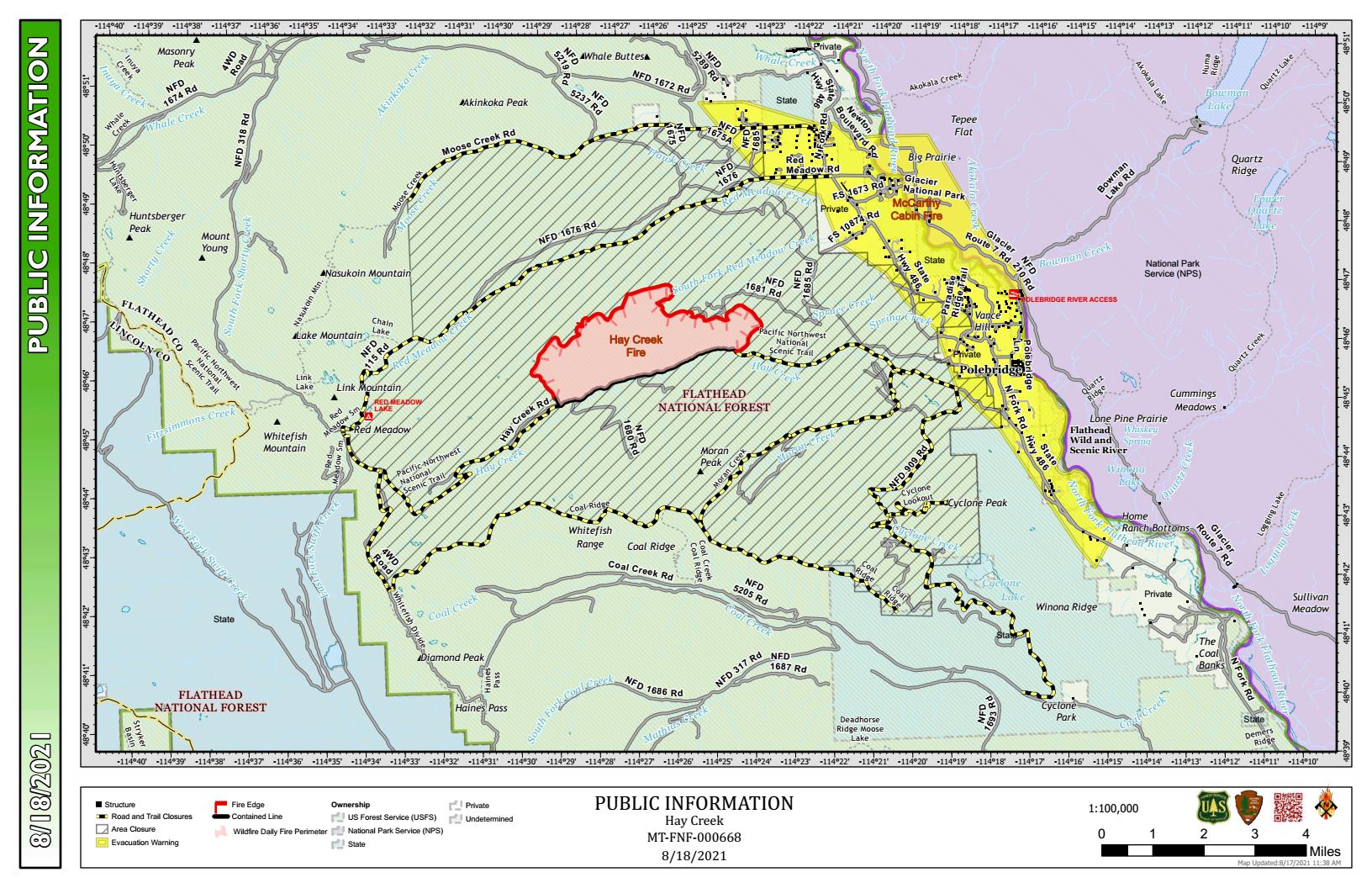
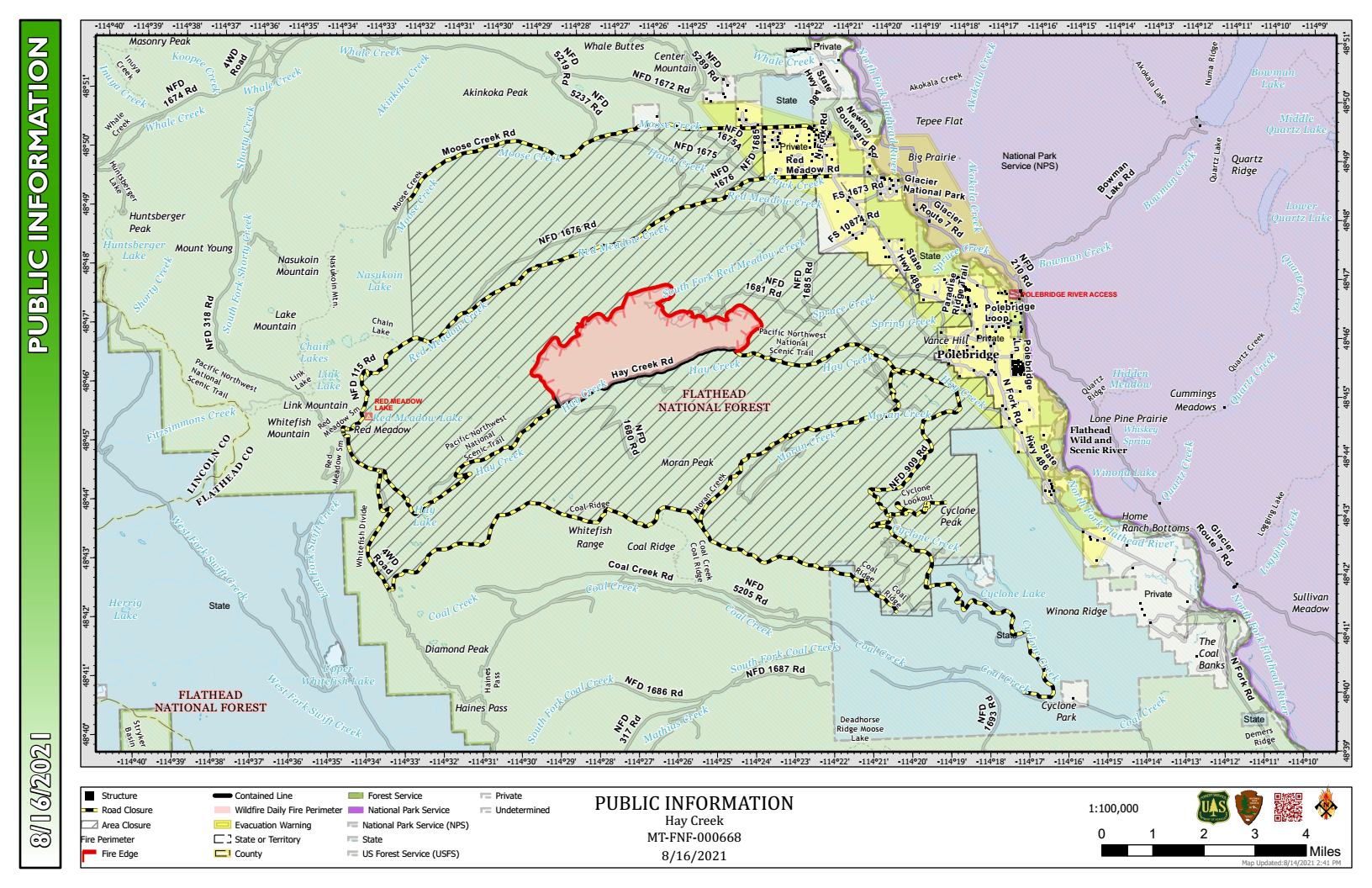
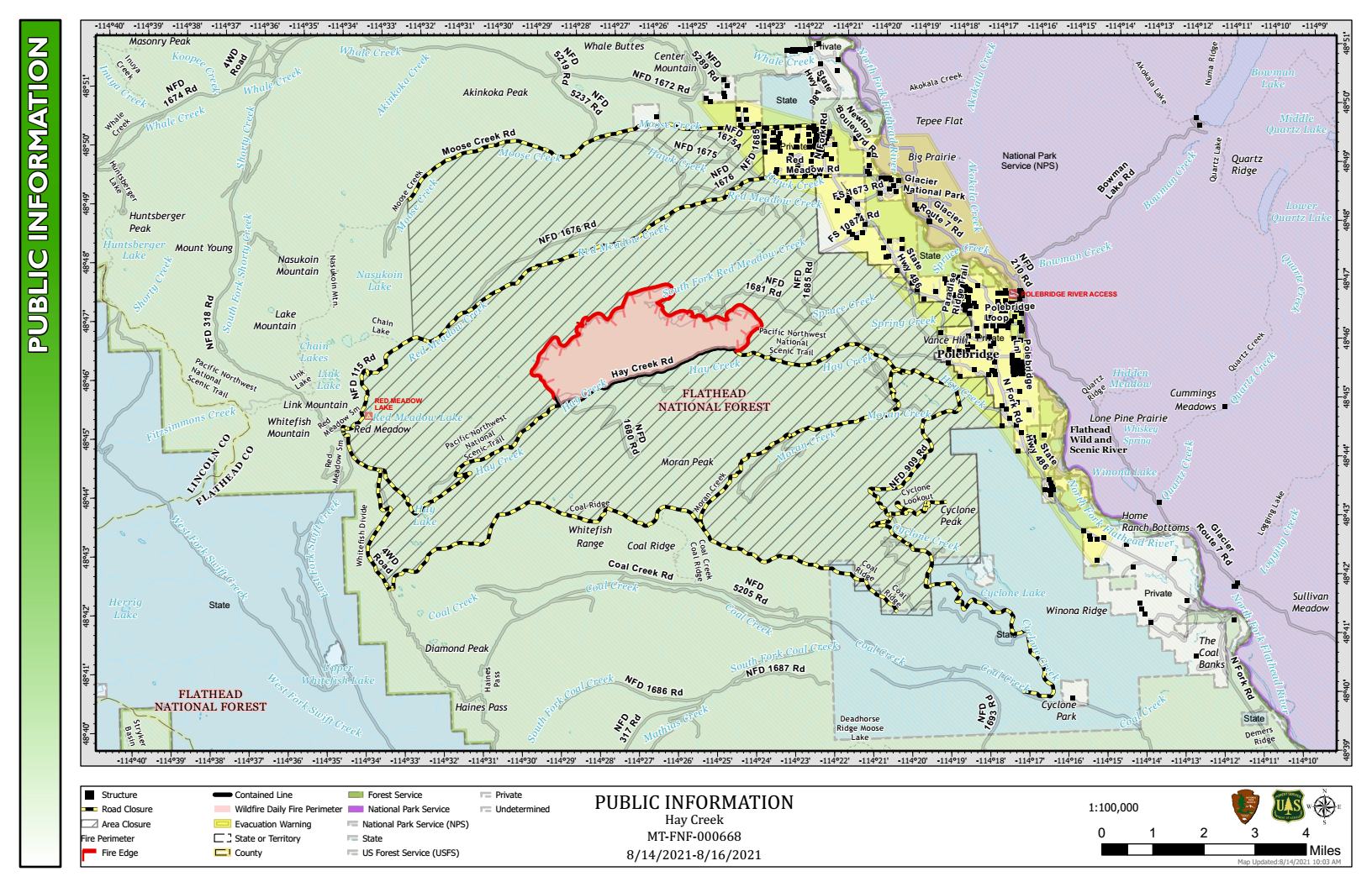
EVACUATIONS AND CLOSURES
Evacuation Warnings remain in effect. See details at https://go.usa.gov/xFjcA and Current Fire Information – Glacier National Park. Road and trail closures are in place.