Weasel Fire update for the morning of August 22nd

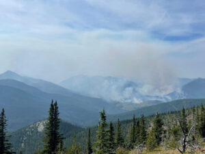
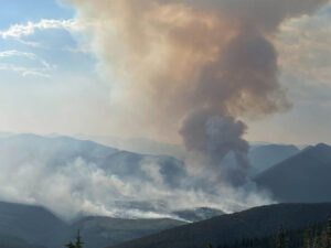
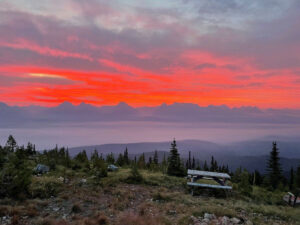
Weasel Fire from Thoma Lookout, August 20, 2022 at sunrise - Leif Haugen, USFS
Weasel Fire from Thoma Lookout, August 20, 2022 at sunrise – Leif Haugen, USFS

Summary: Clouds again hampered an accurate estimate of the Weasel Fire’s extent but the fire did not appear to have made significant gains.  In the U.S., the fire is 20% contained; Canada is also establishing containment lines to the east.

Reminder: Heavy road work begins on NFS Road 114 (Trail Creek/Grave Creek Road) today. It may take up to four weeks for completion, during which time the road will be closed to through traffic. See this post  for details.

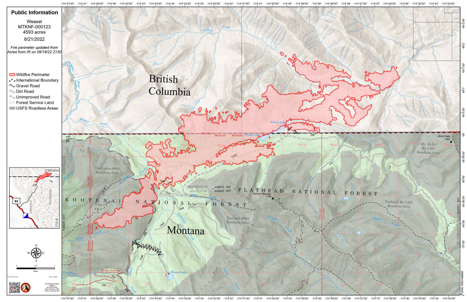
According to Saturday morning’s IR (heat mapping) pass, the Weasel Fire gained 390 acres and was estimated at 4593 acres. (Cloudiness has prevented estimates for the last couple of days, so the current fire extent is likely a bit larger.) Better than half of this area — and most of the fire growth — is in Canada. Expansions were along Couldrey Creek on the northern flank and in Lincoln County along the southwest perimeter. The fire is now 20% contained within the U.S. section; Canadian personnel have been establishing containment lines along the fire’s northeastern/eastern flank to block spread into the Flathead Valley.  The blaze is currently burning in the Kootenai National Forest, the far northwest corner of the North Fork in the Flathead Forest’s Glacier View district, and in Canada. See the attached map for fire location and extent.

The US and Canada are working together to control the Weasel Fire. From the InciWeb site: Jurisdictional collaboration is occurring between the Incident Management Team (IMT) in the United States located in Eureka, Montana and the BC Wildfire Service Incident Management Team in Canada, located in Cranbrook. The two IMT’s are closely coordinating on wildfire management and are sharing resources as required.

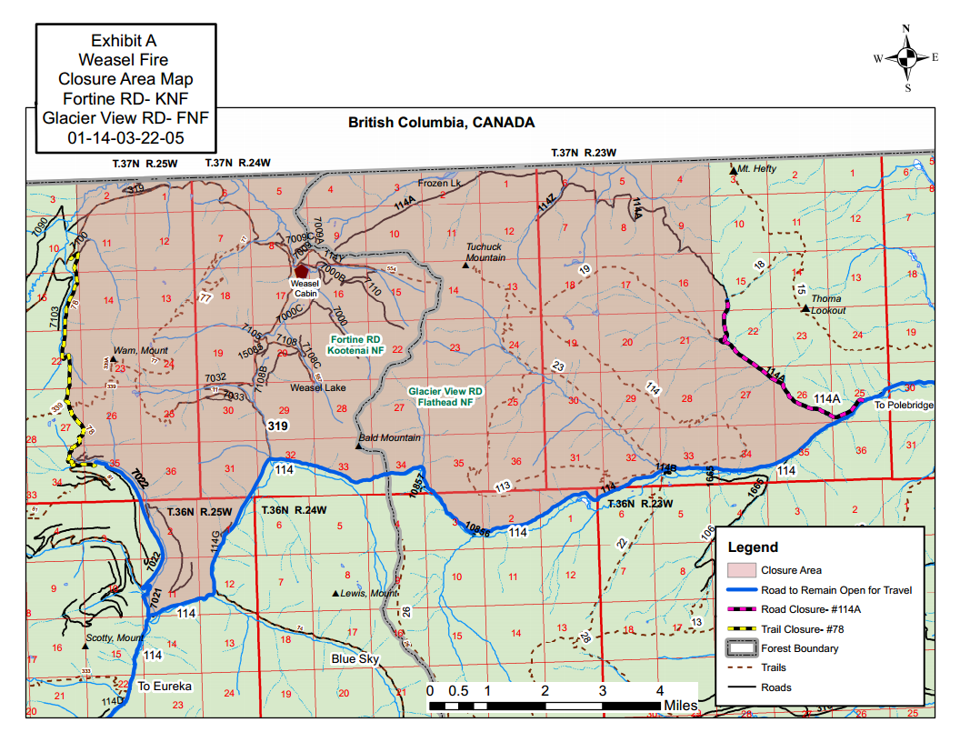
The area closure associated with the fire was finalized August 9 and includes segments of both the Kootenai and Flathead Forests. For the North Fork, this affects an area above Trail Creek Road north to the border and from the Whitefish Divide east to the Frozen Lake Road vicinity. Trail Creek Road remains open. See the attached map and closure order document. Also note that, beginning August 22, major work will be in progress in the Glacier View Ranger District on Trail Creek Road (NFS 114) that will restrict travel for about a month.

Monitor the Weasel Fire InciWeb site for additional information (https://inciweb.nwcg.gov/incident/8290/); in Canada, visit the British Columbia Wildlife Service “Weasel Creek Fire” site (http://bcfireinfo.for.gov.bc.ca/hprScripts/WildfireNews/OneFire.asp?ID=883). Also keep an eye on the NFLA website for fire-related postings.
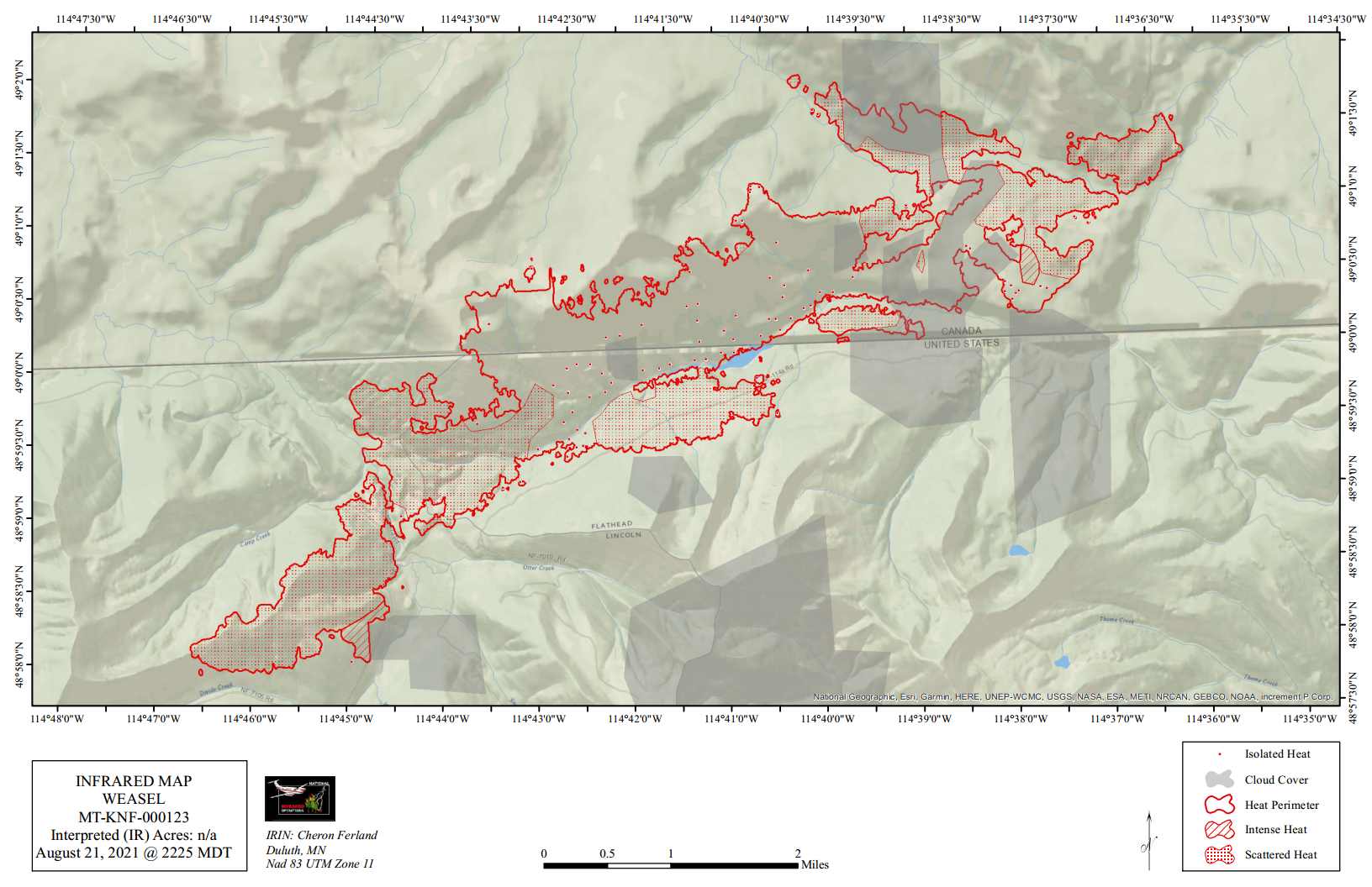
Weasel Fire Heat Map, August 22, 2022
Weasel Fire Area Closure Map

Aug 21: Quartz Fire transitions to Type 3 Incident Management Team

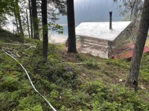
Quartz Lake Patrol Cabin, structure wrap Aug 20 - NPS
Quartz Lake Patrol Cabin, structure wrap Aug 20 – NPS

From the press release . . .

Incident Commander: M. Lewelling
Fire Information Recording: 406-206-6099
Fire Information Phone: 406-206-5272 (8 am to 6 pm)
Fire Information Email: glac_fire_line@nps.gov

Quartz Fire transitions to Type 3 Incident Management Team

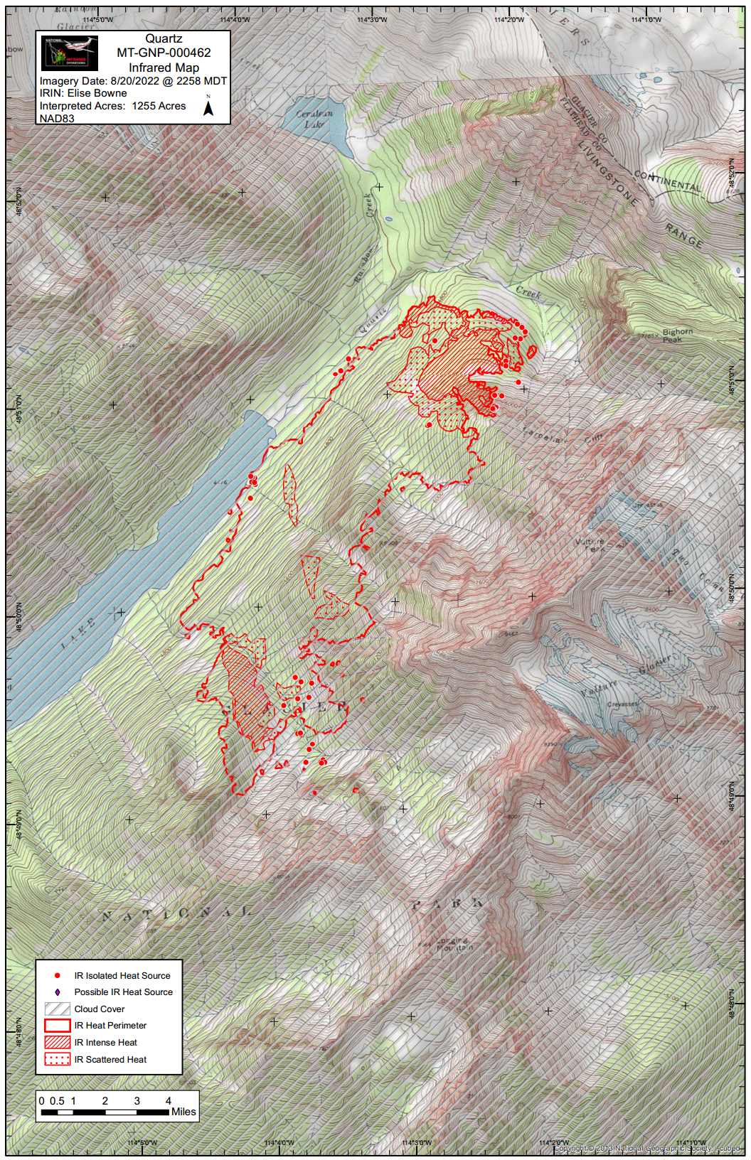
Current Situation: The Quartz Fire remained active yesterday afternoon and throughout the night, with isolated tree torching and movement on the southwestern flank within the remote Quartz drainage. Cloud cover last night made it impossible to accurately map the fire. Management of the Quartz Fire transitions to a Type 3 Incident Management Team under Incident Commander Mike Lewelling today.

Firefighters completed structure protection at the Quartz Lake Patrol Cabin yesterday and remain at that location to fine-tune protection efforts and evaluate fire behavior. Crews will also be working to reduce the risk to the wilderness campground and cultural resources in that area. Fire behavior and movement will continue to be evaluated from the air to plan future fire responses.

Initial attack resources will patrol both the west and east sides of Glacier National Park looking for any new fires which may have been ignited by last night’s lightning. Glacier National Park and Blackfeet Fire Agency engine crews are working cooperatively to patrol and respond to any new fire activity on the east side.

Weather: Today’s weather is predicted to be partly cloudy with a chance of afternoon thunderstorms. Maximum temperatures will be 88-98 in valleys and 70-80 on ridges. Nighttime lows will be 44-55 in valleys and 55-60 on ridges. Winds are predicted to be from the southwest at 5-10 mph. Chance of lightning is 40 percent today and 50 percent tonight.

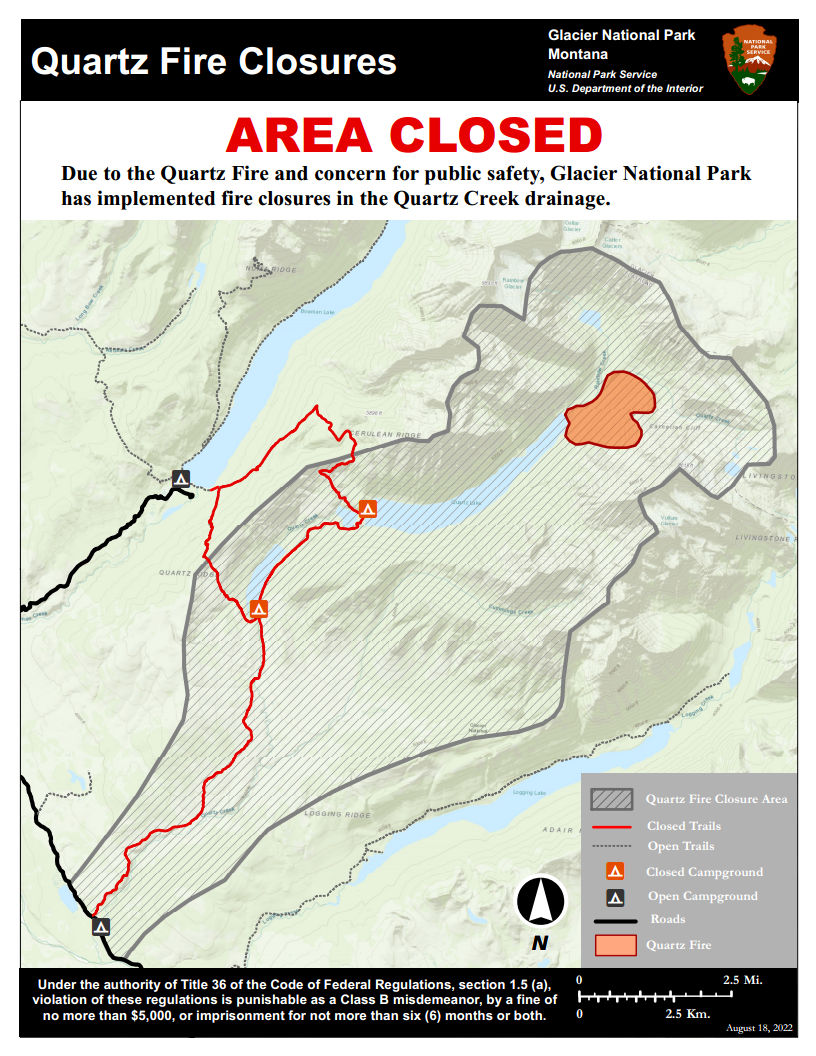
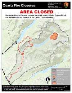
Closures: Glacier National Park has enacted a Closure Order for the areas, campgrounds, and trails within the Quartz Lake drainage from the Continental Divide to the Inside North Fork Road for the protection of park visitors, employees, and natural resources. This includes the Quartz Lake Loop trails starting from just south of Bowman Lake toward Quartz Lake, as well as the Quartz Lake and Lower Quartz Lake Wilderness Campgrounds. A map of the closure is available on InciWeb.

Fire Restrictions: The fire danger rating in Glacier National Park is currently Very High. All park visitors are reminded that campfires are allowed only in designated fire grates and should be kept small. Never leave a fire unattended and drown any campfire with water until cold to the touch before leaving it.

Air Quality: National air quality and smoke conditions can be monitored at https://fire.airnow.gov/. Visibility in different parts of Glacier National Park can vary from hour to hour, depending on fire and wind conditions both locally and throughout the west. Check the park’s webcams at https://www.nps.gov/glac/learn/photosmultimedia/webcams.htm for current views.

Size: Approximately 1,255 acres
Total Personnel: 15
Start Date: Sunday, August 14, 2022
InciWeb: https://inciweb.nwcg.gov/incident/8337/
Containment: 0%
Cause: Lightning

Location: 25 miles north of West Glacier

Fire Information Office: 406-206-5272

Quartz Fire Heat Map, August 21, 2022
Quartz Fire Closure Map, August 18, 2022

Weasel Fire update for the morning of August 21st

Weasel Fire from Thoma Lookout, August 19, 2022,1530 - Leif Haugen, USFS
Weasel Fire from Thoma Lookout, August 19, 2022,1530 – Leif Haugen, USFS

Summary: The weasel Fire added 390 acres on Friday, August 19, adding acreage at its southwest corner in Lincoln County and broadly along the northern perimeter in Canada. (There was no heat mapping pass this morning due to weather, so yesterday’s gains are unavailable.)  In the U.S., the fire is 20% contained; Canada is also establishing containment lines to the east.

According to Saturday morning’s IR (heat mapping) pass, the Weasel Fire gained 390 acres and was estimated at 4593 acres. (There was no heat mapping pass this morning due to weather, so the current fire extent is likely a bit larger.) Better than half of this area — and most of the fire growth — is in Canada. Expansions were along Couldrey Creek on the northern flank and in Lincoln County along the southwest perimeter. The fire is now 20% contained within the U.S. section; Canadian personnel have been establishing containment lines along the fire’s northeastern/eastern flank to block spread into the Flathead Valley.  The blaze is currently burning in the Kootenai National Forest, the far northwest corner of the North Fork in the Flathead Forest’s Glacier View district, and in Canada. See the attached map for fire location and extent.

The US and Canada are working together to control the Weasel Fire. From the InciWeb site: Jurisdictional collaboration is occurring between the Incident Management Team (IMT) in the United States located in Eureka, Montana and the BC Wildfire Service Incident Management Team in Canada, located in Cranbrook. The two IMT’s are closely coordinating on wildfire management and are sharing resources as required.

The area closure associated with the fire was finalized August 9 and includes segments of both the Kootenai and Flathead Forests. For the North Fork, this affects an area above Trail Creek Road north to the border and from the Whitefish Divide east to the Frozen Lake Road vicinity. Trail Creek Road remains open. See the attached map and closure order document. Also note that, beginning August 22, major work will be in progress in the Glacier View Ranger District on Trail Creek Road (NFS 114) that will restrict travel for about a month.

Monitor the Weasel Fire InciWeb site for additional information (https://inciweb.nwcg.gov/incident/8290/); in Canada, visit the British Columbia Wildlife Service “Weasel Creek Fire” site (http://bcfireinfo.for.gov.bc.ca/hprScripts/WildfireNews/OneFire.asp?ID=883). Also keep an eye on the NFLA website for fire-related postings.
Weasel Fire Map, August 21, 2022
Weasel Fire Area Closure Map

Aug 20: Quartz Fire Continues to Burn Actively 

Quartz Fire Heat Map, August 20, 2022

From the official August 20 press release…

Current Situation: The Quartz Fire, mapped at 1163 acres last night, continues to burn within in the remote Quartz drainage of Glacier National Park. Yesterday’s hot and dry weather allowed the fire to grow to the south where it spread to the basin of Logging Mountain. On the west edge, the fire moved downhill to reach the northeast shore of Quartz Lake. Fire was limited to the east by steep rocky terrain and lack of fuel. Smoke may be visible from the North Fork and Flathead valleys.

The National Park Service responds to and manages every fire within park boundaries. Firefighters will complete structure protection preparations today near Quartz Lake. Land and air resources will continue patrolling the Quartz Fire, ready to respond as necessary to this fire, and to any new starts caused by lightning.

Fire behavior is anticipated to continue to progress to the southwest with backing and flanking and short occasional uphill runs. Smoke will continue to be visible from the North Fork and Flathead valleys as well as some haze to the east.

Weather: Today’s weather is predicted to continue to be hot with high temperatures of 90-100 degrees in the valleys and 75-85 degrees on ridges. Winds are expected to transition to a more typical westerly/southwesterly flow. There is a 30 percent chance of lightning today and a 40 percent chance of lightning tonight. 

Closures: Glacier National Park has enacted a Closure Order for the areas, campgrounds, and trails within the Quartz Lake drainage from the Continental Divide to the Inside North Fork Road for the protection of park visitors, employees, and natural resources. This includes the Quartz Lake Loop trails starting from just south of Bowman Lake toward Quartz Lake, as well as the Quartz Lake and Lower Quartz Lake Wilderness Campgrounds. A map of the closure is available on InciWeb.

Fire Restrictions: The fire danger rating in Glacier National Park is currently Very High. All park visitors are reminded that campfires are allowed only in designated fire grates and should be kept small. Never leave a fire unattended and drown campfires with water until cold to the touch before leaving it. 

Air Quality: National air quality and smoke conditions can be monitored at https://fire.airnow.gov/. Visibility in different parts of Glacier National Park can vary from hour to hour, depending on fire and wind conditions both locally and throughout the west. Check the park’s webcams at https://www.nps.gov/glac/learn/photosmultimedia/webcams.htm for current views.

Size: Approximately 1163 acres Containment: 0%
Total Personnel: 9 Cause: Lightning
Start Date: Sunday, August 14, 2022 Location: 25 miles north of West Glacier
InciWeb: https://inciweb.nwcg.gov/incident/8337/ Fire Information Office: 406-206-5272 

August Garden Market canceled

Just received the following announcement from Jerry Wernick concerning the cancellation of the Garden Market scheduled for Wednesday, August 24 . . .

People have been asking about the August Garden Market. Because of my recent accident I am not able to walk yet and have a doctors appointment next Wednesday. Consequently we will not be able to host the market this month. We are hoping to have a market on September 14 to finish out the season. I am healing well, but it is frustratingly slow. I appreciate everyone’s support and understanding.

Quartz Fire morning update for August 19

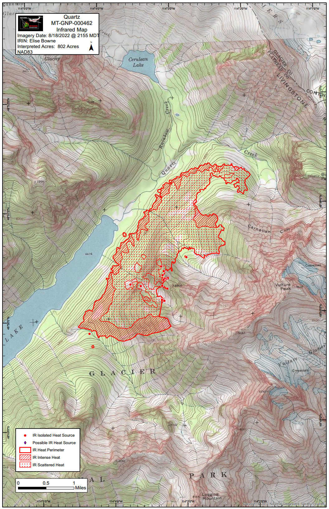
Summary: The Quartz Fire in Glacier Park was quite active over the past couple of days, filling the area full of smoke. It is currently estimated at 802 acres, based on this morning’s heat imagery.

According to this morning’s IR (heat mapping) pass, The Quartz Fire is at 802 acres, with the most intense heat being along the southern perimeter. The Quartz Fire continued to grow yesterday (Thursday, Aug 18) due to east northeast winds. Progression slowed since Wednesday’s initial run, but fire behavior remained active.

Firefighters have initiated structure and area protection for the Quartz Lake Patrol Cabin, Quartz Lake Wilderness Campground, and a footbridge at the foot of Quartz Lake.

Glacier National Park has enacted a closure order for the areas, campgrounds, and trails within the Quartz Lake drainage from the Continental Divide to the Inside North Fork Road for the protection of park visitors, employees, and natural resources. This includes the Quartz Lake Loop trails starting from just south of Bowman Lake toward Quartz Lake, as well as the Quartz Lake and Lower Quartz Lake Wilderness Campgrounds.

Monitor the Quartz Fire InciWeb site for additional information (https://inciweb.nwcg.gov/incident/8337/). Also keep an eye on the NFLA website for fire-related postings.

Quartz Fire Heat Map, August 19, 2022
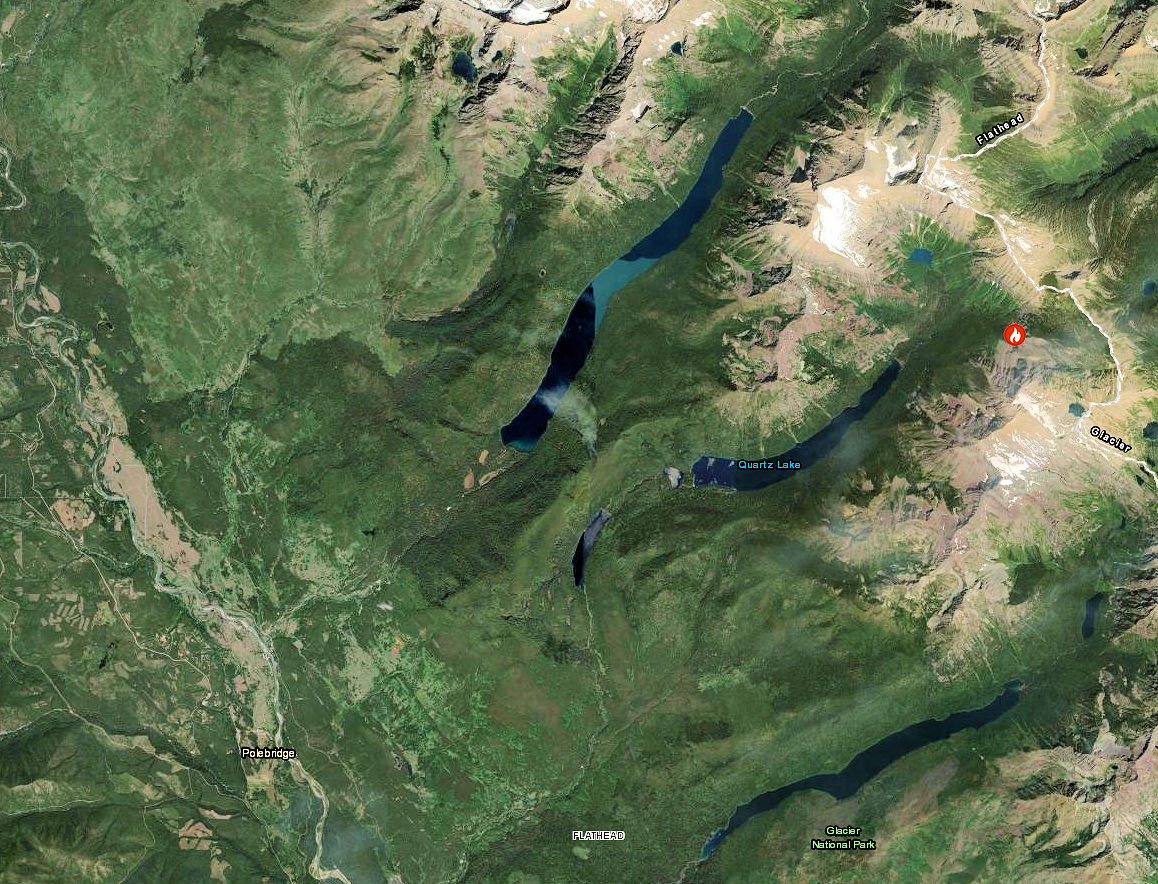
Quartz Fire Location
Quartz Fire Closure Map, August 18, 2022

Weasel Fire update for the morning of August 19th

Weasel Fire - Photo from Thoma Lookout August 17, 2022, 1830 - Leif Haugen
Weasel Fire – Photo from Thoma Lookout August 17, 2022, 1830 – Leif Haugen

Summary: The weasel Fire added 251 acres yesterday, adding acreage at its southwest corner in Lincoln County and along the northern perimeter in Canada. In the U.S., it is 20% contained; Canada is also establishing containment lines to the east.

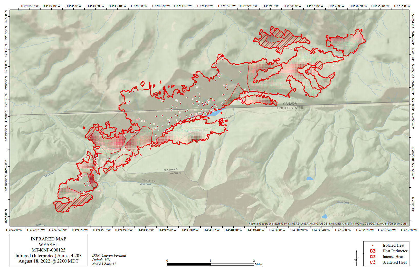
According to this morning’s IR (heat mapping) pass, the Weasel Fire gained 251  acres yesterday and is now estimated at 4203 acres. Better than half of this area — and most of the fire growth — is in Canada. Expansions yesterday were along Couldrey Creek on the northern flank and in Lincoln County along the southwest perimeter. The fire is now 20% contained within the U.S. section; Canadian personnel have been establishing containment lines along the fire’s northeastern/eastern flank to block spread into the Flathead Valley.  The blaze is currently burning in the Kootenai National Forest, the far northwest corner of the North Fork in the Flathead Forest’s Glacier View district, and in Canada. See the attached map for fire location and extent.

The US and Canada are working together to control the Weasel Fire. From the InciWeb site: Jurisdictional collaboration is occurring between the Incident Management Team (IMT) in the United States located in Eureka, Montana and the BC Wildfire Service Incident Management Team in Canada, located in Cranbrook. The two IMT’s are closely coordinating on wildfire management and are sharing resources as required.

The area closure associated with the fire was finalized August 9 and includes segments of both the Kootenai and Flathead Forests. For the North Fork, this affects an area above Trail Creek Road north to the border and from the Whitefish Divide east to the Frozen Lake Road vicinity. Trail Creek Road remains open. See the attached map and closure order document. Also note that, beginning August 22, major work will be in progress in the Glacier View Ranger District on Trail Creek Road (NFS 114) that will restrict travel for about a month.

Monitor the Weasel Fire InciWeb site for additional information (https://inciweb.nwcg.gov/incident/8290/); in Canada, visit the British Columbia Wildlife Service “Weasel Creek Fire” site (http://bcfireinfo.for.gov.bc.ca/hprScripts/WildfireNews/OneFire.asp?ID=883). Also keep an eye on the NFLA website for fire-related postings.
Weasel Fire Heat Map, August 19, 2022
Weasel Fire Area Closure Map

Quartz Fire evening update for Thursday, August 18

The Quartz Fire in Glacier Park is becoming a nuisance. As of this evening, it is estimated at 500 acres, up from 150 yesterday. Here’s the word from the Quartz Fire InciWeb site . . .
The Quartz Fire continued to grow today due to east northeast winds. Progression slowed since yesterday, but fire behavior remained active. The fire is currently estimated at 500 acres – fire managers have requested an infrared flight tonight in hopes of getting more accurate mapping which was not possible today due to smoke.

Firefighters have initiated structure and area protection for the Quartz Lake Patrol Cabin, Quartz Lake Wilderness Campground, and a footbridge at the foot of Quartz Lake.

Glacier National Park has enacted a closure order for the areas, campgrounds, and trails within the Quartz Lake drainage from the Continental Divide to the Inside North Fork Road for the protection of park visitors, employees, and natural resources. This includes the Quartz Lake Loop trails starting from just south of Bowman Lake toward Quartz Lake, as well as the Quartz Lake and Lower Quartz Lake Wilderness Campgrounds.

Quartz Fire Closure Map, August 18, 2022

Quartz Fire Area Closure in effect Aug 18

No more hiking the Quartz Lake Loop for a while. Here’s the text of the official press release . . .

AREA CLOSURE ORDER for the Quartz Fire

Quartz Fire Closure Map, August 18, 2022

Effective at 1600, Thursday, August 18th, 2022, pursuant to 36 CFR 1.5 (a), the following acts are prohibited within Glacier National Park:

PROHIBITIONS:

All visitor use, use for research, concession use, commercial use authorizations, and special use permits are prohibited in the areas below. 36 CFR 1.5 (a)

AREA DESCRIBED: (See Map: QuartzFire2022_Closure dated 08/18/2022)

The areas, campgrounds, and trails within Quartz Lake drainage from the Continental Divide to the Inside North Fork Road.

The Quartz Lake Loop trails starting from just south of Bowman Lake towards Quartz Lake.

These areas are all within Glacier National Park.

PURPOSE:

The closure is in order to protect the safety of park visitors and employees, and for the protection of the park’s natural resources due to wildland fire activity caused by lightning.

IMPLEMENTATION:

      1. This Order shall be in effect at 1600 on Thursday, August 18th, 2022 and shall remain in effect until further notice.
      2. This Order supersedes, rescinds, and replaces any previous orders prohibiting the same acts covered by this order.
      3. Any violation of these prohibitions is punishable by a fine of not more than $5,000.00 for individuals and/or imprisonment for not more than six (6) months.


The Quartz Fire so far…

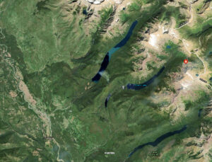
Quartz Fire Location

The Quartz Fire, about 14 miles northeast of Polebridge in Glacier Park, way up against the Continental Divide above Quartz Lake, made a pretty good run yesterday, filling the valley full of smoke. It’s estimated size is 150 acres, although it is likely a little bigger by now.

Here’s the official word as of yesterday evening from the fire’s InciWeb site . . .

Quartz Fire – Evening Update August 17, 2022

…Fire activity increased on the Quartz Fire this afternoon with east northeast winds moving it to the west and southwest within the Quartz drainage. The fire is currently estimated to be 150 acres. Fire growth caused an increase in smoke visibility from both sides of the Continental Divide, but there has not been any fire movement to the east.

Glacier National Park fire managers have ordered additional resources including firefighters who will begin structure protection measures for the historic Quartz Lake Patrol Cabin at the foot of Quartz Lake. Standard structure protection for small historic buildings includes laying hoses with pumps and sprinklers as well as wrapping the structure with fire-resistant structure wrap.

Glacier National Park will be enacting a closure order for trails and backcountry campsites in and around the Quartz drainage on Thursday. Details will follow when the closure order is finalized.