(PDF version of this document: 2021-07-31-HayCreek-FNF-Update.pdf)
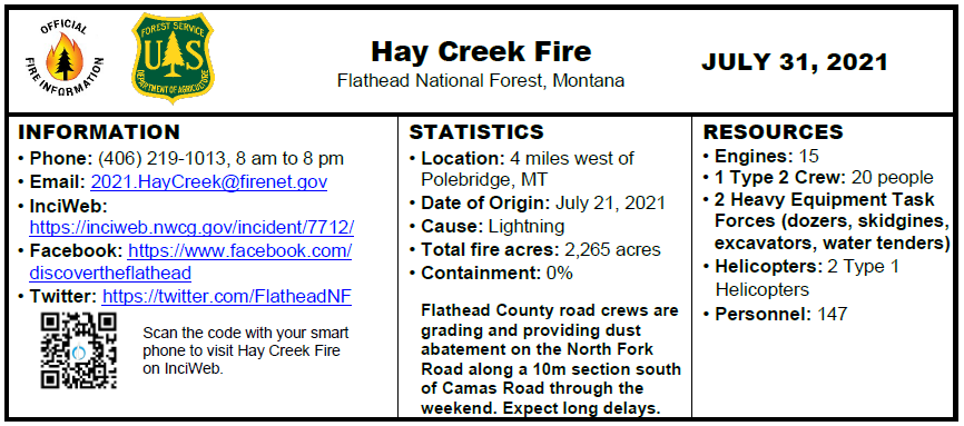
INCIDENT UPDATE
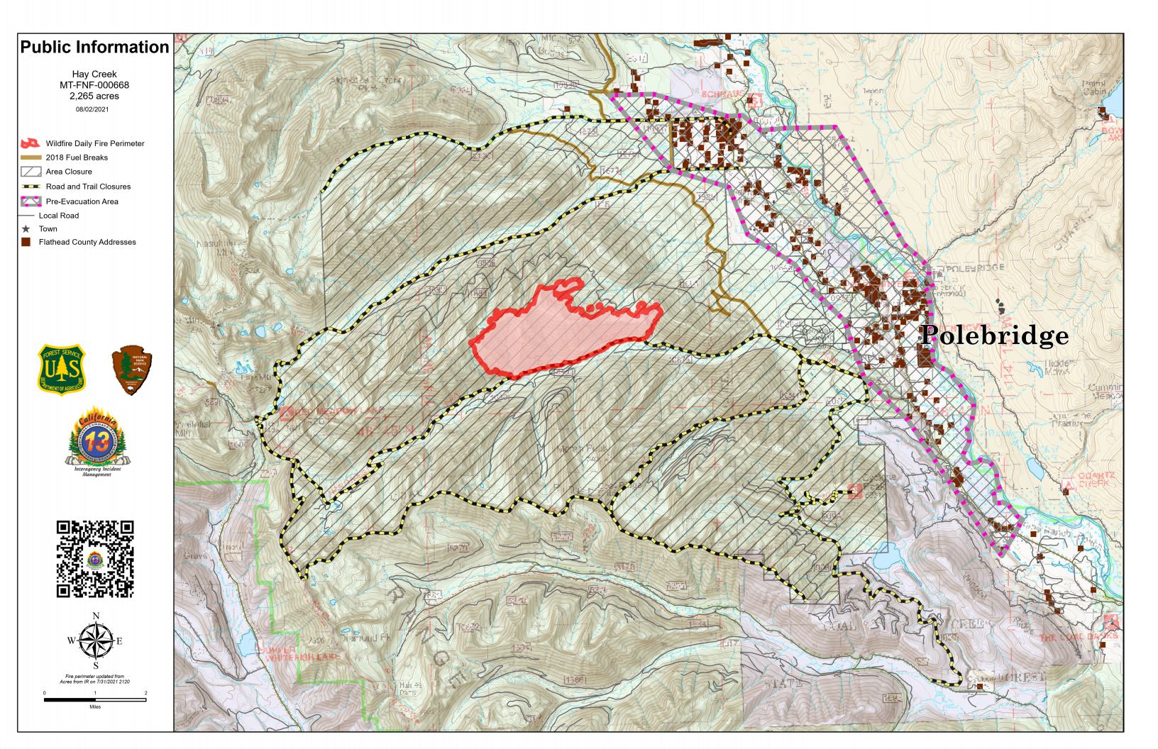
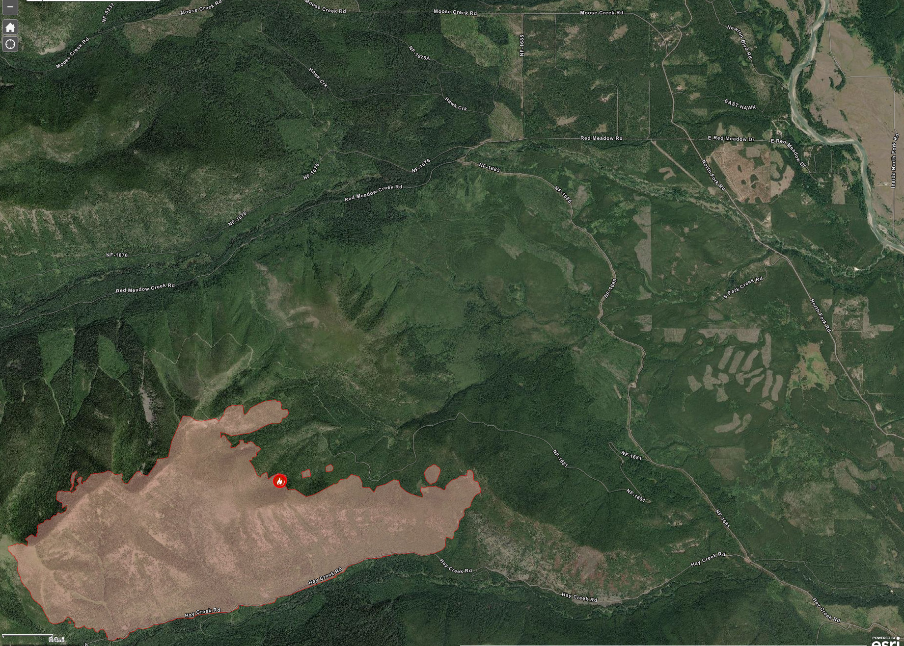
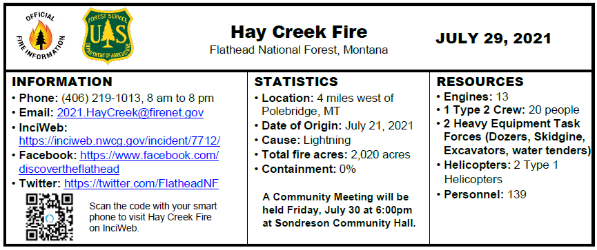
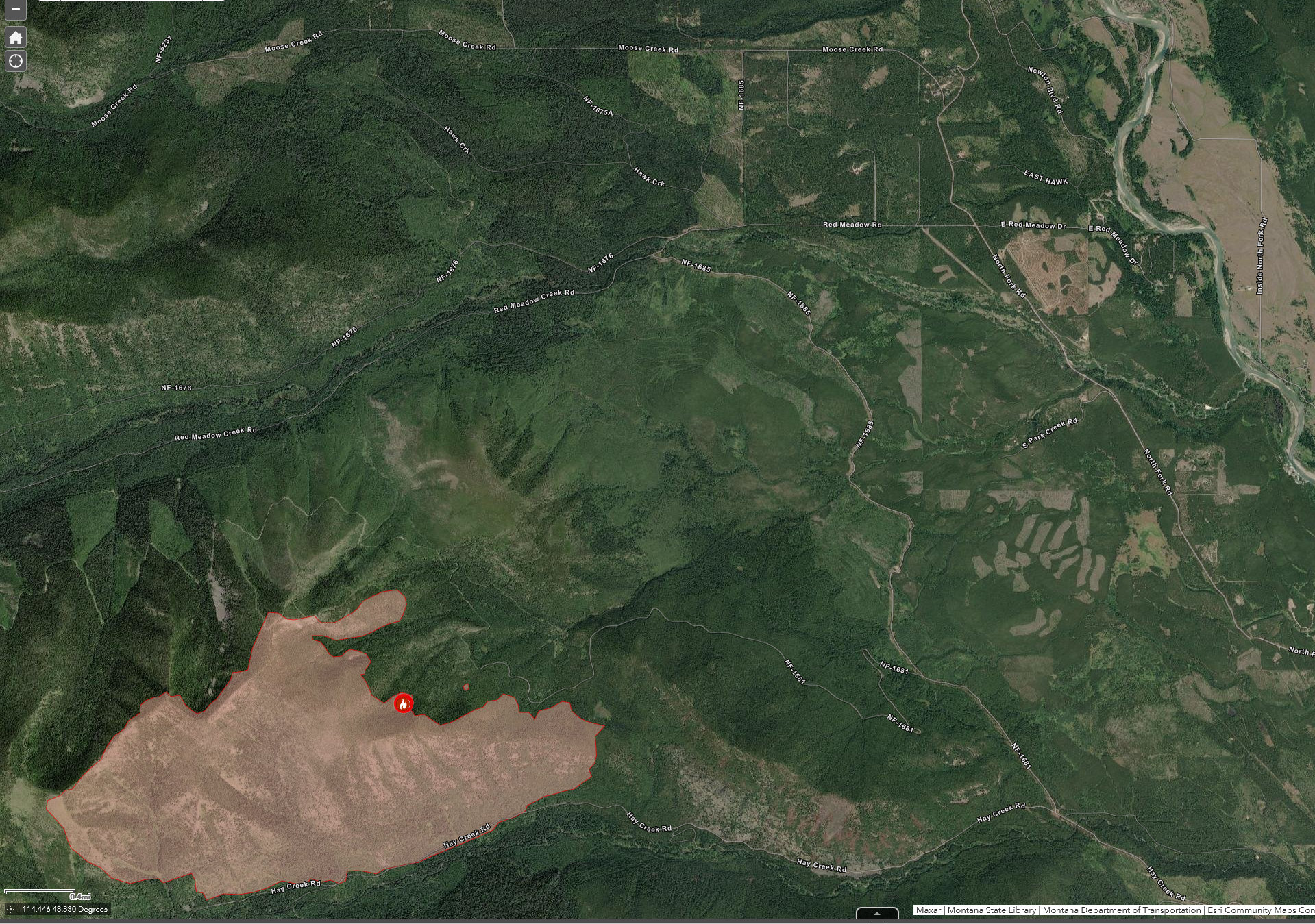
The southwest flank of the fire remains the most active, exhibiting single and group tree torching and making short crown runs. Overall fire behavior is moderate however, unseasonably hot and dry conditions will result in noticeable fire activity continuing overnight.
Conditions during the burn period on Friday allowed for further firing operations from the Hay Creek Road along the eastern front with the intent to reduce available fuels ahead of the main fire. Helicopters dropped buckets along the southwest flank of the fire to aid ground personnel in holding their line along the road.
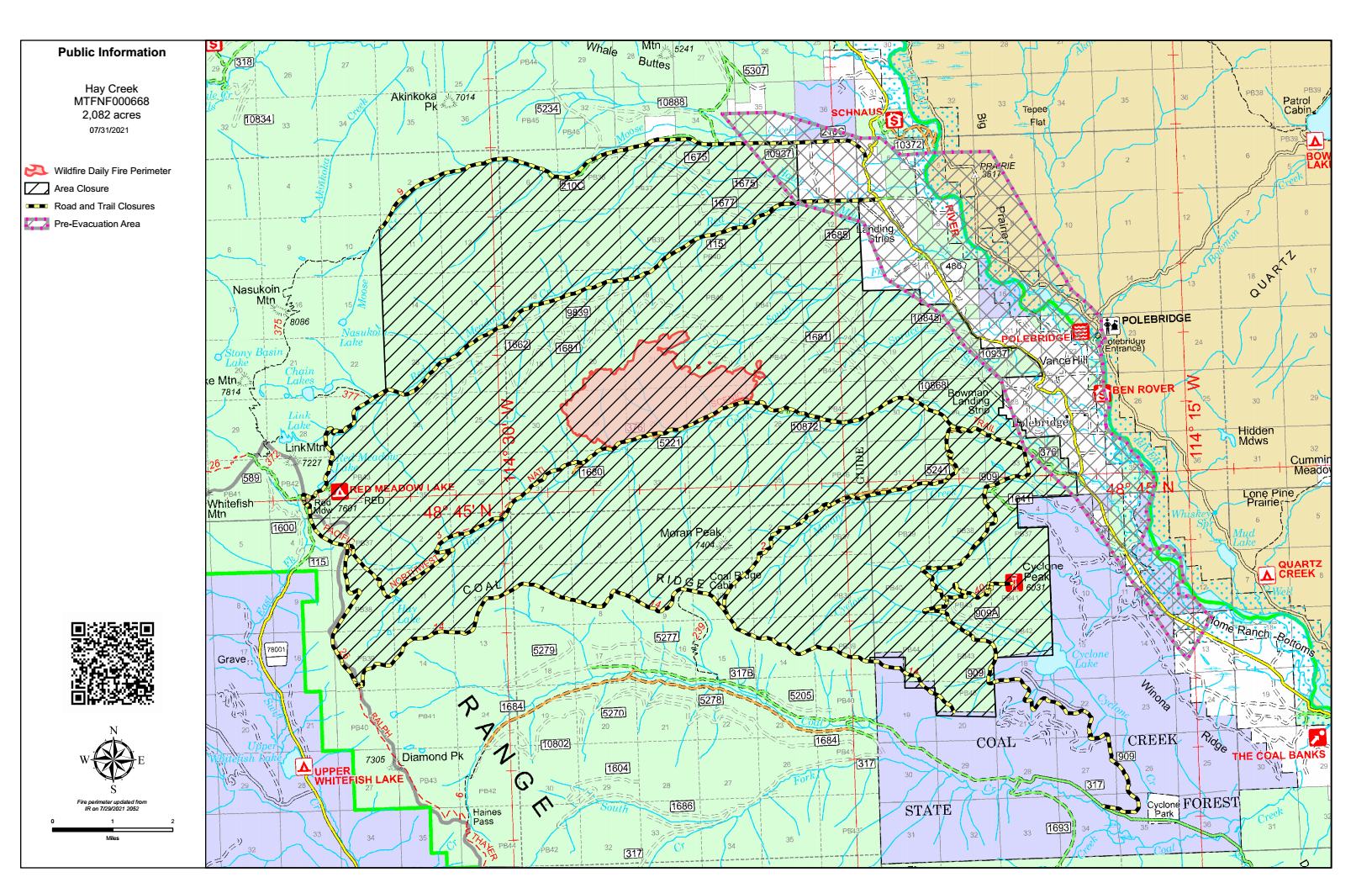
Previously established roads and fuel breaks are being widened and reinforced along primary and contingency lines between the main fire and private properties to the east.
EVACUATIONS
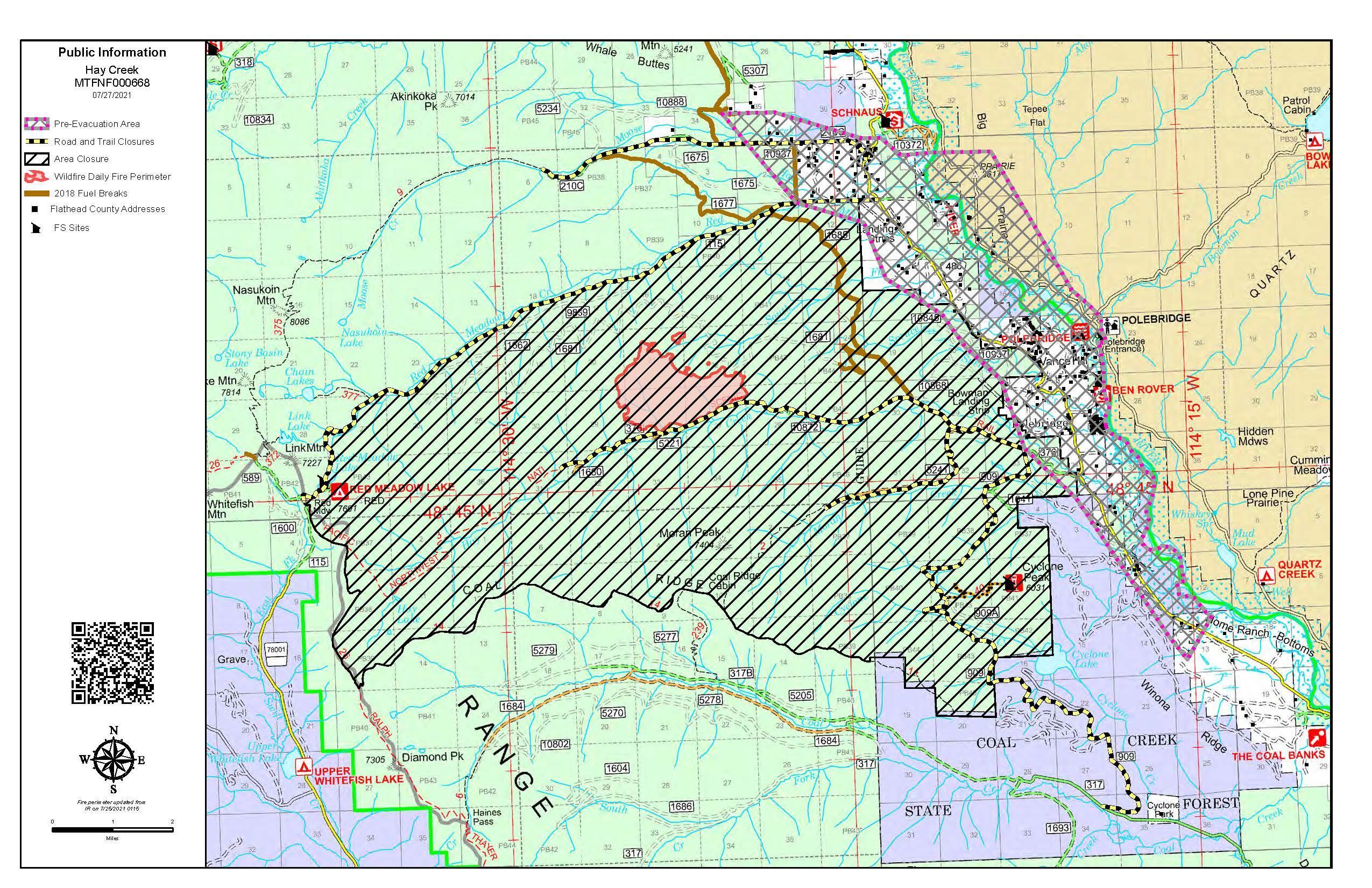
Evacuation Warnings include all residences east and west of the North Fork Road from Home Ranch Bottoms north to and including Moose Creek Road and the community of Polebridge. Glacier National Park has issued an Evacuation Warning for the North Fork area of Glacier National Park north of Logging Creek. See details at https://go.usa.gov/xFjcA and Current Fire Information – Glacier National Park.
CLOSURES
Road and trail closures are in place. See details at Inciweb: https://inciweb.nwcg.gov/incident/article/7712/62192/.
WEATHER AND AIR QUALITY
Continue reading Hay Creek Fire – Incident Update for July 31