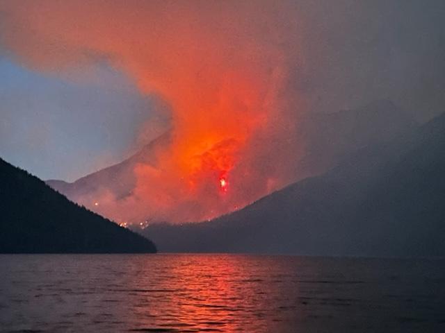
An excellent article in the Flathead Beacon about this year’s rapidly approaching fire season . . .
As Flathead County passes the midpoint of its fifth-driest year since 1894, top fire managers are bracing for a worrisome wildland fire season. Despite those ominous projections, officials say “firewise” residents and fire-adapted communities can provide the best line of defense by taking common-sense precautions to prepare.
With roughly 63,000 Flathead County residents living in the wildland-urban interface (WUI), or about 65% of the population — including 7,745 new residents who have migrated to the WUI in the past two years, according to U.S. Census Bureau data — top fire officials say education, outreach and proactive property owners could spell the difference between a calm or catastrophic summer.
“It’s just something that people need to understand and realize,” Fire Service Area Manager Lincoln Chute said Friday. “We live in a fire environment, so we all have a responsibility to mitigate the risk. And most of what we’re asking from folks is just commonsense behavior and maintenance.”
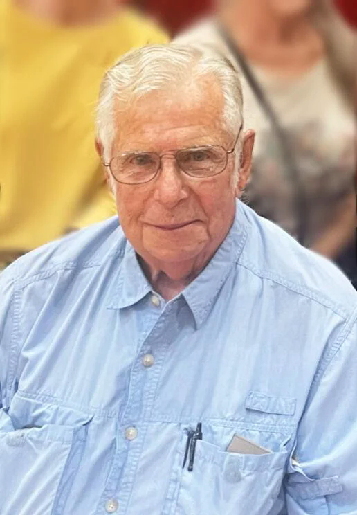
It is with great sadness that the family of Raymond A Bartram announces his sudden passing on June 22, 2023 at the age of 77.
His love of life did not come to an end with his death here on earth. He was surrounded by his loved ones, who will continue to honor his legacy by living their lives to the fullest.
Graduating from New Braunfels High School, he earned his Bachelor’s Degree from the University of Texas in Austin and his MBA from SMU. He started his longtime banking career in the Trust Department at Broadway National Bank in San Antonio. Moving back to New Braunfels, he took the position of Executive Vice President-Trust and Investment Officer at the First National Bank. This position spanned three bank name changes. . . from First National Bank to Texas Commerce Bank to JP Morgan-Chase.
Upon retiring from the position he remained on as an Advisory Director.
He was an active community leader receiving numerous honors, awards and recognitions and was a member of the Rotary Club. After retirement from the bank, his next project was a joint venture to develop the condos known as Camp Warnecke Estates on Garden Street and establish the property management company. Then, in his spare time, he took up ranching. He registered in the Selective Service System in September of 1963 and served in the Texas Army National Guard, Bravo Battery, 4th Battalion, 133rd Field Artillery Unit.
He is preceded in death by his parents Raymond and Lucy (Schleyer) Bartram and is survived by his wife Carole; his son John and his wife Ashley and daughters Gaines and Lucy; his daughter Lezlee and her husband Shawn Jurica and daughters Porter and Keefer.
Via Kevin O’Bryan (on June 25)…
Sad News. Skip Bartram died late Friday of septic shock. I received an email from his wife Carole. Carole is currently in their home in Texas with her children and grandchildren. At this time, I have no further information on when (or if) they might even be coming to Montana this year.
If any Northforkers want to send a sympathy card, Carole’s address in Texas is:
Bob Lee will be giving his well-regarded First Aid/CPR/AED class in the North Fork again this summer. It is an all-day course, starting at 9:00am and wrapping up by 4:00pm. The date is Tuesday, July 18. The course will be held at Sondreson Hall. Cost is $45/person. Bring your own lunch and drinks. Class size is limited to 10 people.
The course offers two-year AHA certification in First Aid, CPR and AED usage. If your job requires certified First Aid training, your current certification is expiring or if you just want to get up to speed on such things, this is an excellent way to get it done.
Contact Bill Walker, 406-407-2764 or wkwalker@nvdi.com to sign up for the course.
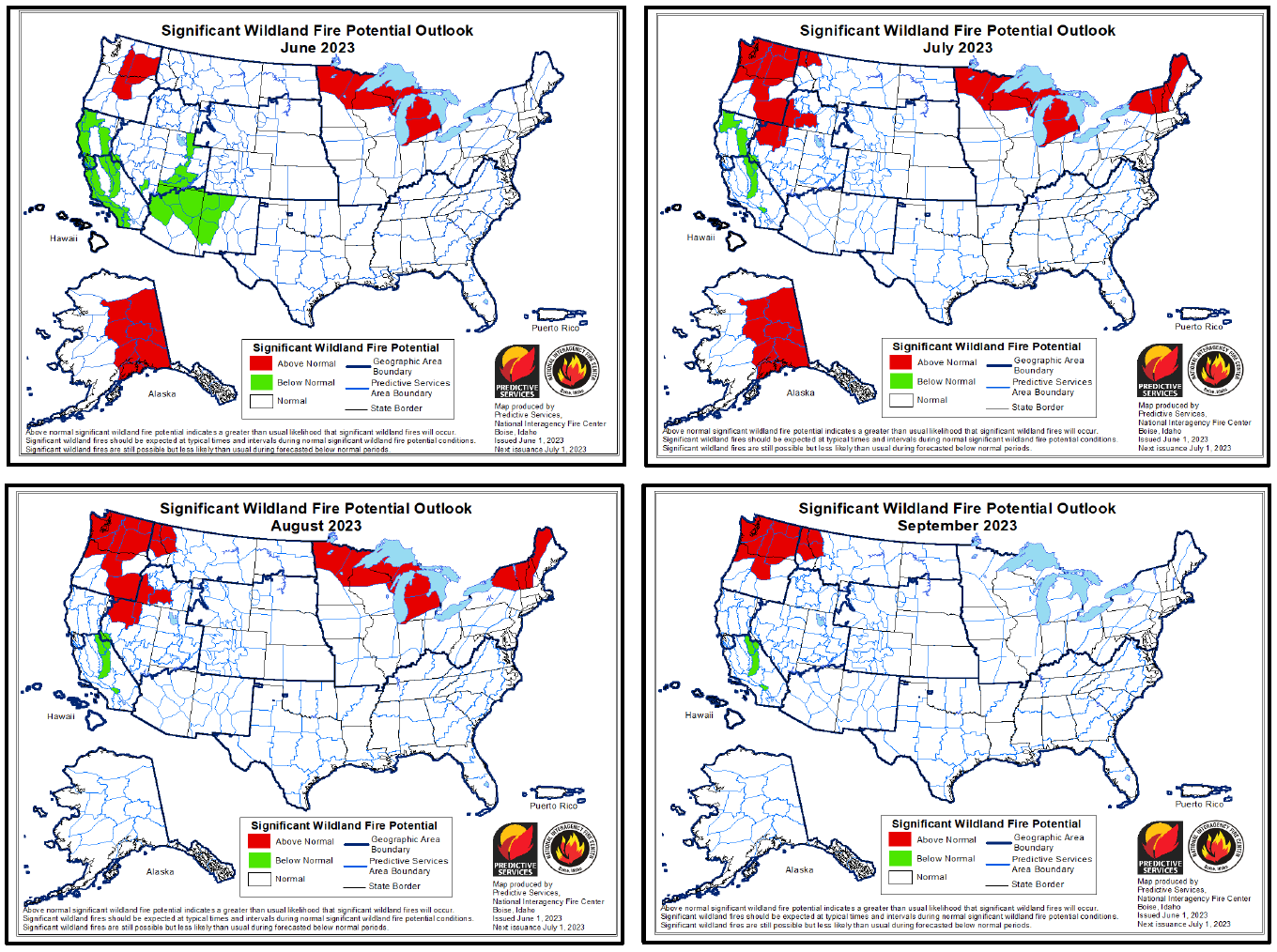
I’m a little late in posting this, but here is the June/July/August Wildland Fire Potential Outlook.
July, August and September are looking dry for extreme Northwest Montana. The shaded areas are actually west of the Whitefish Divide, but lines mean nothing at that scale.
And this is merely an outlook based on global weather. What we get is what we get. What we do know is that we are dry for June now, even with the moisture that has come. Mountain snowpack is low, which is more of an issue for river floating than it is for fire season.
We should all hope for nice wetting rains spaced weekly through July and August, and the fall rains coming in after Labor Day. Works for me!
Regardless, now is a great time to do your trimming and grass mowing and get prepared for fire season. The July 1 update will give us a better forecast, but we all know we have fire season in July and August, sometimes carrying into September and October. Let’s hope for a short and quiet fire season.
June 21 Summer Solstice Hike to Cyclone Lookout has been cancelled. The hike in Covey Meadow is on, meet at the Ranger Station at 6.30 pm. This is approximately 2.5 miles and is mostly flat.
Changes to the Square Dance Schedule: July 8th, July 29th cancelled , Aug 19th has been rescheduled for Aug 20th and will be hosted by Debo Powers
Aug 12th Annual Pie and Ice Cream Social and Square Dance will be hosted by Kevin and Beth Ulrichsen and Debo Powers.
New addition to the calendar: June 24th Welcome to the Summer Dance and Social, 7.30 pm at Sonderson Hall, Hosted by Dan and Dawn Jacobsen. You don’t have to dance but Debo Powers will lead us with some dancing suitable for all ages and abilities, Come and Meet your neighbors celebrate summer and the crowning of the 2023 Ms Polebridge. Bring along your favorite finger foods and drinks to share.
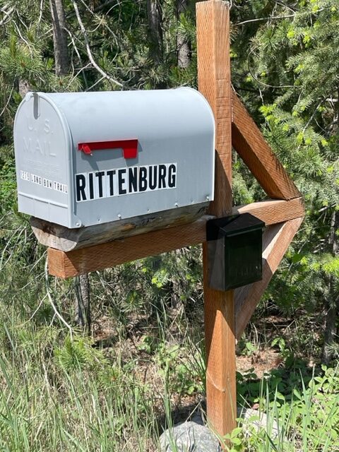
Printed Versions of the North Fork Calendar can be picked up at the top of Vance Hill. There is a small black mail box for calendars on the side of the Rittenburg Mail Box. Heading North this is the first mail box on the left in the group of 6 at the top of Vance Hill. These will be available later in the week. Tell your neighbors.
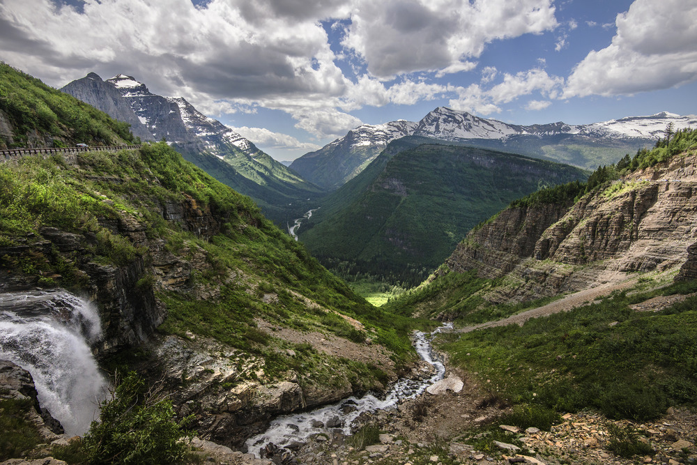
WEST GLACIER, Mont. [June 13, 2023] – Going-to-the-Sun Road officially opened this morning for the 2023 summer season. The road may now be accessed by motorized vehicles all the way through from both the West Glacier and St. Mary entrances. This is the earliest the road has opened since 2005.
Vehicle reservations are required May 26 through September 10, 2023, for those entering the park by vehicle or motorcycle from 6 am to 3 pm at west side entrances including the North Fork, Camas, and West entrances.
With Going-to-the-Sun Road fully open, the number of vehicle reservations available will be increased in the corridor. This increase will be executed through a series of additional reservation releases made available each morning starting today, June 13 at 8 am MDT. For opening day, a one-time release for additional Going-to-the-Sun Road vehicle reservations will also take place today at 6 am.
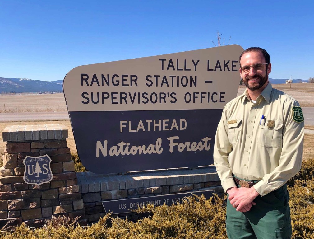
Kurt Steele, Flathead National Forest Supervisor has moved to a position with Region 1 Forest Headquarters. In the meantime, Deputy Flathead Forest Supervisor Tami McKenzie is holding the fort…
Flathead National Forest Supervisor Kurt Steele has accepted a new position at the U.S. Forest Service’s Northern Region headquarters in Missoula, capping a three-and-a-half-year stint overseeing 2.4 million forested acres in northwest Montana that in the past year had become beset in controversy.
Tami MacKenzie
According to an agency spokesperson, Steele “was offered and accepted” a new post as deputy director at the regional office that involves “environmental planning,” although the details of the position are still being worked out.
“I think it’s just a lateral move to a position at the regional office level,” Dan Hottle, the federal agency’s northern region public information officer, said Friday afternoon, when details about the transition were still scant. “It’s a new role and he will work closely with the regional leadership team on a number of different projects across the region as deputy director. His start date is still being negotiated right now.”
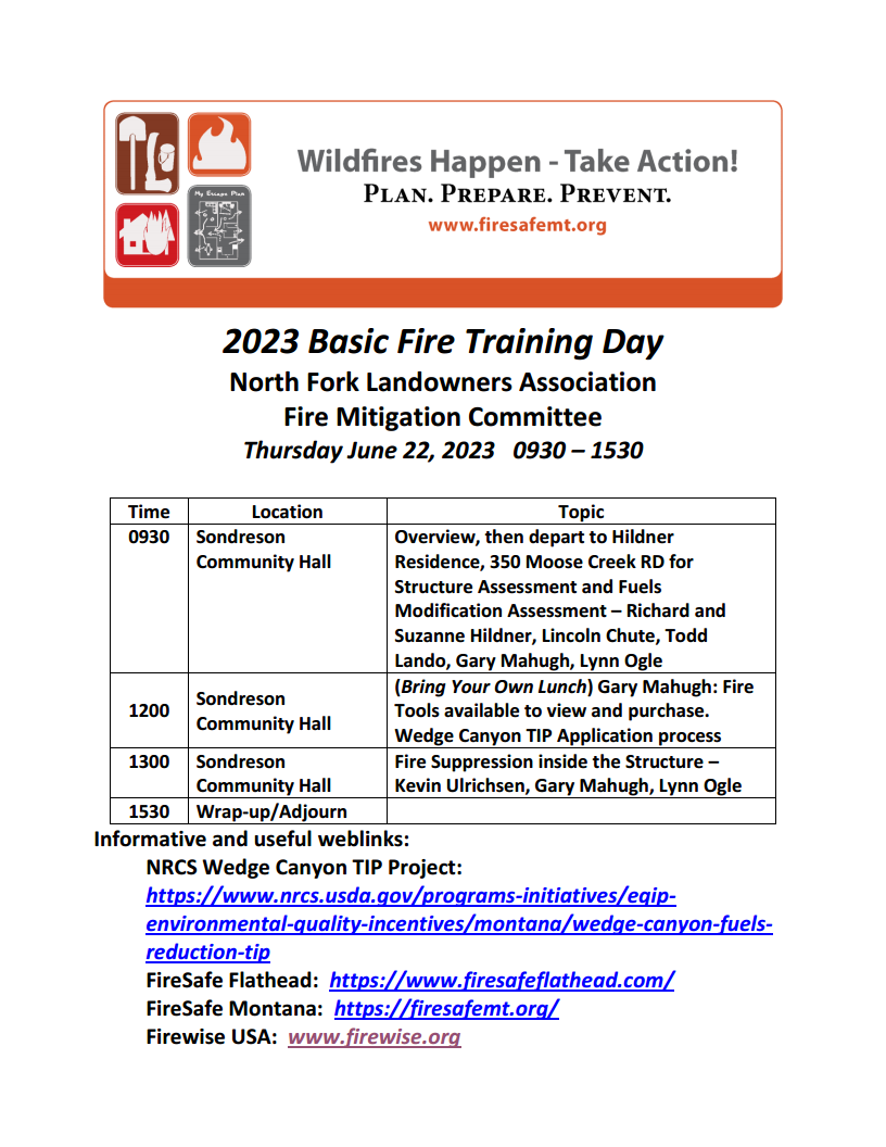
Greetings all!! Here is the Agenda for the North Fork Basic Fire Training Day on June 22nd…
We’ll start at Sondreson Community Hall at 0930. We’ll have coffee, bottled water, and light refreshments available. Molly will open with brief introductions, then turn it over to Richard Hildner to brief the exercise at the Hildner Cabin.
The Group will travel to the Hildner residence at 350 Moose Creek Rd. Structure Assessment forms will be passed out, the group split into teams, and the teams will be tasked with assessing the structures and the fuels modifications surrounding the structures. We would appreciate Lincoln Chute, Todd Lando and Gary Mahugh forming the oversight group to put together the “book answers” and to debrief the teams as they report out on their findings.
At noon, the Group will return to the Community Hall for their brown bag lunch. During this time, we’d appreciate it if Gary Mahugh would have some of his standard firefighting tools and supplies available to display and sell. And Sean Johnson, if you could brief the Wedge Canyon TIP application process, there is time for that. We don’t have plans to have a projector or laptop available for this event, but if you need a projector, the NFLA has one we can use. You’ll either need to bring a laptop or let us know you need one.
After lunch, Kevin Ulrichsen will lead a discussion about how to suppress fires within the Structure. We have asked Kevin or Lynn to lead a moment of silence in memory of Doug Barnes who passed away in a house fire. We would like Gary Mahugh and Lynn Ogle to also participate in the discussion on fire suppression inside the structure.
Molly can wrap up whenever things are done – no later than 3:30.
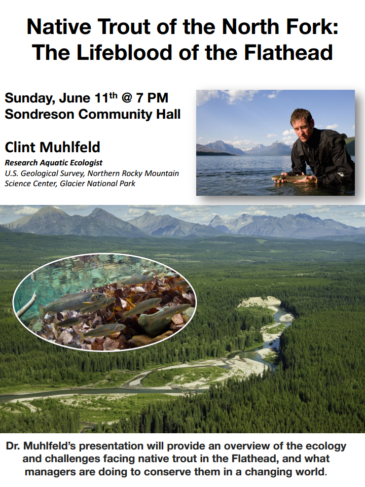
June’s NFLA meeting will feature a presentation at 7:00pm by Clint Muhlfeld, the Fisheries Biologist with the USGS in Glacier Park. Clint has been heading up the work on preserving native west slope cutthroat and bull trout. His recent work has been in Quartz and Gunsight Lakes. (BONUS item from Clint: “Here is a story that came out in National Geographic last year that features our work on native trout in the North Fork. Thought folks may be interested in case they haven’t seen it.”
 Bob Lee will be giving his well-regarded First Aid/CPR/AED class in the North Fork again this summer. It is an all-day course, starting at 9:00am and wrapping up by 4:00pm. The date is Tuesday, July 18. The course will be held at Sondreson Hall. Cost is $45/person. Bring your own lunch and drinks. Class size is limited to 10 people.