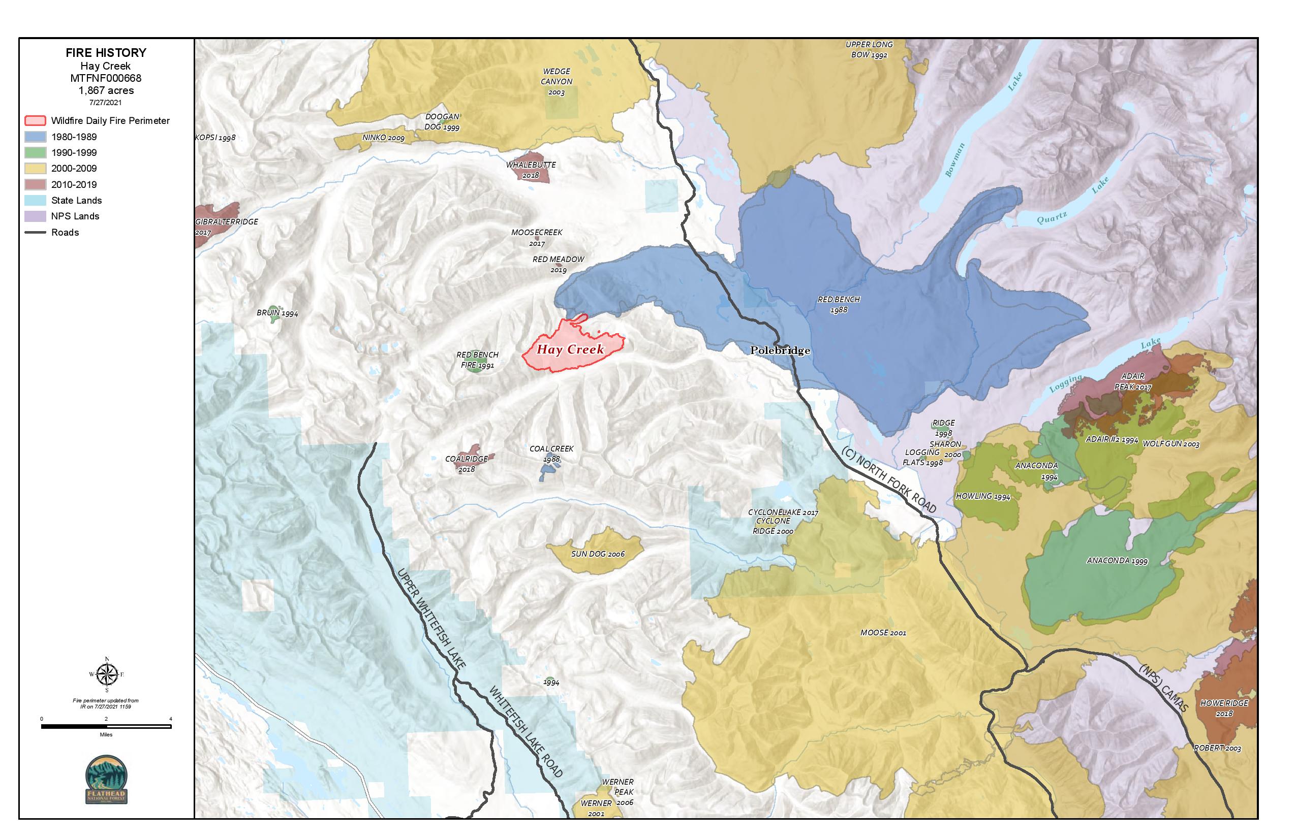
Jay Nichols, the Public Information Officer with the Type 2 fire team passed along this fire history map showing the Hay Creek Fire in context…
This was passed along by Diane Sine, a Glacier Park public affairs officer who is currently on assignment at the Hay Creek Fire . . .
I just wanted to make sure you have the most up-to-date information from the park concerning North Fork residents being able to use the Camas Road for pre-evacuation preparedness without having a ticketed entry reservation.
When entering the park at West Glacier, they need to tell the folks at the ticketed entry checkpoint that they are a North Fork property owner needing to get to their property for evacuation preparation. They will then be allowed to proceed to the regular West Glacier entrance station, where they will show their park pass or pay the entry fee and explain their situation and ask to be issued one of the special North Fork property owner ticketed entry passes. They will then have this ticketed entry pass which will allow them to get through ticketed entry for future evacuation preparation trips – as usual, a regular park entrance pass is also required.Night work is still scheduled on the Camas Road Monday-Thursday starting at 7 pm for the next two weeks, so make sure folks know that they won’t be able to use the Camas Road during those times.In the event of an actual evacuation order, the Camas Road would be available for egress 24 hours with or without special passes.
(PDF version of this document: 2021-07-31-HayCreek-FNF-Update.pdf)
The southwest flank of the fire remains the most active, exhibiting single and group tree torching and making short crown runs. Overall fire behavior is moderate however, unseasonably hot and dry conditions will result in noticeable fire activity continuing overnight.
Conditions during the burn period on Friday allowed for further firing operations from the Hay Creek Road along the eastern front with the intent to reduce available fuels ahead of the main fire. Helicopters dropped buckets along the southwest flank of the fire to aid ground personnel in holding their line along the road.
Previously established roads and fuel breaks are being widened and reinforced along primary and contingency lines between the main fire and private properties to the east.
Evacuation Warnings include all residences east and west of the North Fork Road from Home Ranch Bottoms north to and including Moose Creek Road and the community of Polebridge. Glacier National Park has issued an Evacuation Warning for the North Fork area of Glacier National Park north of Logging Creek. See details at https://go.usa.gov/xFjcA and Current Fire Information – Glacier National Park.
Road and trail closures are in place. See details at Inciweb: https://inciweb.nwcg.gov/incident/article/7712/62192/.
Continue reading Hay Creek Fire – Incident Update for July 31
Here’s the latest Hay Creek Fire Public Information Map showing fire extent, closures and current evacuation zone boundaries . . .
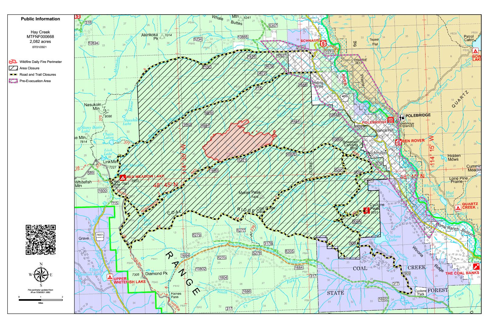
PDF version: https://nflandowners.org/nflawp/wp-content/uploads/2021/07/Hay-Creek-Fire-Public-Information-Map-July-31-2021.pdf
Excellent article on the Hay Creek Fire by Chris Peterson of the Hungry Horse News, July 29 . . .
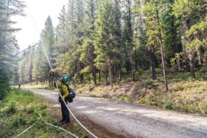
Crews were working on containment lines on the Hay Creek Fire Wednesday, cutting fuel breaks, soaking down duff with hose lines and setting small burnouts in pockets of unburned fuel on the fire’s south flanks.
Fire managers hope to keep the fire north of the Hay Creek Road, explained Lincoln Chute, fire service area manager for the Flathead County Office of Emergency Services.
The fire has already burned down to the road in some places. Fire managers want to ease the fire down to the road, which gives them a black line of control.
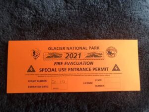 Some clarification on Glacier Park’s temporary Camas Road transit permit for North Forkers under pre-evacuation orders. This is relayed via Jim Dahlstrom, Polebridge District Ranger:
This is directly from Pete [Webster, Acting Superintendent] moments ago:
They just need to drive to the ticketed entry point at West glacier and state they are NF evacuation. They will be let in to the entrance where the fee collectors will issue a placard to them. For their next trip(s) they just need to show the placard.
Trying to keep it simple for everyone. We don’t need a list. Entrance will have a log of issued permits.
I did not state previously but this access goes through Monday 8/9. After that the NF road from C Falls should be good.
In case it was not clear the night closure for Camas applies to residents. No night travel M-Th.
See also: “Glacier Park offers free transit to residents under pre-evacuation orders“
Here’s the latest Hay Creek Fire Public Information Map showing fire extent, closures and current evacuation zone boundaries . . .

PDF version: https://nflandowners.org/nflawp/wp-content/uploads/2021/07/July-29-2021-Hay-Creek-Fire-Map.pdf
(PDF version of this document: 2021-07-29-HayCreek-FNF-Update.pdf)
INCIDENT UPDATE
Fire activity was moderated by light rain Wednesday morning resulting in minimal smoke production throughout the day. Conditions were favorable to conduct small burnout operations to consume pockets of unburned fuel and help to hold the Hay Creek Road. Crews and heavy equipment continued to make progress strengthening fuel breaks, widening roads, and connecting past silvicultural forest management treatments. Nightshift observed single tree torching and several fire-weakened trees across the Hay Creek Road. Today fire personnel will work to cool spot fires identified south of the Hay Creek Road and continue to assess any structure protection needs. The Type 2 Incident Management Team (California 13) will transition to take over the fire on Sunday, August 1st.
EVACUATIONS
Evacuation Warnings include all residences east and west of the North Fork Road from Home Ranch Bottoms north to and including Moose Creek Road and the community of Polebridge. Glacier National Park (NP) has issued an Evacuation Warning for the North Fork area of Glacier NP north of Logging Creek. See details at https://go.usa.gov/xFjcA and Current Fire Information – Glacier National Park.
CLOSURES
Road and trail closures are in place. See details at Inciweb: https://go.usa.gov/xFjcC.
WEATHER AND AIR QUALITY
High pressure will strengthen over the area on Thursday bringing warmer temperatures and dry conditions. Winds will be 5-9 mph out of the Southwest with gusts up to 20 mph. Poor humidity recoveries in the thermal belts will allow active fire behavior throughout the evening. For the most current fire weather forecast go to https://www.weather.gov/wrh/fire?wfo=mso. For smoke and air quality go to http://svc.mt.gov/deq/todaysair/.
For current visibility in Glacier NP see https://www.nps.gov/glac/learn/photosmultimedia/webcams.htm. Continue reading Hay Creek Fire – Incident Update for July 29