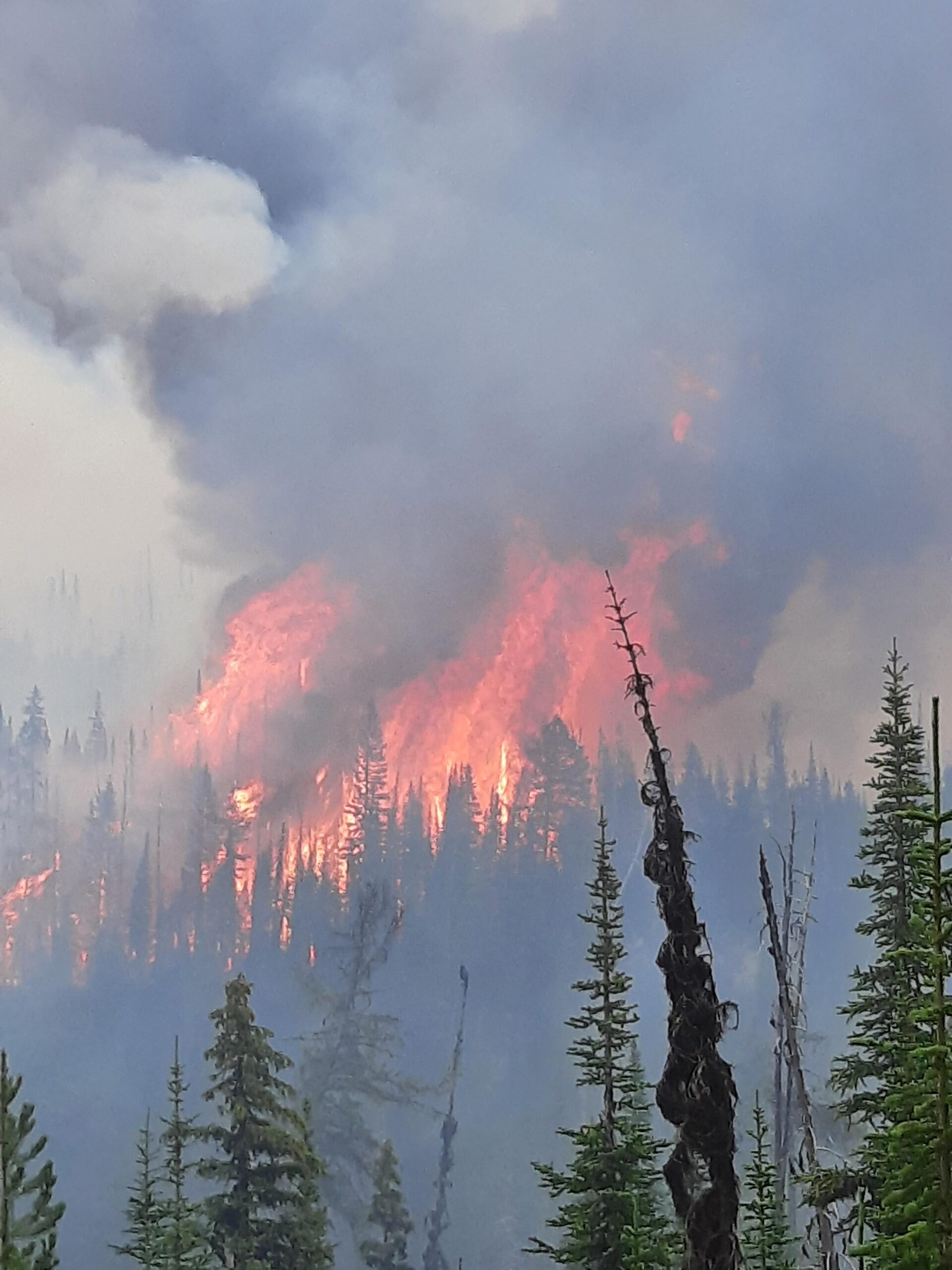
Short version: The Weasel Fire grew by 230 acres yesterday, most of it in Canada…
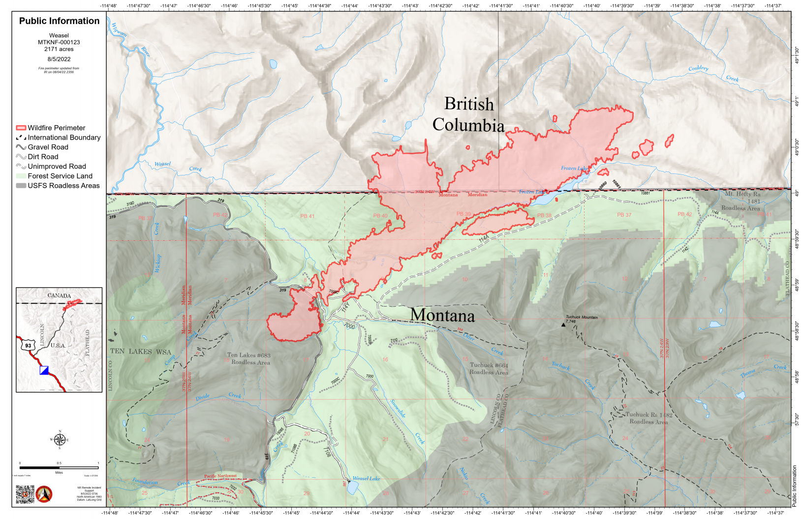
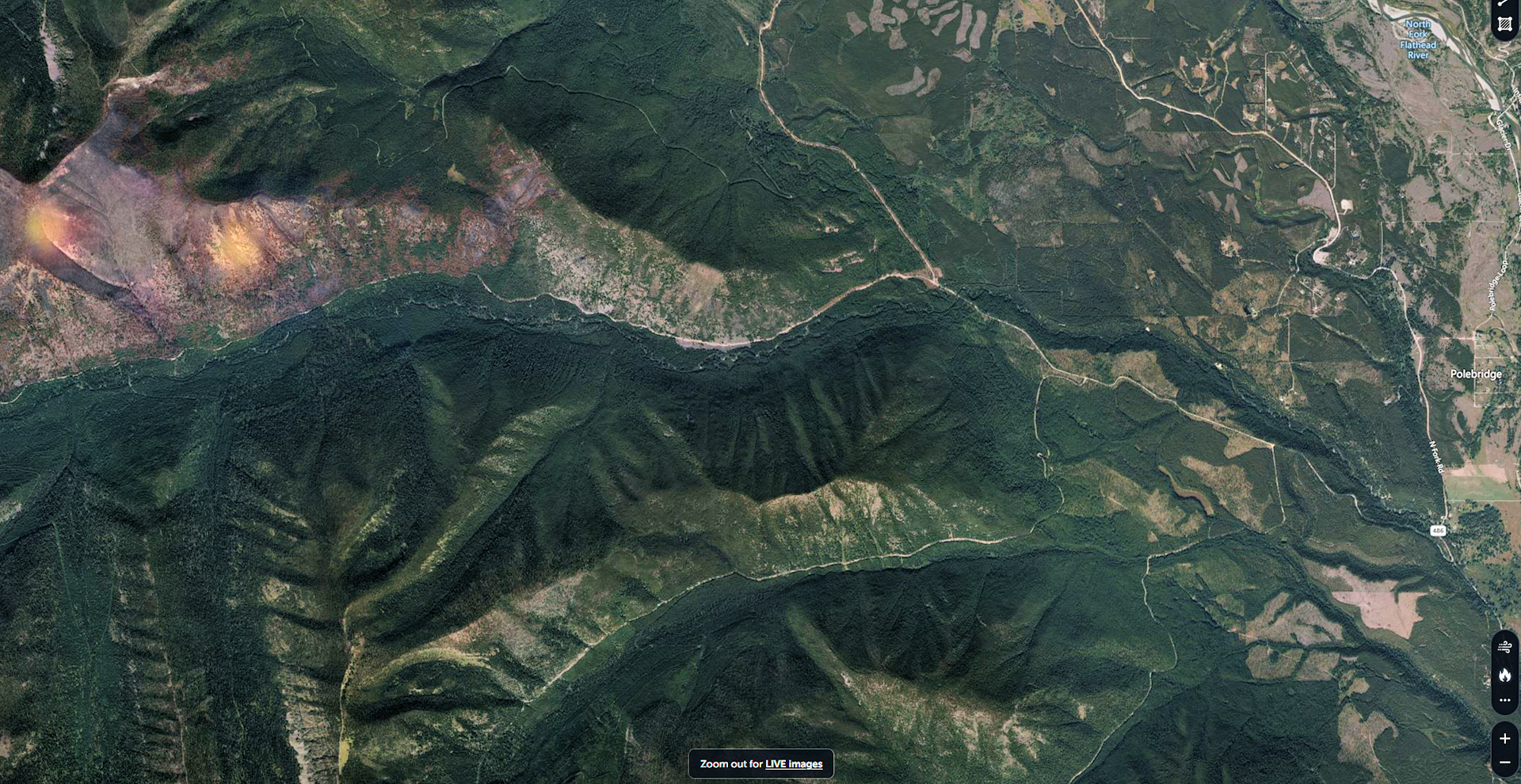
According to this morning’s IR (heat mapping) pass, the Weasel Fire gained 230 acres yesterday and is now estimated at 2542 acres. The western perimeter of the fire grew along Weasel Creek, about 0.2 miles west of the Lincoln/Flathead County line, but the bulk of the increase was along the northeastern and eastern edges of the burn in Canada. A little more than half the fire acreage is now in Canada. The blaze is currently burning in the Kootenai National Forest, the far northwest corner of the North Fork in the Flathead Forest’s Glacier View district, and in Canada. See the attached map for fire location and extent.
The US and Canada are working together to control the Weasel Fire. From the InciWeb site: Jurisdictional collaboration is occurring between the Incident Management Team (IMT) in the United States located in Eureka, Montana and the BC Wildfire Service Incident Management Team in Canada, located in Cranbrook. The two IMT’s are closely coordinating on wildfire management and are sharing resources as required.
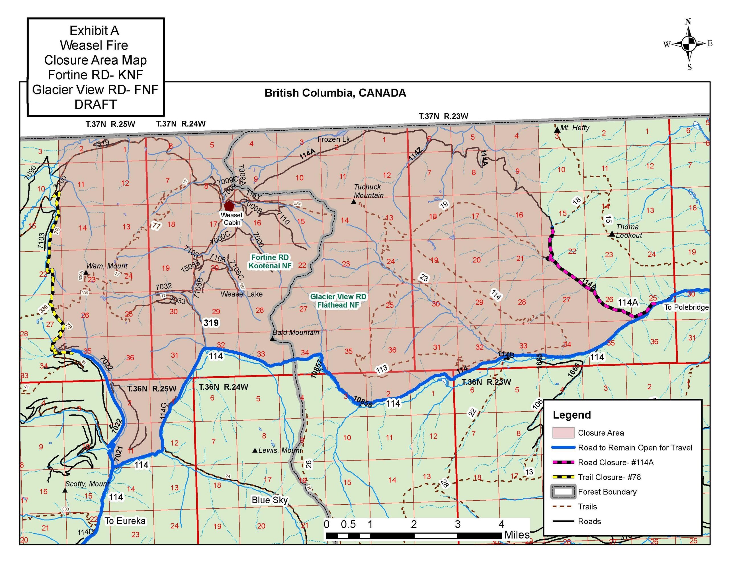
The area closure associated with the fire now includes segments of both the Kootenai and Flathead Forests. For the North Fork, this affects an area above Trail Creek Road north to the border and from the Whitefish Divide east to the Frozen Lake Road vicinity. Trail Creek Road remains open. See the attached map for details.
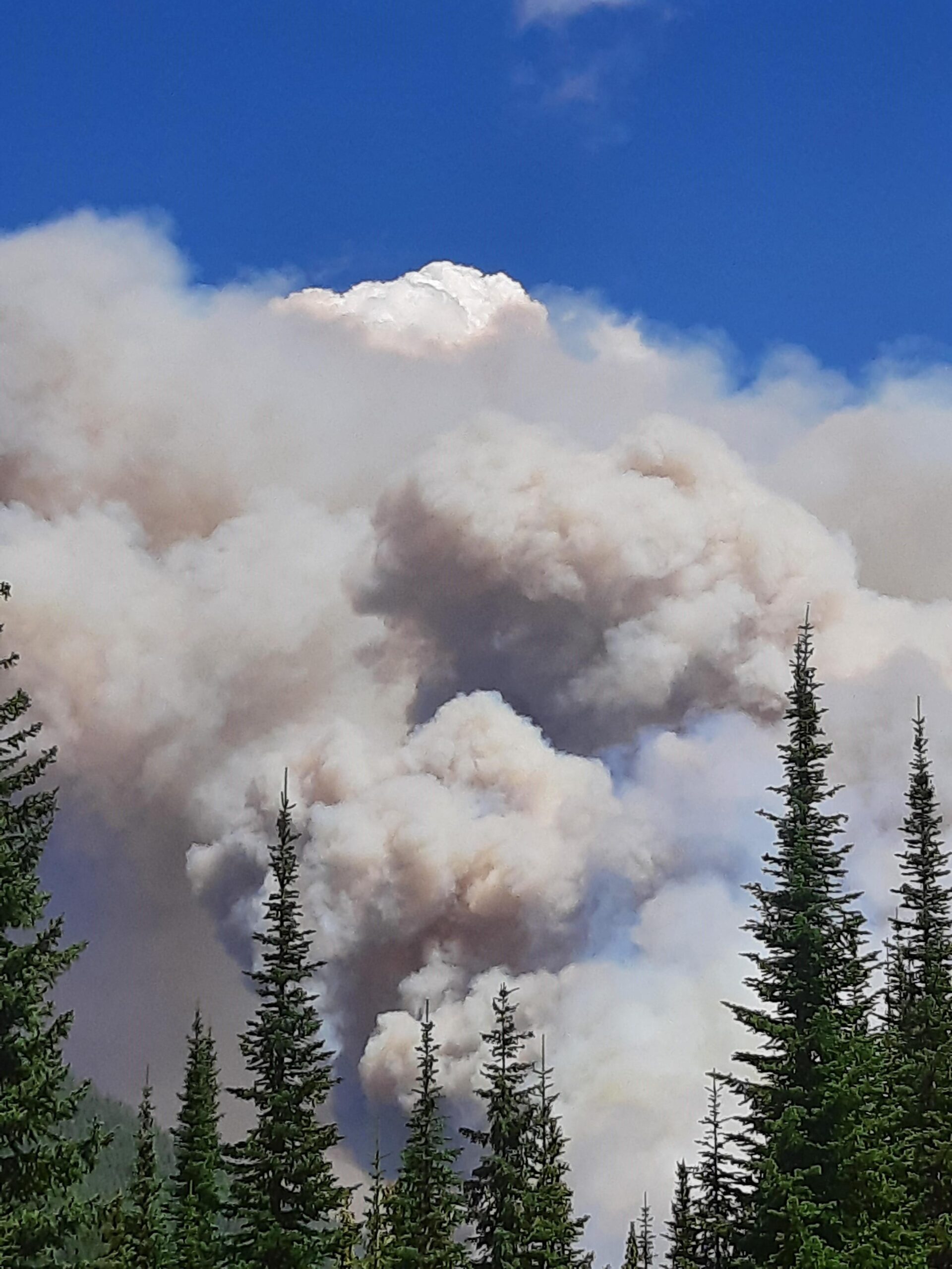
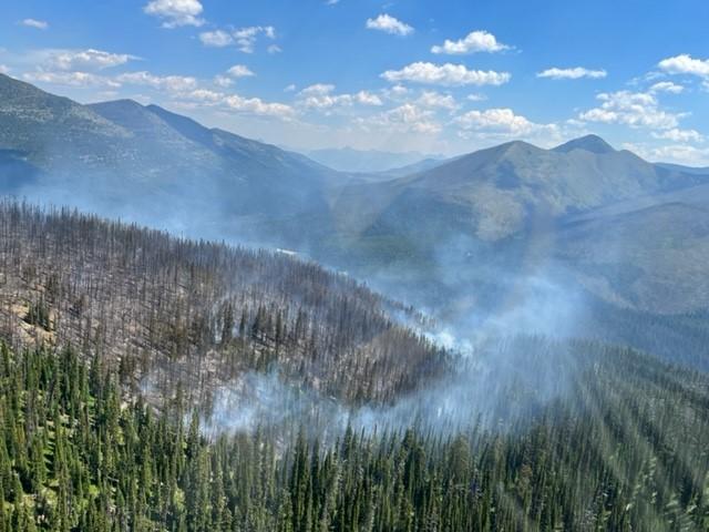
Weasel Fire – Extreme Fire Behavior, August 4, 2022 – USFS
Using information from various online resources…
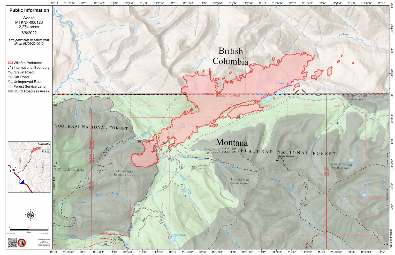
The Weasel Fire gained another 100 acres yesterday and is now estimated at 2274 acres. The blaze is currently burning in the Kootenai National Forest, the far northwest corner of the North Fork in the Flathead Forest’s Glacier View district, and in Canada. The Weasel fire has done a fair bit of spotting beyond the main perimeter and is still quite active. See the accompanying map for information on the fire’s extent.
There’s no official word yet on North Fork area trail and road closures, although it is safe to assume that at least some of the trails and Forest Service roads north of Trail Creek Road will be off-limits. There are no current plans to close Trail Creek Road itself.
From the official press release. This mostly discusses the bridge work on the “Inside” North Fork Road, but also note the reference to work on the “North Fork Bridge,” which apparently means the Camas Bridge to us normal people…
WEST GLACIER, Mont. [August 5, 2022] – In a July press release Glacier National Park announced a construction project to rehabilitate 13 bridges throughout the park. Since then, work has begun on the Anaconda, Camas, and Dutch Creek Bridges located on the Inside North Fork Road.
The Weasel Fire, which began in the Kootenai National Forest, made a substantial run yesterday, jumping FS Road 319 and pushing northeast towards the Frozen Lake area and on into Canada north of Tuchuck Mountain.. It is now estimated at 2174 acres. The blaze is currently burning in the Kootenai National Forest, the far northwest corner of the North Fork in the Flathead Forest’s Glacier View district, and a substantial portion is in Canada. See the accompanying map for more information.
According to a note sent yesterday afternoon from Rob Davies, Hungry Horse/Glacier View District Ranger: “We are in touch with the Kootenai NF and the Canadians are in the communication loop as well. This is on Glacier View Ranger District and the lands consist of 5a Backcountry Non-Motorized Year-Round and 1b Recommended Wilderness Area and Tuchuck – Whale Recommended Wilderness. There are no suppression actions planned at this time on the Flathead side of the fire. We will be implementing/evaluating closures, updating signage and assessing any potential values at risk in the area.”
0930: Update from Andy Huntsberger, District Fire Management Officer: “We are… currently working on area/trail closures for this area. We aren’t planning to close Trail Creek Road at this time but areas to the north of Trail Creek Road will be closed and some trails in the area will be affected.”
From Rob Davies, Hungry Horse/Glacier View District Ranger . . .
As of about 1200 today the Weasel Fire on the Kootenai NF has jumped FS Road 319 and is headed northeast towards the Frozen Lake area. It is estimated that about 50 acres of the fire are now on the Flathead National Forest and the overall size is now over 200 acres. We are in touch with the Kootenai NF and the Canadians are in the communication loop as well. This is on Glacier View Ranger District and the lands consist of 5a Backcountry Non-Motorized Year-Round and 1b Recommended Wilderness Area and Tuchuck – Whale Recommended Wilderness. There are no suppression actions planned at this time on the Flathead side of the fire. We will be implementing/evaluating closures, updating signage and assessing any potential values at risk in the area. I have attached a map of the fire from this AM. This does not include the fire growth from today but it will give you an idea of where the fire is located. It should also be noted that there was a Weasel Fire from 2017 (3800 acres) on the Kootenai and Flathead and is directly east of the current Weasel Fire.
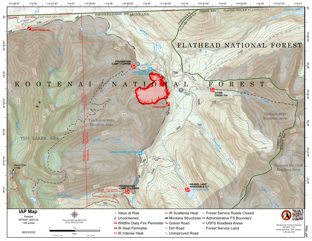
The Weasel Fire in the Kootenai National Forest continues to grow slowly, reaching 162.38 acres according to the IR estimate posted this morning. It still poses no threat to the North Fork.
The Flattop Mountain Fire in Glacier NP continues to skunk around at 0.1 acres.
Using information from Lynn Ogle, Debo Powers (currently at Cyclone LO) and online resources…
The Weasel Fire in the Kootenai National Forest grew quite a bit yesterday, reaching 150 acres (see attached image). There was some spotting across Road 319 to the east, but it rained for 30 minutes and a helicopter made water dumps, too. It continues to be no threat to the North Fork.
The Flattop Mountain Fire in Glacier NP continues to hold at around at 0.1 acres.
Using information from Lynn Ogle, Debo Powers (currently at Cyclone LO) and some digging through online resources…
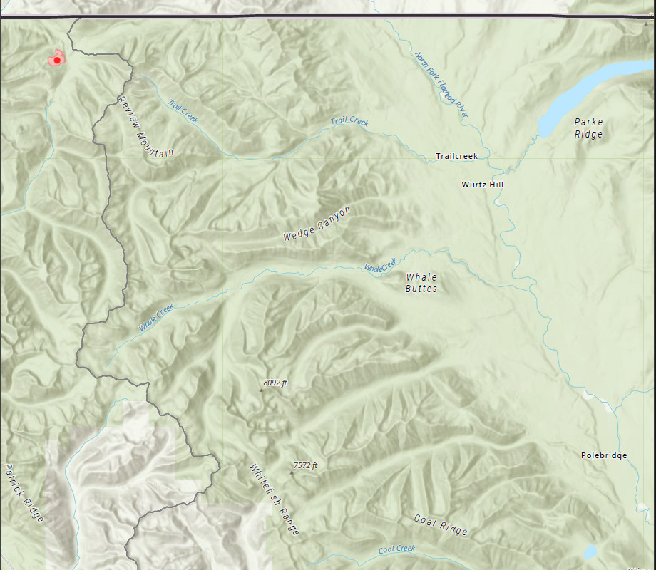
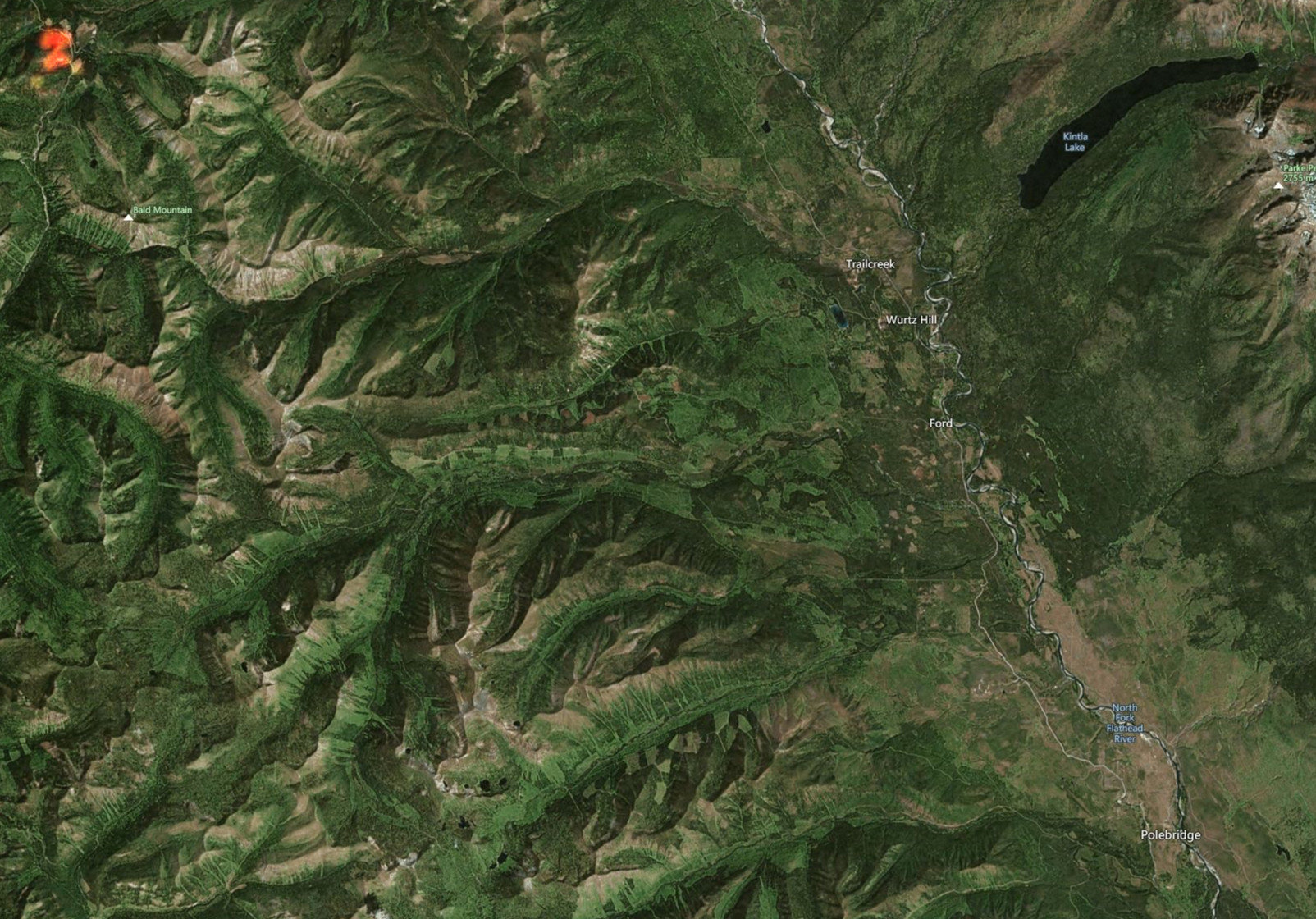
The Weasel Fire is at 30 acres, up from it’s initial 10, and moving towards the northeast. It generated a lot of visible smoke yesterday, but is currently no threat to the North Fork. Location is in the Kootenai National Forest, 26 miles northwest of Polebridge (see image; fire location is in upper left corner).
The hot spots in last year’s Hay Creek burn disappeared from the satellite imagery overnight and there is no smoke from that location.
The Flattop Mountain Fire in Glacier NP continues to skunk around at 0.1 acres.
There were no other verifiable local smoke reports yesterday.
This is a summary of local wildfire issues based on information from Lynn Ogle and various other resources. No agency had issued any press releases at the time I put this together at 0720…
Flathead NF: Two hot-spots along the ridgetop in last year’s Hay Creek burn; FNF is sending a ground crew in to check it out; initial report 30 July. (See image below.)
Kootenai NF: Weasel Fire (sometimes called “D3 Weasel”), on the east slope of a ridge to the west of Weasel Creek. It was about 7 acres in extent initially on 30 July, is now 13.50 acres, and is being handled by the Kootenai National Forest. According to Bill Fordyce, “The Kootenai has put a lot of resources on the Weasel Fire. It’s a 10 plus acres. Some of that area burned 5 or 6 years ago so there would be standing dead and down…”
Bill
Approximate position, according to Zoom Earth, of the two hotspots in last year’s Hay Creek burn. The nearest is about 6.5 miles west of Polebridge. We should know more once Flathead NF gets some people up there to look around…
(look for the kind of orangy glows near the left edge of the image. Those spots are *not* to scale, they just indicate rough positions!)
Hay Creek Hotspots, approximate postions, 31 July 22