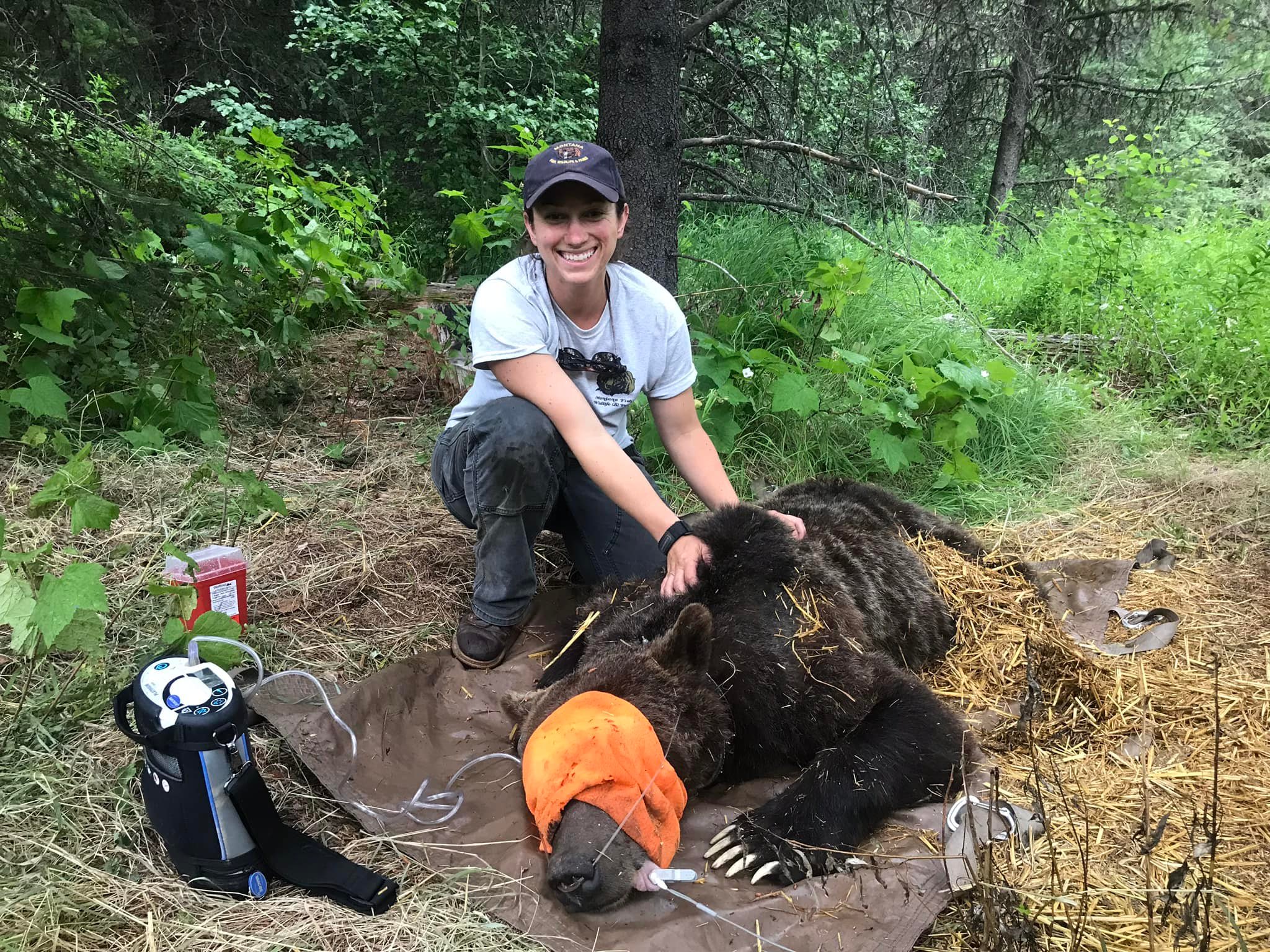
Justine Valieres, Wildlife Conflict Specialist for Montana Fish, Wildlife & Parks (Region 1)
A note posted to Facebook this morning from our new Fish, Wildlife and Parks Wildlife Conflict Management Specialist, Justine Vallieres . . .
Hey North Forkers! I just wanted to pop in and do a quick introduction of myself. As most of you know, Tim Manley retired from FWP after 37 years of grizzly bear management. I was lucky enough to be his technician these last 4 years so I learned from the best! I applied this winter for the Wildlife Conflict Management Specialist position and was offered the position and started in March. So I will now be covering the North Fork. So if you have any mountain lion, black bear or grizzly bear conflicts please give me a call. My number is Tim’s old work cell which is 406-250-1265.
On another note, there have been a handful of reports from the North Fork area recently of grizzly sightings, some in yards. Please remember that if you do have a bear in your yard (black or grizz), please make them leave. This is so crucial that they learn that being around people and homes is not OK or safe. I know we all enjoy viewing wildlife, but it’s really important to remember that the more they hang around homes, the more comfortable they get, which can lead to habituation. We don’t want to give them the opportunity to snoop around and get into stuff, but we also do not want to create habituated bears where they are no longer wary of people. You personally may be tolerant of a bear in your yard, but other people may not be so tolerant, which could ultimately end up in the bear being hurt or killed.
So if you have bears in your yard, from a safe place, yell at them in a deep tone and tell them to move along. The human voice is the best deterrent, as we are “danger” to them. Bang pots and pans, set off car alarms, use air horns etc. Please refrain from shooting as we want to avoid any potential accidents and bears get used to hearing gunshots. If you have continuously tried to make a bear leave and it shows no interest in doing so please give me a call.
Thank you for helping keep the North Fork and its wildlife wild! I look forward to meeting many of you and seeing some familiar faces this season!
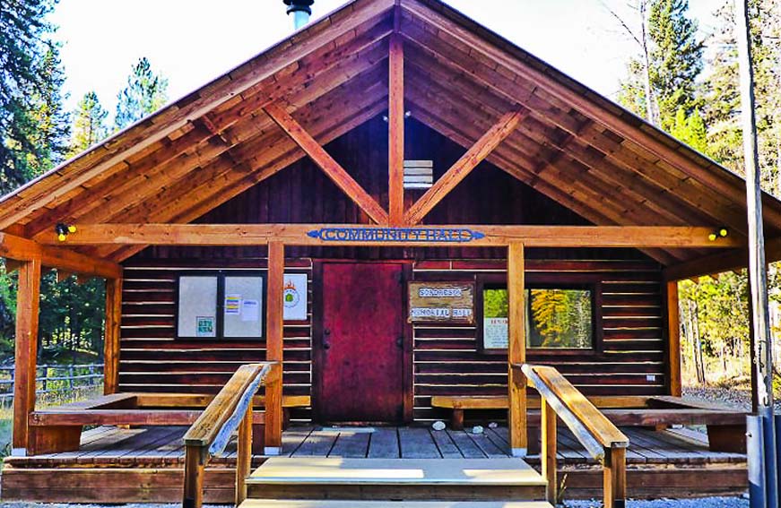
The Sondreson Hall spring cleanup is fast approaching. This year, there will be two events: Cleaning out the loft over the kitchen area on Saturday, May 7, and the usual general cleanup in and around the building on Saturday, May 14. Start time for both events will probably be 10:00am.
We need to ensure we have volunteers on both days for some specific tasks, listed below. Contact Irv Heitz (47irvh@gmail.com or 406-261-2690) if you can help out.
Sat., May 7, 10:00am – Loft Cleanup
Clean up. Haul unneeded junk from loft above kitchen.
Some of this material should probably be kept (Christmas decorations, for example); some may be useful to other folks in the community; some may just be trash.
We need folks to haul down and help sort all this out.
We will also need a trailer for disposal of material that doesn’t make the cut.
Sat. May 14, 10:00am – General Hall Cleanup
Outside tasks include, but are not limited to…
Place cinder blocks under wood-fired cook stove in kitchen.
Search for and repair roof leak over counter window. Look on roof for loose screws/nails.
Clean up brush with weed-whacker.
Cut and remove to burn pile those trees/brush per Deb Starling Hazardous fuels reduction inventory. (Irv will have marked them)
Fix inside roof by new chimney; seal and insulate. (Call Irv for instructions.)
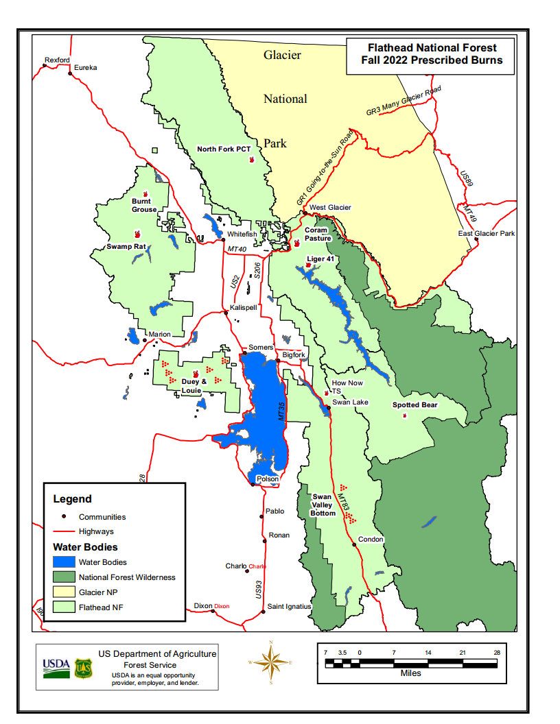
Flathead National Forest Prescribed Fire, Spring 2022
Here’s the Flathead Forest press release announcing this spring’s prescribed burns. Short version: There’s only one on the North Fork, the “North Fork Road PCT,” where “5 acres of hand piles will be ignited along the North Fork Road north of the Demers Ridge trailhead.”
The full text of the release . . .
Kalispell, MT, March 21, 2022 — The Flathead National Forest is planning to conduct spring prescribed fire projects when weather, fuel conditions, and air quality become favorable. Smoke will be visible from various places in the Flathead Valley depending on the location of the burn units and weather conditions.
Each project follows a Prescribed Fire Burn Plan. The prescribed fire projects are located and designed to be controlled to reduce the potential for adverse effects, or to escape as a wildland fire. These projects will follow Montana air quality standards and coordinated with Montana State Department of Environmental Quality to reduce the impacts of smoke to our neighbors, cooperators, and surrounding communities. The project areas include:
Pile burning: On the attached map major locations of concentrated piles are identified. These may include both landing and hand piles. There are also scattered piles not identified on the map which may also be burned.
Swan Lake Ranger District:
Dewey and Louie Timber Sales – This project includes broadcast burning in timber harvest units located within the Blacktail Mountain area west of Lakeside, MT and South of Kila, MT. These treatments will use prescribed fire for fuels reduction, vegetation regeneration, and wildlife habitat improvement.
How Now Timber Sale – This project includes broadcast burning in timber harvest units located on Sixmile Mountain, North of Swan Lake, MT. These treatments will use prescribed fire for fuels reduction and vegetation regeneration.
Swan Valley Bottom Maintenance Burning – This project includes maintenance broadcast burning in previously treated timber harvest units located within the Swan Valley. These treatments will use prescribed fire for fuels reduction, large ungulate winter range improvement, and improvement of forest health.
Swan Lake Ranger Station – This project includes under burning the administrative site at the Swan Lake Ranger District office located in Bigfork, MT. These treatments will used to rejuvenate the grass and reduce fuels.
Pile Burning – Hand or machine piles are located in locations within the Blacktail Mountain area, Swan Valley, Bigfork community, and miscellaneous piles around the district as a result of but not limited to: logging, hazardous fuels reduction in the wildland urban interface, hazard tree removal, recreation site management and trail or road construction. These piles are burned to reduce fuel loads in these areas. These piles are strategically burned based on their location, access, and weather conditions.
Tally Lake Ranger District:
Burnt Grouse 2.0 – This ecosystem burn will use prescribed fire for fuels reduction, vegetation regeneration, and wildlife habitat improvement. The burn would involve up to 150 acres of planned ignition.
Swamp Rat 5/5A/6 – Treatment will include approximately 57 acres of a hand ignited understory burn just south of Star Meadows.
Hungry Horse/Glacier View Districts:
Coram Pasture RX – Forest Service Administrative Site near Martin City, used for pasturing agency livestock. Up to 15 acres of livestock pasture will be burned to rejuvenate the grass and remove encroaching conifers. Five acres of hand piles from blowdown cleanup will also be treated.
Liger 41 Rx—20 acres of understory burning will occur adjacent to FS road 38 near Emery Bay campground. The purpose of this burn will be to reduce fire hazard and to prepare the site for regeneration planting.
North Fork Road PCT—5 acres of hand piles will be ignited along the North Fork Road north of the Demers Ridge trailhead.
Spotted Bear Ranger District:
Spotted Bear Ranger District is monitoring the weather and fuels conditions this spring in anticipation of conducting a few prescribed burns to meet a variety of objectives including slash reduction and site preparation in harvest units as well as reducing natural fuels in the surrounding areas. All of the burn units under consideration for this spring are near the Spotted Bear Ranger Station on south and west aspects.
For more information about these projects, contact the appropriate Ranger Station:
Justine Valieres, Wildlife Conflict Specialist for Montana Fish, Wildlife & Parks (Region 1)
Recently announced on Facebook by Tim Manley . . .
Congratulations to Justine Vallieres! She is the new Wildlife Conflict Specialist for Montana Fish, Wildlife & Parks (Region 1) based out of Kalispell.
I retired at the end of 2021. Justine was one of several qualified individuals that applied for the job and was selected by the interview committee. I know Justine will do a great job!
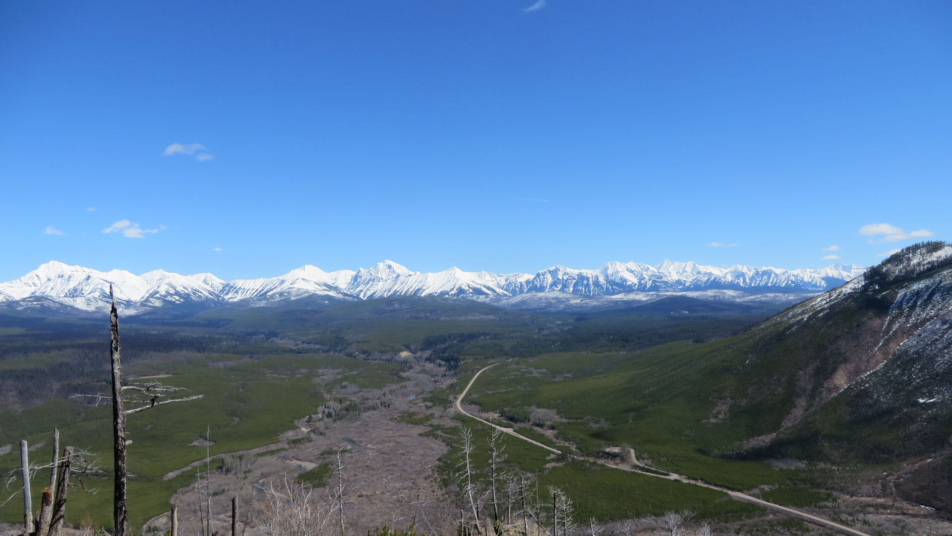
View East into Glacier NP from Glacier View Mtn, April 16, 2017 – W. K. Walker
Here’s the latest on this year’s “vehicle reservation” (they are not called “tickets” anymore) system for gaining entrance to Glacier National Park.
Highlights:
Tickets …er, uh… vehicle reservations will be required to enter the park’s Going-to-the-Sun (GTSR) corridor and at Polebridge.
A separate reservation is required for the GTSR and for Polebridge. GTSR reservations are good for 3 days, between 6:00am and 4:00pm; Polebridge reservations are good for only 1 day, between 6:00am and 6:00pm.
Vehicle reservations will be required from May 27 to September 11. They will be available 120 days in advance on a rolling window starting March 2 at 8:00am. Like last year, reservations cost $2.00.
Vehicle reservations can be purchased from recreation.gov, either online or through their call center.
North Fork specific details not mentioned in the press release (Camas Road transit, local boating access, etc.) will be discussed at the Interlocal on February 9.
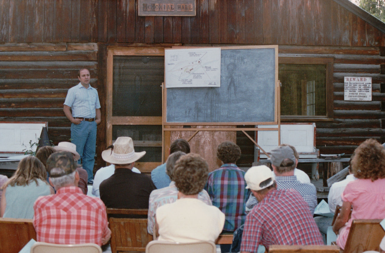
Bob Dunkley explains Park plans for the Polebridge Ranger Station, post Red Bench Fire, at the 1989 Interlocal at Sondreson Hall.
The Winter 2022 Interlocal Agreement Meeting is hosted by Glacier National Park at 10:00am on Wednesday, February 9. Note that this will again be a virtual meeting – hopefully, the last one. Links for the online session should be available soon.
For those of you who are new to this, The Interlocal Agreement provides for face-to-face contact with representatives of agencies whose policies and actions affect the North Fork. Interlocal Agreement meetings are held twice a year, in the winter (in town) and summer (at Sondreson Hall). This is always a very interesting meeting, with reports from a range of government agencies and local organizations and often some quite vigorous discussion.
A note from Rob Davies, Hungry Horse-Glacier View District Ranger:
We will be initiating a contract next week in response to the large slash piles left from the Hay Creek Fire fuel breaks.
Plowing of the Red Meadow road will be allowed up to the Spruce Creek Road (about 2 miles) where that very large slash pile exists. The contractor will be grinding slash, loading into trucks and hauling back to town.
There are other slash plies up the Moose Creek Road that will also be ground up and hauled off.
The Moose Creek Road is already plowed, which shouldn’t create any issues, but the Red Meadow Road activity will create a situation where snowmobilers need to drive with their trailers up to the Spruce Creek road junction instead of parking at the bottom where the North Fork Road Connects to Red Meadow. A turn-around and small parking area will be plowed out at the junction of Red Meadow and Spruce Creek Roads.
Hauling is not expected to be very frequent — maybe two loads a day. Activity may occur all winter until the county sets load limits in the spring. We don’t know if the contractor will start at Moose Creek or Red Meadow Road but as I get more details I will share them with you.
Feel free to call myself (406-387-3801) or Timber Management Assistant Paul Donnellon (406 387-3807 or 406 260-7264), at the ranger station in Hungry Horse.
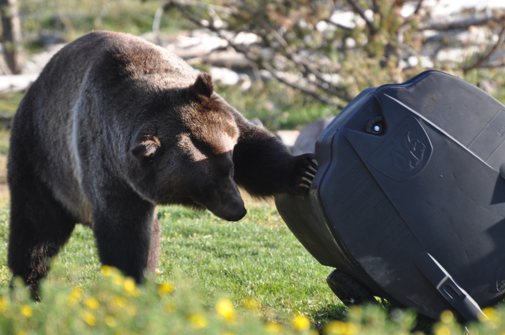
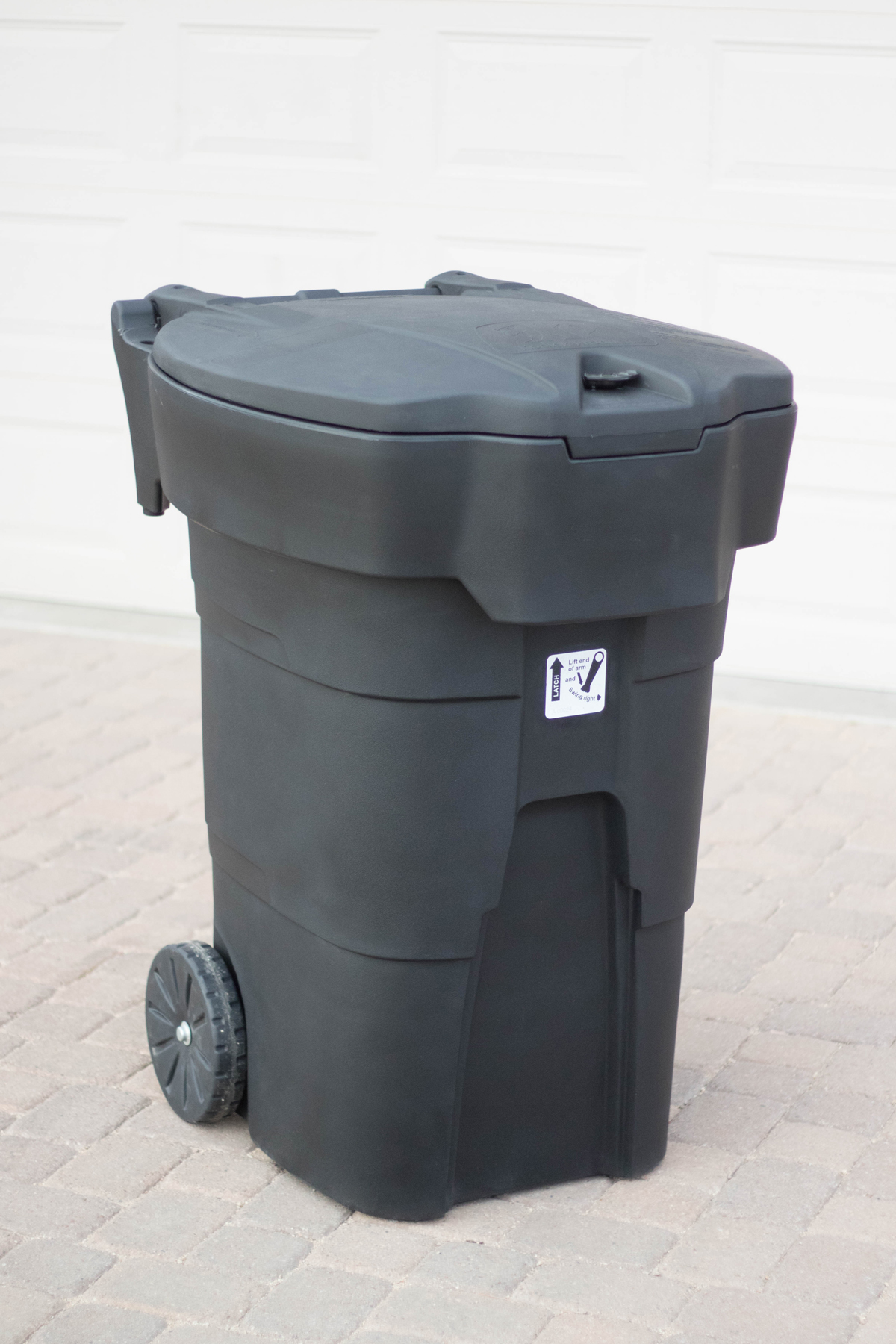
Attention!! BEAR RESISTANT CONTAINERS AVAILABLE Immediate Action Needed
Grizzly trying to open Kodiak CanKodiak Can
NFLA and NFPA are partnering to offer members the opportunity to purchase 96-gallon Kodiak bear resistant garbage containers at a reduced price. NFPA has negotiated a reduced price of $300 per container. In order to take advantage of this opportunity your order needs to be placed by January 24th. Please send a check made out to “Northland Products” to NFPA ASAP or hand deliver to Flannery Coats, Randy Kenyon, or Suzanne Hildner. If you miss the deadline, there may be a few containers available for purchase, but we expect them to disappear rapidly. Delivery will be in April.
NFPA Address:
77 Moose Creek Rd.
Polebridge, MT 59928
Because USPS (and Karin) only deliver twice a week and time is short you may also mail to:
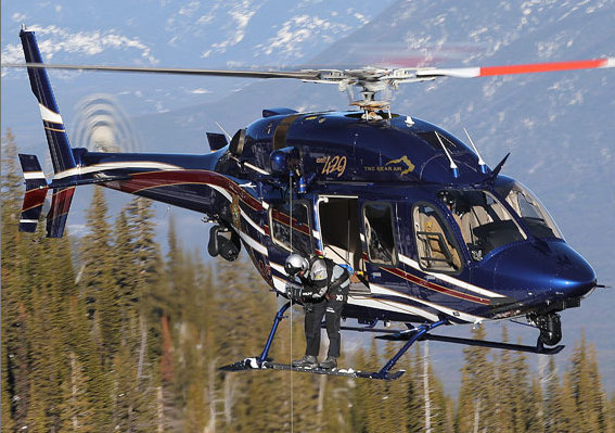
North Valley Rescue is planning to have its North Fork Winter training on Saturday, 12 February, from 0800–1700. Training will occur in the Kintla Ranch area and possibly state section 16. Two Bear Air is scheduled to be on-station at around 0930.
If you have any questions, please contact Mark Heaphy at 406-890-5043 or m-mheaphy@hotmail.com.
There has been a recent significant turn of events in the Avila zoning variance matter. It appears now our zoning language makes this variance a done deal. This is confirmed by the planning office email below. This, along with a variety of other logistical considerations, has placed the NFLUAC in an awkward position. This has led to the difficult decision of canceling the upcoming meeting scheduled for this coming Wednesday the 22nd. We do feel it remains important to express your concerns to the planning staff and Board of Adjustment. This outcome underscores the need to complete the text amendment revision. These efforts proceed on and we can assure all landowners that their participation in this endeavor is essential. We look forward to your continued support.
NF Neighborhood Plan and Zoning 3.40.04
3. Any existing lot or tract which cannot meet these setbacks because of size or topographic limitations will be given a variance.
I spoke with Erik, the director, and he did confirm that this particular variance, it did meet the criteria for approval as stated in The Zoning Regulations, Section 3.40.03 (as you had referenced earlier) and will be granted. The review of the LUAC is just a formality and will go forward.